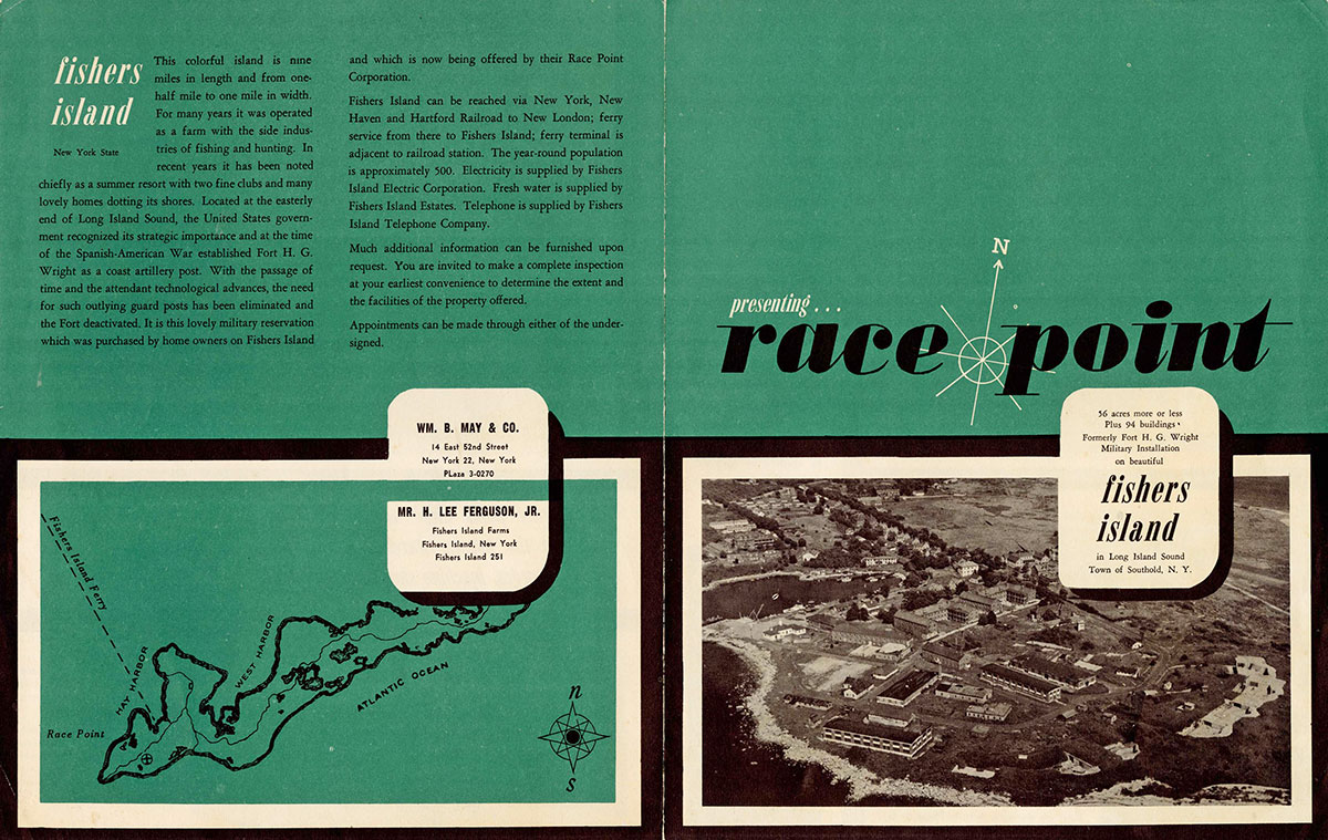
ANNUAL EXHIBITION 2020
Fort H.G. Wright, Fishers Island, N.Y.
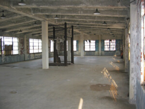
The U.S. Government purchased a 216-acre tract of land at the western tip of Fishers Island in April 1898 in order to establish coast defense fortifications at that site. Fort H.G. Wright, founded in 1900, was a hub of activity through World War II, but was shuttered in 1949. The twists and turns of the disposition of the surplus property and its subsequent conversion to a variety of civilian uses form the core of this section of the exhibition. The restoration of a dilapidated Officers Row, the use of gun emplacements for waste management, and the ecological rescue of distressed grasslands south of Whistler Ave. are but three of the stories told…
-
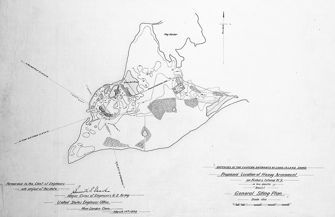
- “Proposed Location of Heavy Armament on Fishers Island, New York,” map by U.S. Army Corps of Engineers, March 19, 1898. The U.S. Government purchased a 216-acre tract of land at the western tip of Fishers Island in April 1898 in order to establish coast defense fortifications at that site. Photo courtesy of National Archives and Records Administration (NARA).
-
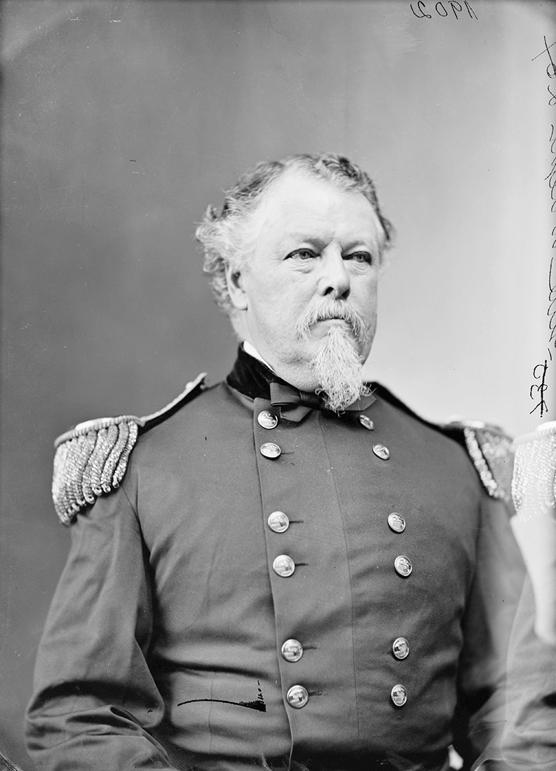
- On April 4, 1900, the new fort on Fishers Island was named in honor of Major General Horatio G. Wright (1820-1899), a distinguished Civil War general who had served as Chief of the U.S. Army Corps of Engineers from 1879 to 1884. Photo courtesy of Brady-Handy Photograph Collection, Library of Congress.
-

- Military map showing the chain of forts guarding the eastern entrance to Long Island Sound. Strategically located at the edge of the Race, the main entrance into Long Island Sound, Fort H.G. Wright became the headquarters of the Coast Defenses of Long Island Sound in 1910, eclipsing the position previously held by Fort Trumbull, New London, Conn. Photo courtesy of NARA (Museum Collection).
-
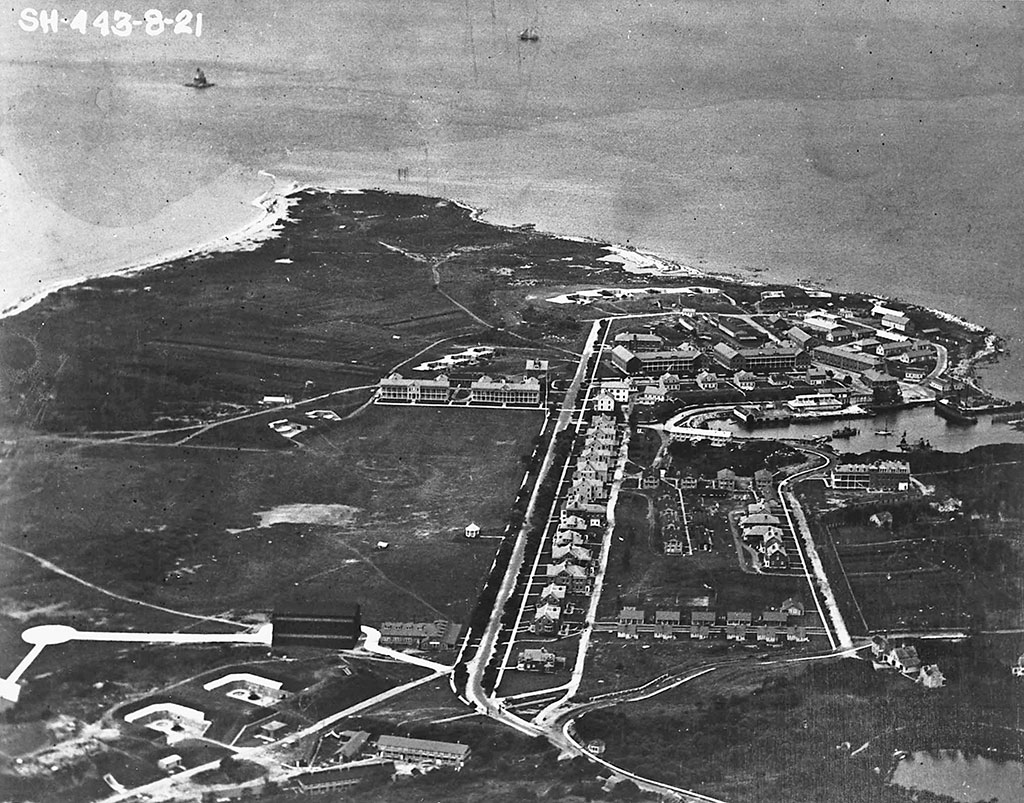
- Looking west over Fort H.G. Wright, August 1921. Here you can see some of the sites that will be visited in this exhibition. Note the two mortar emplacements in lower left. The one at left is utilized by Race Rock Garden Company, the other one is buried. Below and to the left of the barracks at center left are the two 6-inch gun emplacements of Battery Marcy that are still intact. The three 6-inch emplacements facing today’s Airport site are buried by rubble. At center top are two 12-inch and two 10-inch gun emplacements, today part of the Compost Station. Photo courtesy of NARA (Museum Collection).
-
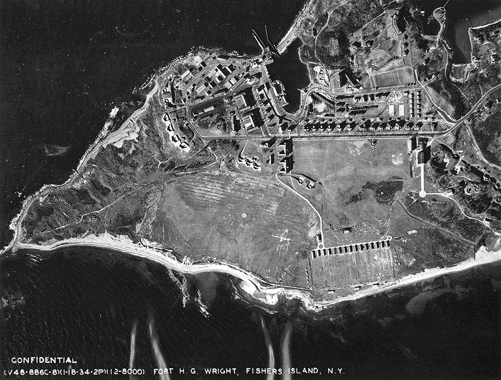
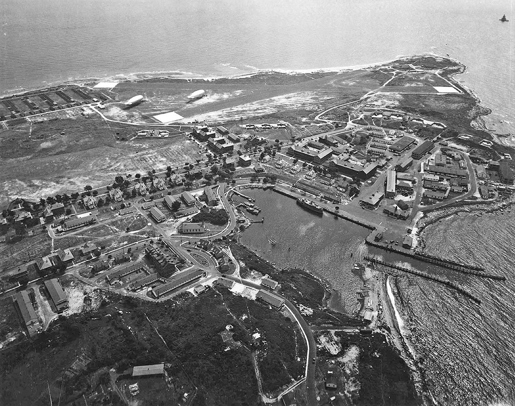
- Aerial of the main reservation of Fort H.G. Wright, January 18, 1934. This view shows clearly the ring of gun emplacements mostly facing west and south that wrapped around the main cluster of buildings and barracks. Photo courtesy of NARA (Museum Collection).
-
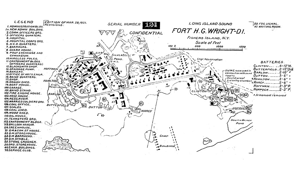
- “Fort H.G. Wright, Fishers Island, N.Y. – DI, Edition of March 28, 1921.” This military map provides a schematic with legends for both structures and armament. Photo courtesy of NARA (Museum Collection).
-
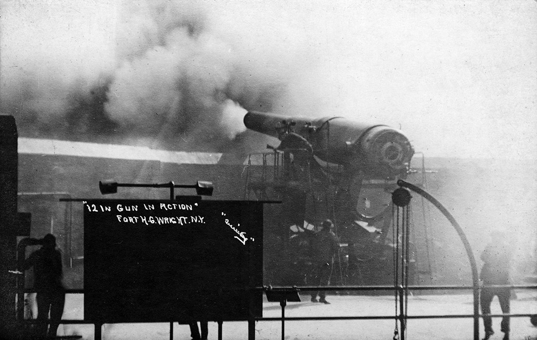
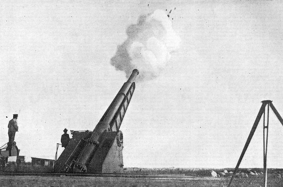
- “12-inch gun in action, Fort H.G. Wright, N.Y.,” photo by Quimby, circa 1913. The 12-inch guns of Battery Butterfield were the largest mounted at Fort Wright. Two 16-inch gun emplacements were built at Wilderness Point during World War II, but the guns were never mounted as the German threat never materialized. Photo courtesy of H.L. Ferguson Museum Collection.
-
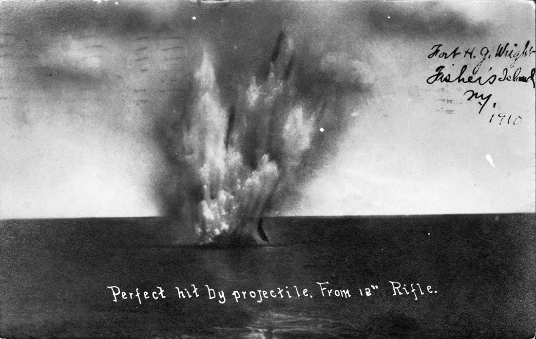
- “Perfect hit by projectile. From 12” Rifle,” circa 1910. Photo courtesy of H.L. Ferguson Museum Collection.
-
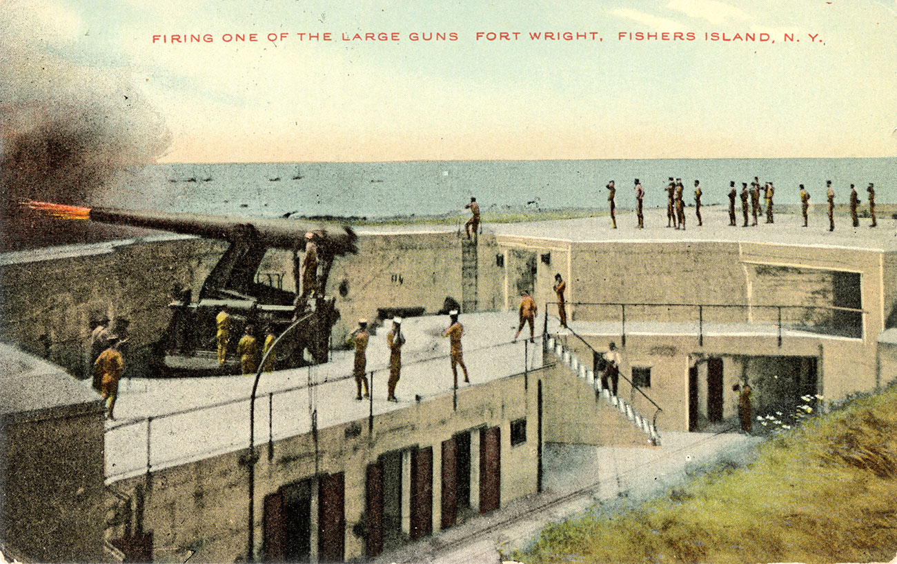
- “Firing One of the Large Guns, Fort Wright, Fishers Island, N.Y.,” 1910s. This view of Battery Barlow reveals the multilayered dimensions of the emplacements, a characteristic that historically made them popular as “pit party” locations. Today this emplacement is integrated into the Fishers Island Waste Management (FIWM) Compost Station. Postcard courtesy of H.L. Ferguson Museum Collection.
-
- Aerial view of main reservation, Fort H.G. Wright, August 21, 1944. This photograph captures Fort H.G. Wright at its maximum buildout. A hub of activity during both World War I and II, by the time the latter conflict was over, the Fort’s weaponry had been rendered obsolete. Disappearing guns were as effective as children’s toys in the new world of atomic weapons and missiles. As World War II drew to a close, the Fort’s days were numbered. Photo courtesy of NARA (Museum Collection).
-
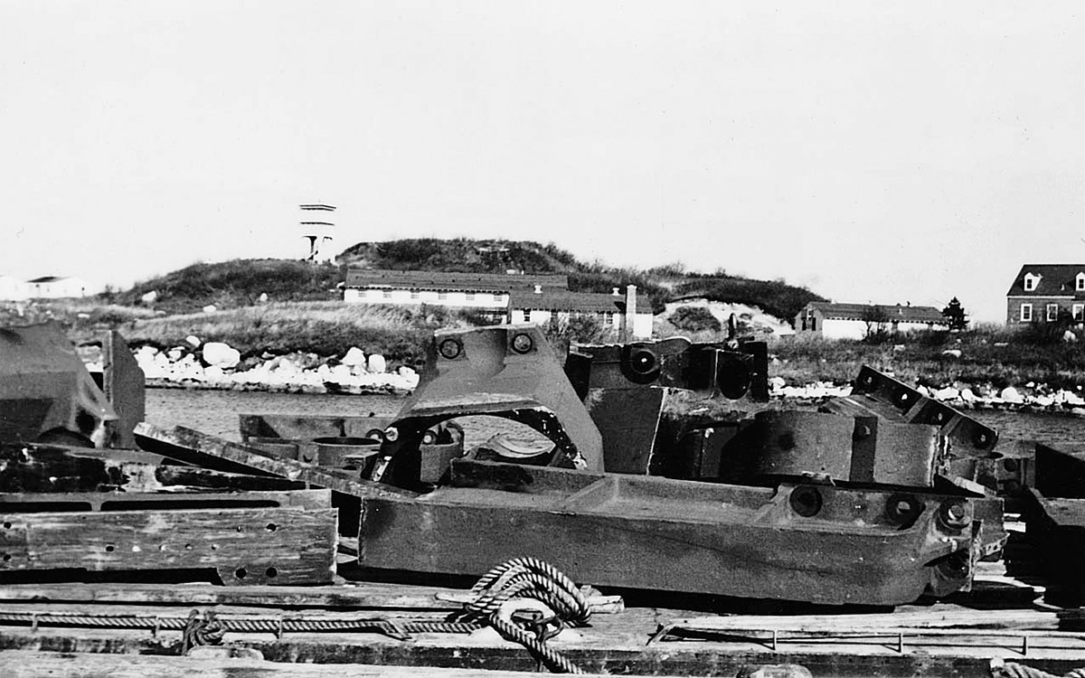
- Scrap salvaged from one of Battery 215’s modern six-inch guns being shipped off Island, circa 1948. On May 31, 1949, after several years of stripping the fort of its armament and its soldiers, the U.S. Army placed Fort H.G. Wright in an inactive “caretaking” status, pending further study for other possible uses. Photo courtesy of H.L. Ferguson Museum Collection.
-
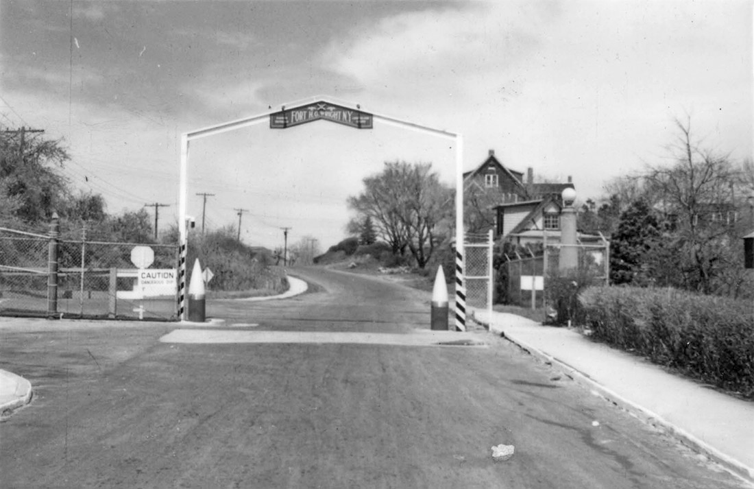
- Looking out the eastern entrance gate, Fort H.G. Wright, circa 1948. In 1950, the Army screened Fort Wright for its usefulness and decided that there was no further need for the property. The General Services Administration (GSA) subsequently received 297.23 acres of Fort Wright land for disposition, including areas beyond the main reservation. Photo courtesy of H.L Ferguson Museum Collection.
-
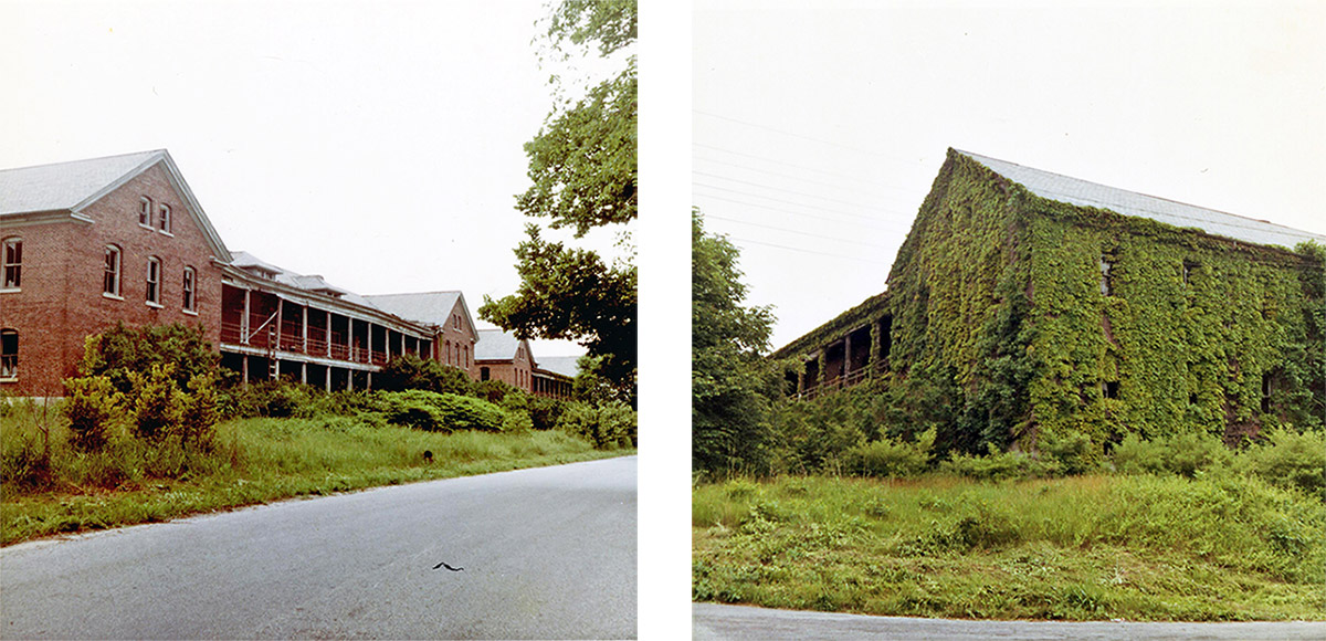
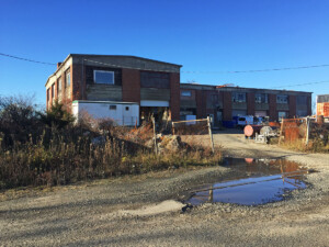
- Abandoned brick barracks on future site of Fishers Island School, circa late 1950s. After the Army left, Fort Wright was a ghost town with dozens of abandoned buildings subject to vandalism, vegetative growth, and the elements. A small caretaker force of hired Island residents looked after the buildings, but it was an uphill struggle as there seemed to be no future for the once formidable structures and infrastructure. Photos courtesy of H.L. Ferguson Museum Collection.
-

- In 1958, nine years after the Fort was first shuttered, the GSA finally announced the sale of “56 acres, more or less, plus 94 buildings on famous Fishers Island in Long Island Sound, Town of Southold, N.Y.” Brochure courtesy of H.L. Ferguson Museum Collection.
-
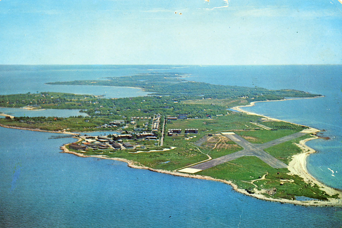
- An aerial view featuring deserted Fort H.G. Wright, circa mid-1950s. Before the GSA sale, all Fort property south of Whistler Avenue was granted to the Town of Southold, Long Island, N.Y., of which Fishers Island is a detached part. This property included the Army’s Elizabeth Field Airport, shown here, and the Parade Grounds beyond. The Town made the Fishers Island Ferry District the managers of the property. Photo courtesy of H.L. Ferguson Museum Collection.
-
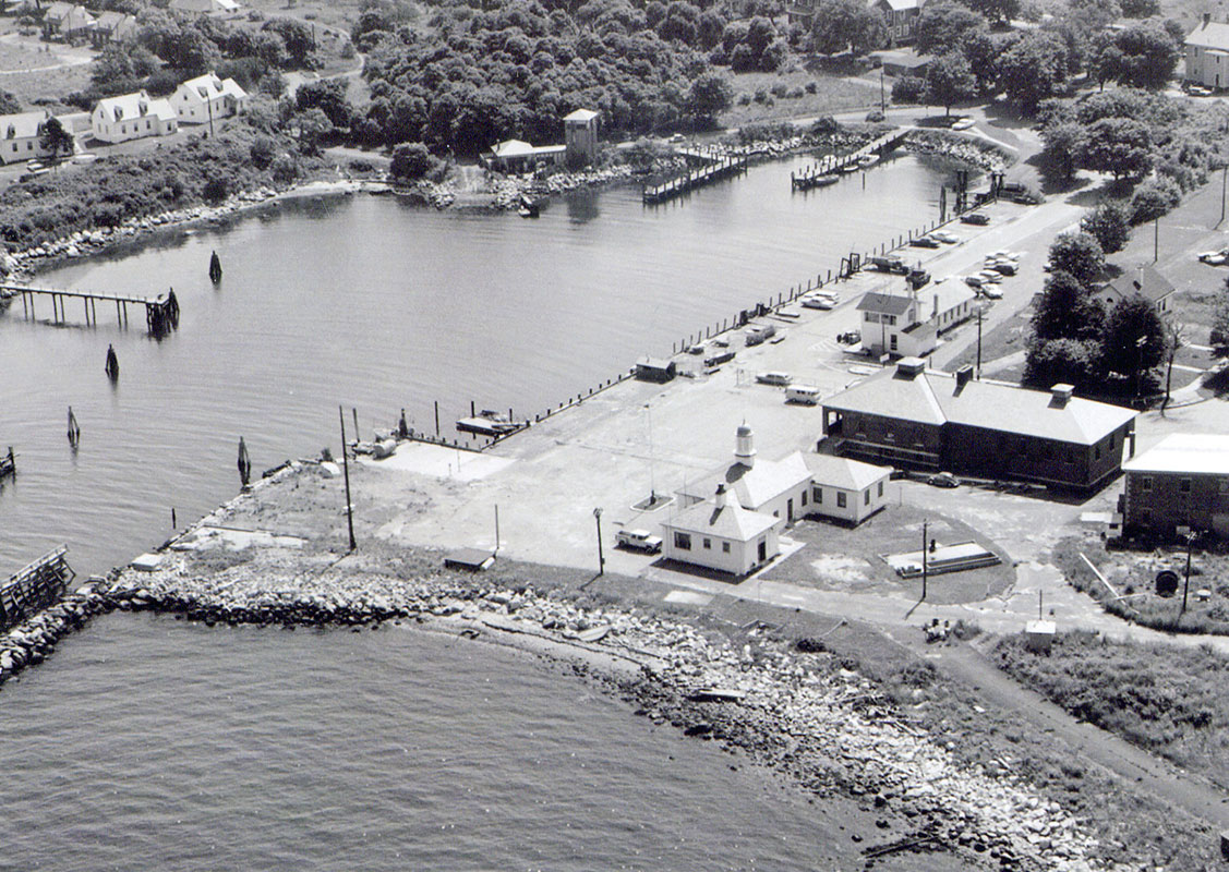
- Aerial of Silver Eel Cove, circa 1960s. The ferry docking area and the Coast Guard Station and other sections of Silver Eel Cove were also exempted from the land turned over to GSA. Photo courtesy of the U.S. Coast Guard (Museum Collection).
-

- Naval Underwater Systems Center sign, Fishers Island, N.Y., circa 1997. The fenced-in Wilderness Point section of Fort Wright, having been taken over by the U.S. Navy in 1949, was held out from the GSA sale; 67.17 acres remain Government property to this day. Photo by John Wilton.
-
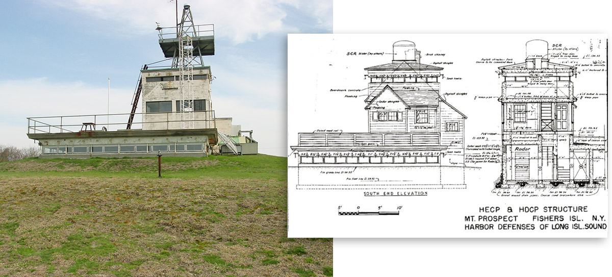
- Naval Underwater Systems Center, Fishers Island, N.Y. atop Mount Prospect, May 2, 2003. This concrete structure, usually seen from afar, was built as the Harbor Entrance Command Post (HECP) during World War II. Much of the building is underground, and the above ground portion was originally sheathed with a fake wooden façade and porch to disguise it as a farmhouse from the air (see drawing at right). Photo by Mark Berhow, CDSG. Drawing courtesy of fortwiki.com.
-
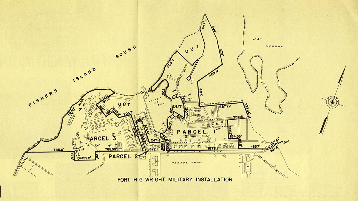
- The Fort Wright auction brochure defined the boundaries of land for sale and outlined which sections were “out.” The properties for sale were divided into three parcels, although they were to be sold as one lot to the high bidder on an “as is” basis. Brochure courtesy of H.L. Ferguson Museum Collection.
-
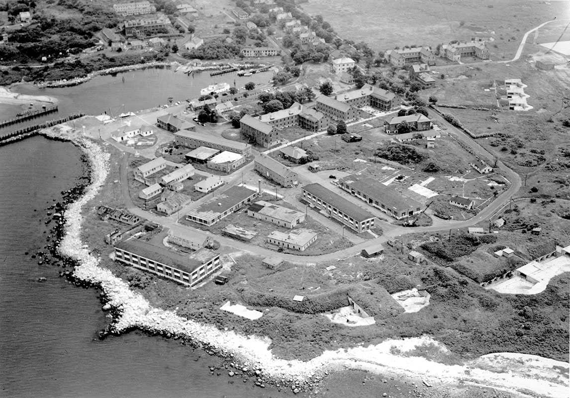
- Aerial photograph of deserted Fort H.G. Wright featuring property to be sold at auction. This view does not include the full sweep of Officers Row, a key part of the auction sale. Photo by C. Hoff, courtesy of Daily News, July 27, 1958.
-
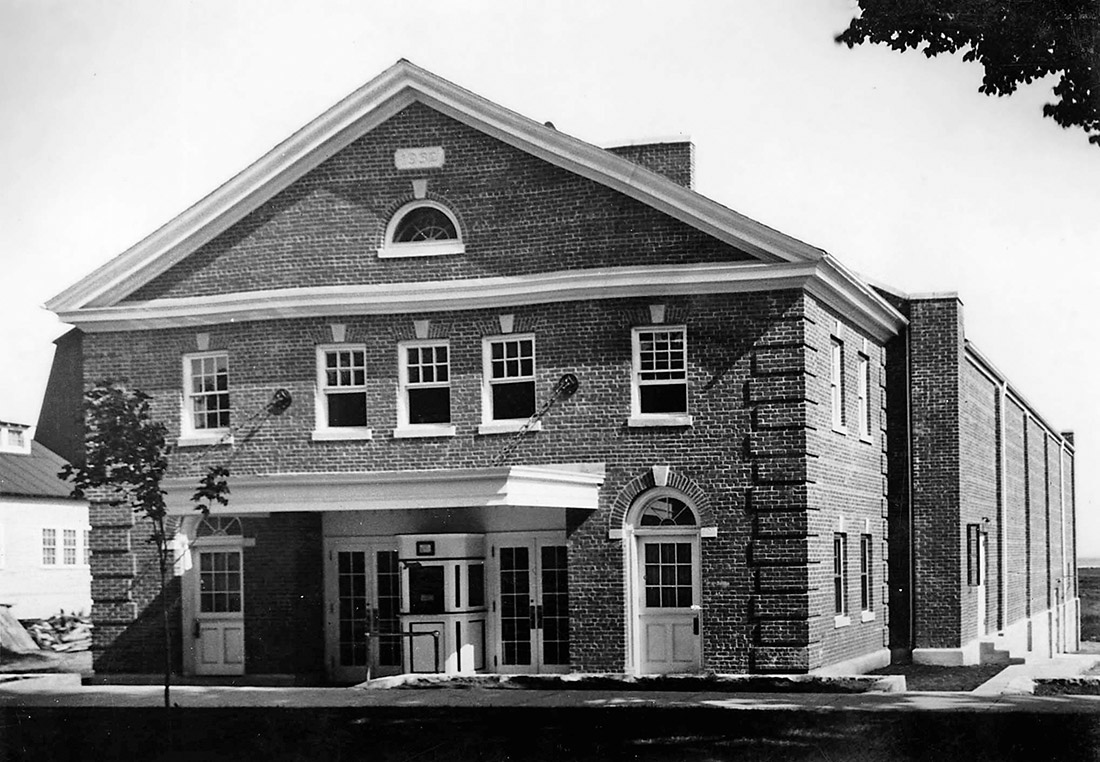
- Exterior of Fort H.G. Wright movie theater, circa late 1930s. The Fort auction was held on August 15, 1958, on schedule, in the Fort’s movie theater. To defeat outside bidders, a syndicate of summer residents pooled resources and formed the Race Point Corporation, led by Grant Simmons, president, and William C. Ridgway, Jr., vice-president and treasurer. During the auction, an unexpectedly avid bidder from Boston, associated with car rental firms, pushed the price up far beyond the syndicate’s preset limit. Photo courtesy of the late Mary Collings Pillsbury.
-
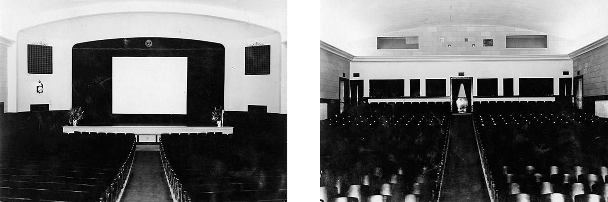
- Interior of Fort Wright’s movie theater, 1933. Not to be beaten at any price, Race Point Corp. matched every raised bid until finally winning. The price was $350,000 (1958 dollars). The Boston businessman stated later that he had intended to use the land for a motel and cottages. The other losing bidder, a prominent hotel developer from New York City, told residents they he too had planned to build a motel and cottages. Photos courtesy of the late Mary Collings Pillsbury.
-
- Race Point Corp. sales brochure, 1958. The new owners, seeking to recoup, soon published a sales brochure of their own and offered properties for sale a la carte. The Hartford Courant reported: “The corporation president, Grant Simmons, said the area will partly become a ‘light commercial area,’ with shops and warehouses. He also stated that “the remainder of the property will be used for residential purposes.” Brochure courtesy of the H.L. Ferguson Museum Collection.
-
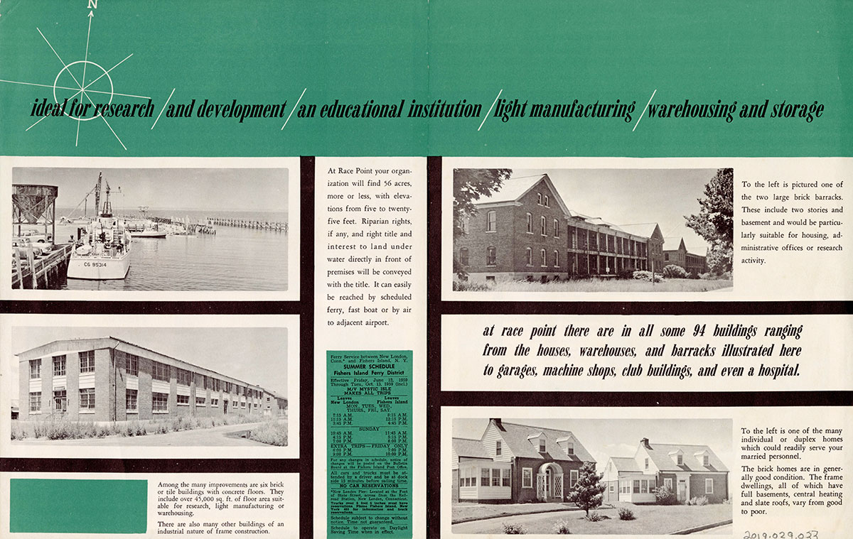
- Race Point Corp., as advertised in this brochure, sought research and educational facilities, light manufacturing and warehouse usage. Realtor William B. May wrote letters to dozens of name brand U.S. companies trying to encourage businesses to utilize Fishers. The response was less than overwhelming. The Salvation Army was briefly intrigued by the possibility of using the former Army buildings for warehouse purposes. Brochure courtesy of H.L. Ferguson Museum Collection.
-
- The Race Point Corporation sold numerous buildings to private buyers, including Fort Wright Building 57 to Mrs. Caroline Cleveland. Photo by Mark Berhow, Coast Defense Study Group (CDSG), May 2, 2003.
-

- Architects Billie Tsien and Tod Williams have recently renovated Building 57 into living/work space. Please see the associated gallery below this section of the exhibition that features the conversions of five buildings in the Silver Eel neighborhood, including this one. A new “gateway” to Fishers Island is being created one former fort building at a time. Photo courtesy of Billie Tsien and Tod Williams.
-
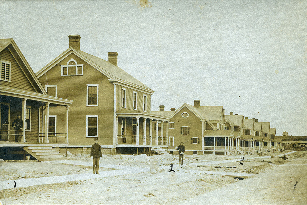
- Officers Row, Fort Wright, 1902. A big contribution of the Race Point Corporation, second only to preventing a slew of motels, was its successful transitioning of the houses and apartment buildings on Officers Row to new owners. Photo courtesy of Henry L. Ferguson Museum Collection.
-
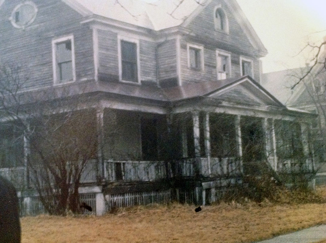
- Building 18, Officers Row, circa 1962. By the time the Race Point Corporation’s sales began in the early 1960s, the properties along Officers Row were in a derelict state having been abandoned for more than a decade and stripped of everything of value, including stair railings, light fixtures, mantels, door knobs, etc. The houses were offered at a bargain price of $2,500, or less, each with the stipulation that exteriors had to be fixed up within eighteen months. This house today, much improved, belongs to the Essers. Photo courtesy of Sandy and George Esser.
-

- Burr residence, Officers Row, April 2011. After purchasing their shell of a building in the mid-1960s for $2,000, the Burrs had to scramble to meet the exterior improvement deadline. But they and other new owners along the length of the Row succeeded in both stabilizing and preserving an almost intact Officers Row. One Officer’s Quarters, located at the corner of the turn off to the ferry, was razed by a new owner circa 1963. Another building adjacent to the Apartment Building at the western end of the Row was also demolished. Photo by John Wilton.
-

- Aerial featuring Fort Wright Guard House and U.S. Coast Guard Station, Silver Eel Cove, circa 1960s. Dozens of former Fort Wright building were razed, primarily during the 1960s and 1970s. The Fort Wright Guard House met its demise in 1975. U.S. Coast Guard Photo (Museum Collection).
-
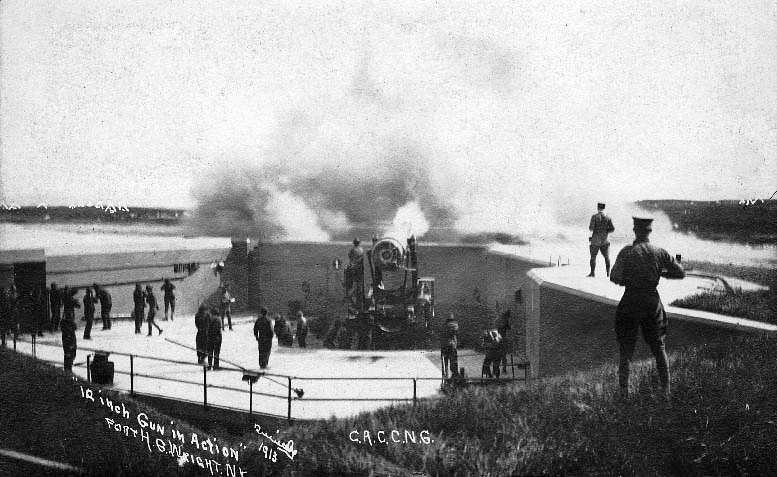
- Gun crew of Connecticut National Guard firing a 12-inch disappearing gun at Battery Butterfield, Fort H.G. Wright, N.Y., 1913. Photo by Quimby. Courtesy of H.L. Ferguson Museum Collection.
-
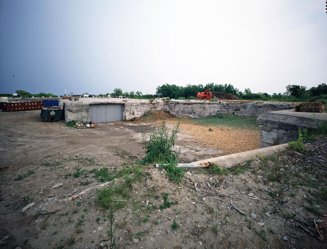
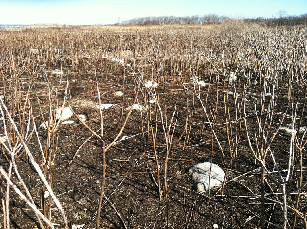
- Former Battery Butterfield emplacement, Fishers Island Garbage & Refuse District station, 1997. In the 1980s, the Garbage District (today’s F.I. Waste Management) began utilizing the gun emplacements at the west end of Whistler Ave. Three emplacements were initially used as a Burn Dump for brush and debris, and one for non-burnable items. The Burn Dump was closed in 1992. Around that time the lower levels of the emplacements were filled in with debris. Photo by John Wilton.
-
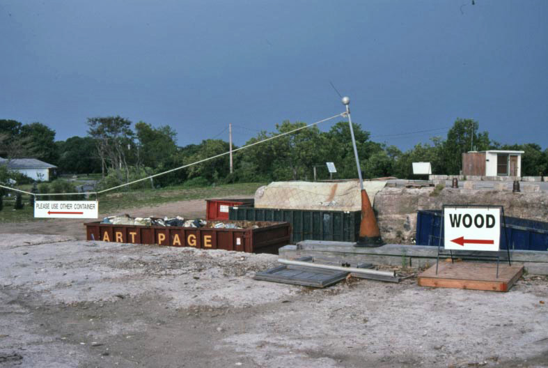
- Fishers Island Garbage & Refuse District bins within former Battery Barlow gun emplacement, 1997. Today one can drop off yard waste, construction debris and discarded household items into the emplacements that once protected Connecticut’s ports and New York City beyond. Photo by John Wilton.
-
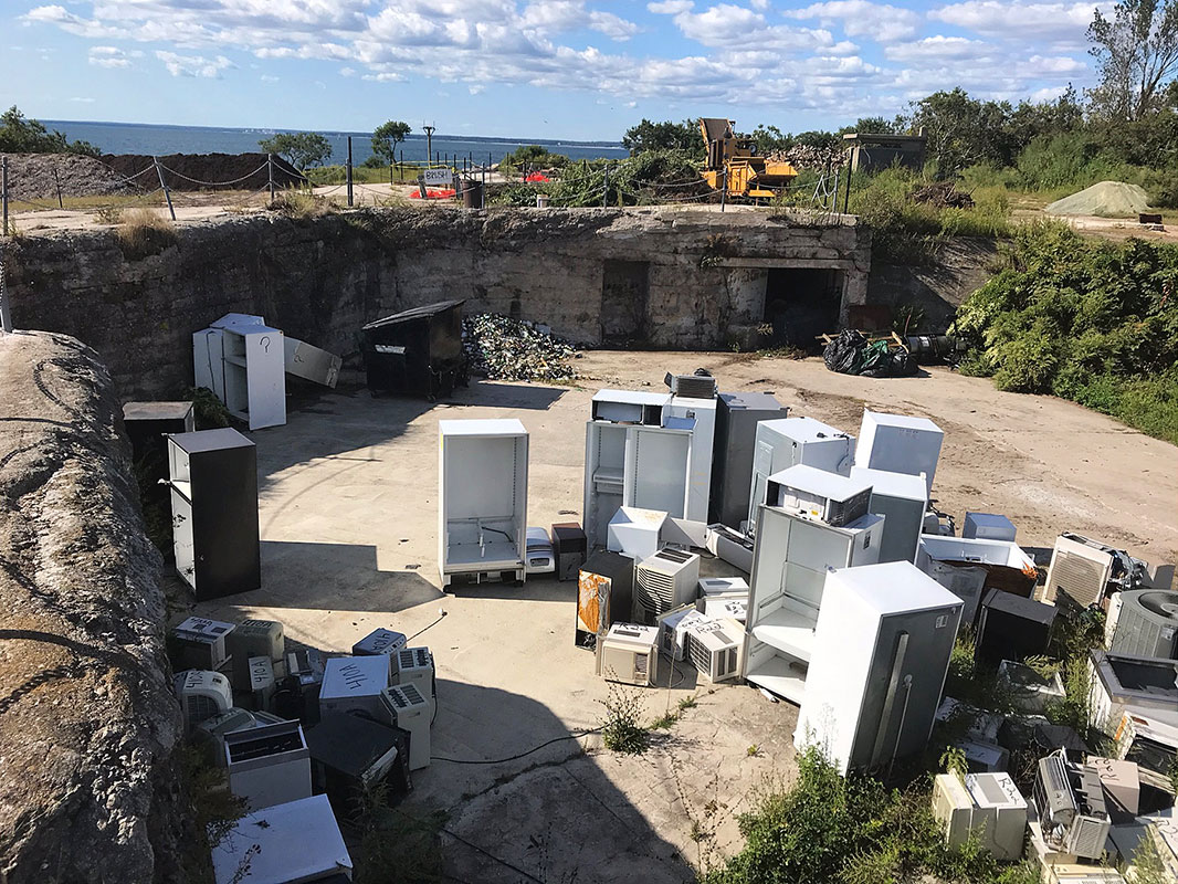
- Anthropomorphically speaking, it appears that these refrigerators, if organized, have a chance of seizing control of Battery Barlow. Photo by Pierce Rafferty, September 19, 2019.
-

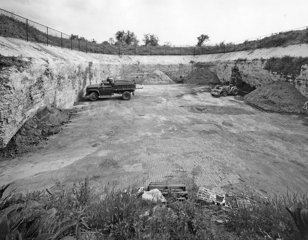
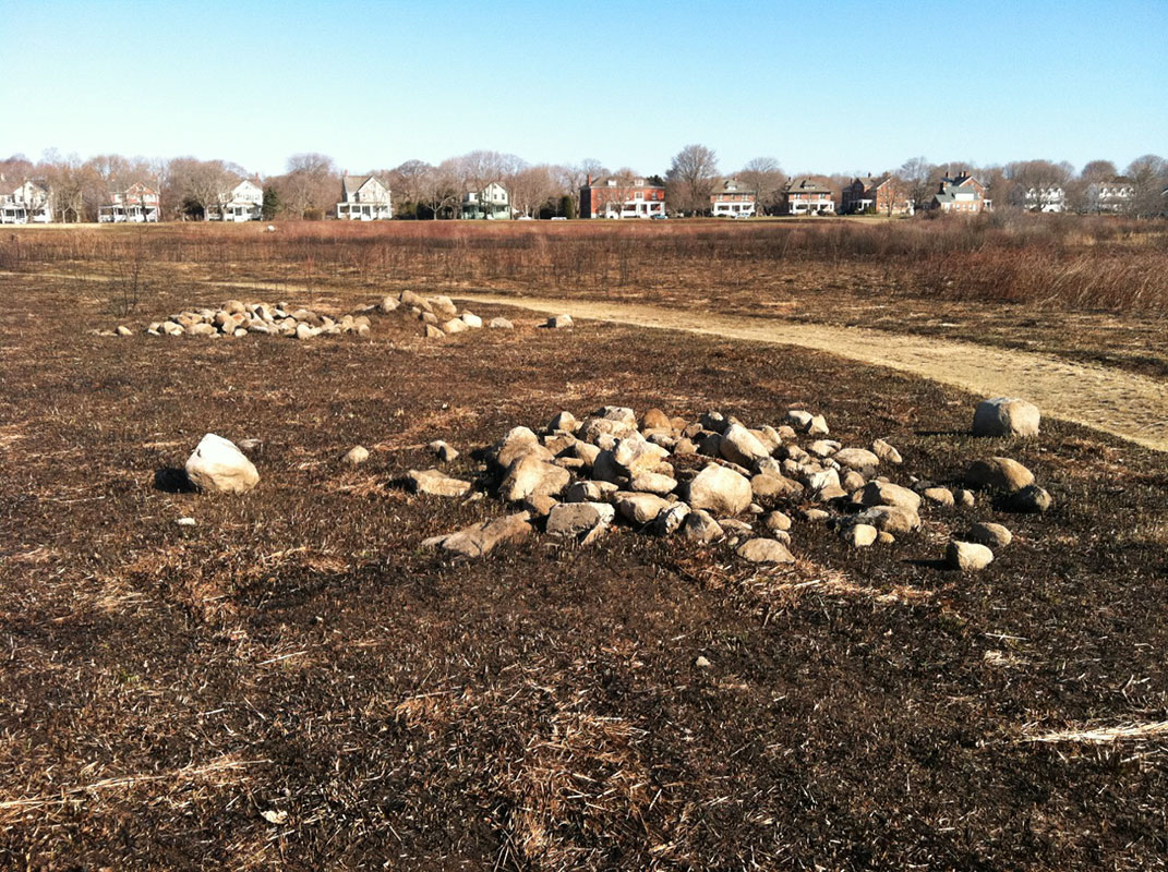
- Aerial view of Fishers Island Waste Management’s Compost Center, June 2, 2014. Please note the two former 12-inch gun emplacements at top (Battery Butterfield), and two former 10-inch gun emplacements at bottom (Battery Barlow). The emplacement at bottom is filled with rocks and non-burnable construction debris. Photo by Jim Reid.
-
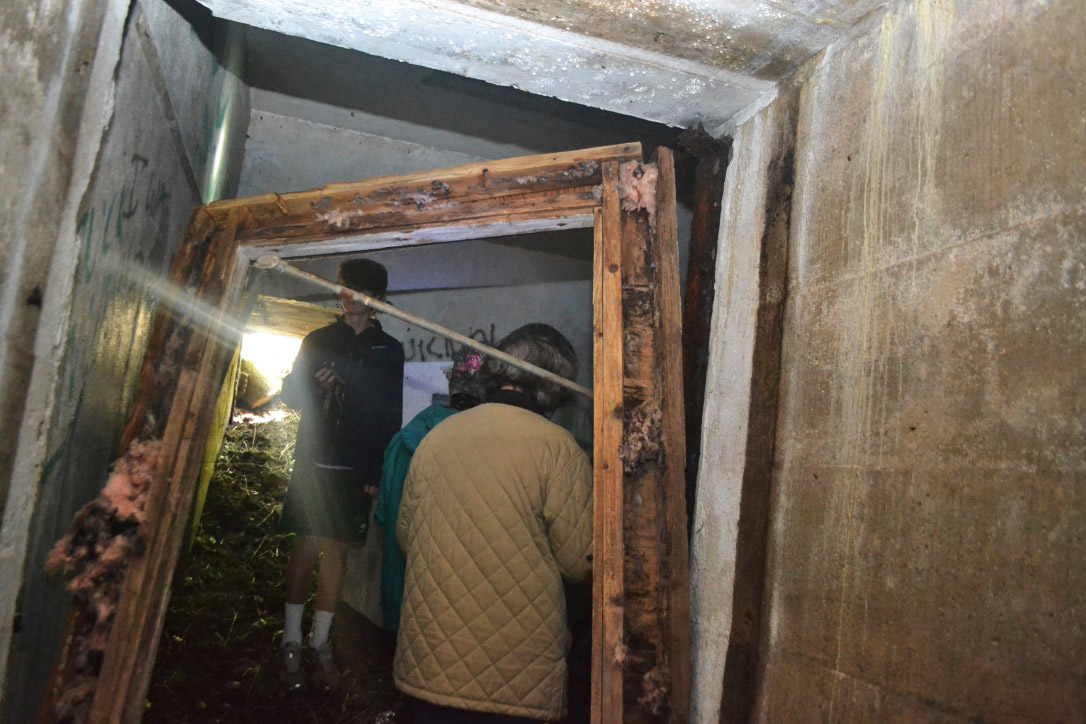
- This series of photos documents a tour of subterranean Battery Barlow on June 2, 2014 prior to an entrance being sealed off by debris. Photo by Jim Reid.
-
- Subterranean Battery Barlow, June 2, 2014. Photo by Jim Reid.
-
- Subterranean Battery Barlow, June 2, 2014. Photo by Jim Reid.
-
- Subterranean Battery Barlow, June 2, 2014. Photo by Jim Reid.
-
- End of subterranean Battery Barlow tour, June 2, 2014. Photo by Jim Reid.
-
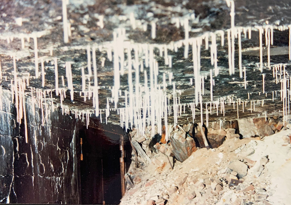
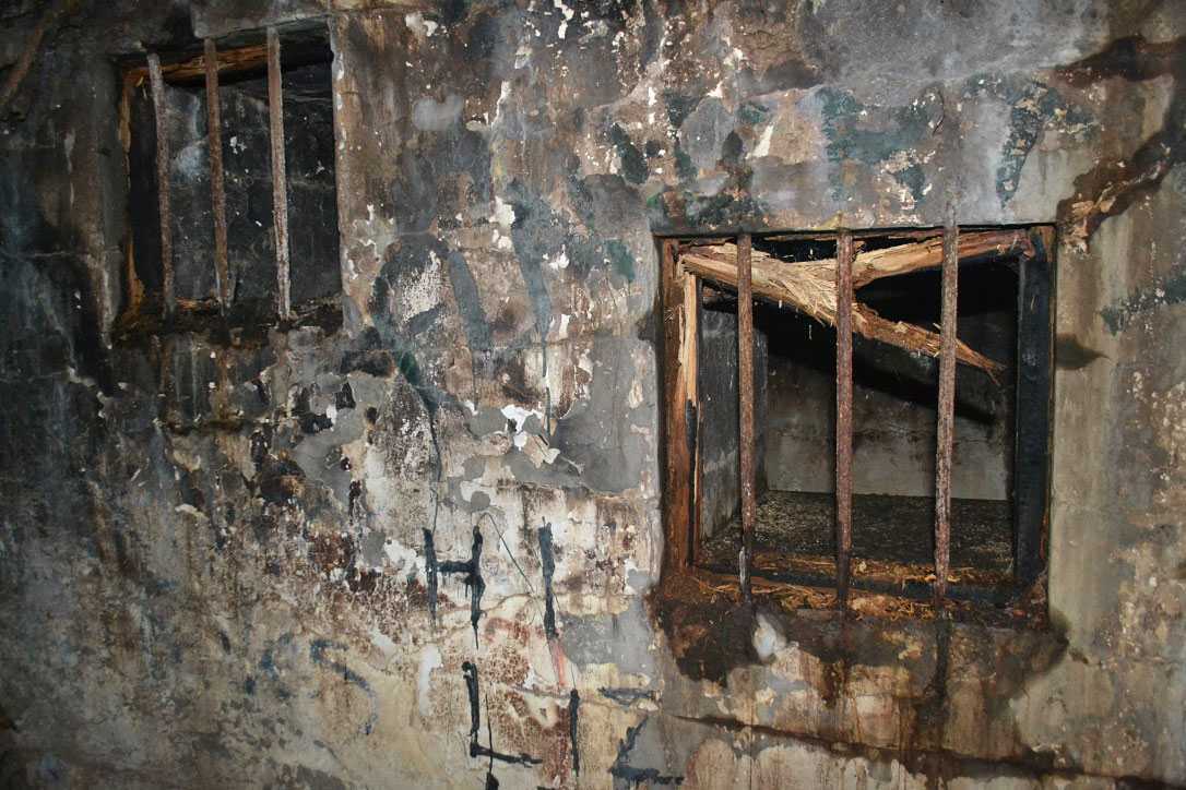
- Otherworldly stalactites, Fort Wright bunker, photo by William Gill, circa 1995.
-
- An almost infernal bunker interior, Fort Wright. Photo by Mary Murphy.
-

- Now that we have descended deep into the Big Gun emplacements, here are a few rare pictures taken at one of the legendary “pit parties,” circa 1962. At left: the late Jerry and Sandy Riegel. Jerry was a main organizer of the first wave of parties that began circa 1959 and lasted until circa 1963. At right: Harry Ferguson (standing), and an unidentified man (seated). Photos courtesy of Melie Spofford.
-

- Pit party snapshots, circa 1962. At left: Brian Dougherty (Draper), with Kandi duPont (Sanger), her friend from Wilmington. At right: the late Peter Sanger. Both photos courtesy of Melie Spofford. The often boisterous affairs featured kegs of beer and live music, including in this period Eddie Drew, later Ward Wellman and the Kents, an instrumental group from the Westport, Conn. area, whose best known hit was “Written in the Sky.” Photos courtesy of Melie Spofford.
-
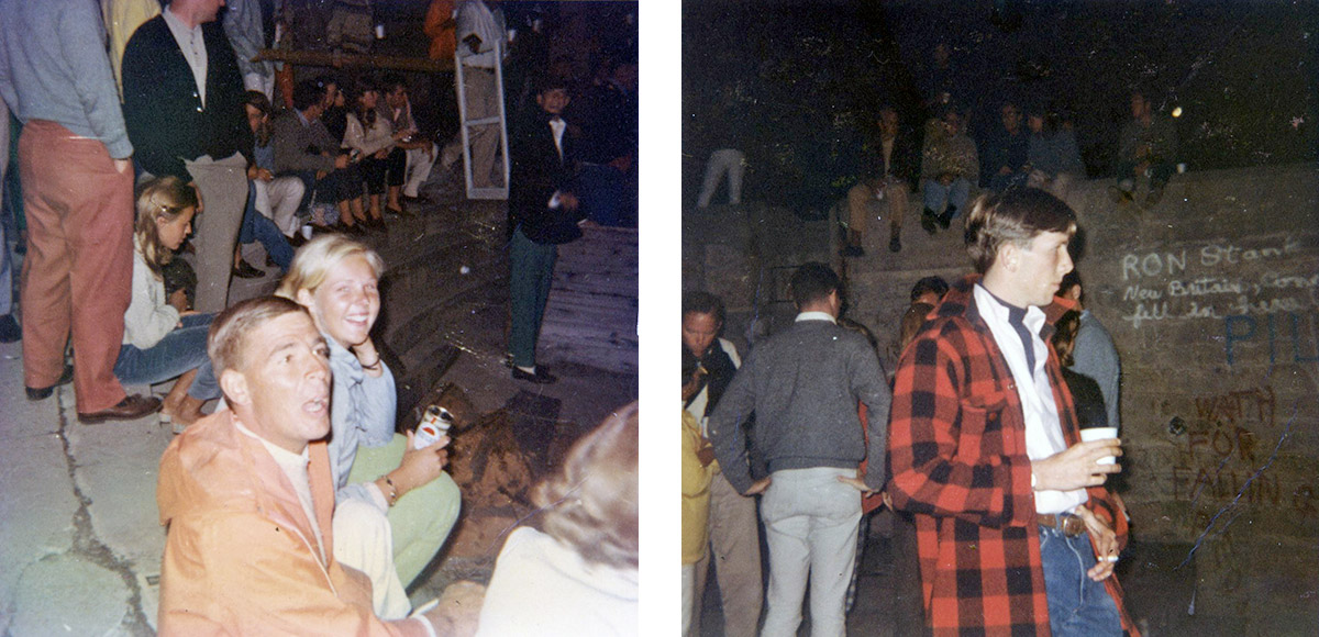
- Pit party snapshots, circa 1962. At left: Scudder Sinclair and an unidentified woman. At right: Ray Ogden, with two levels of party goers in background. A new “generation”—in reality one or two years younger—carried the pit party tradition forward into the 1960s. Today Race Rock Garden Company uses the former mortar pit for its company’s annual pit party. Photos courtesy of Melie Spofford.
-

- Dynamite gun at Race Point, circa 1901. Fort Wright’s most exotic weapon was the dynamite gun that functioned as a giant “air gun” capable of delivering high explosives without blowing itself up. Only a handful of these guns were ever deployed. Using compressed air generated in the steam plant at left, it pneumatically launched torpedoes of dynamite with a variety of fuse types at targets in the Race whose waters were considered too swift for submarine mines. Photo courtesy of H.L. Ferguson Museum Collection.
-
- Successful test firing of the dynamite gun at Fort H.G. Wright, October 31, 1901. The gun was never popular with the Coast Artillery who considered it too complicated to operate. The dynamite gun on Fishers was scrapped in 1902. Photo courtesy of Harper’s Weekly, November 16, 1901. (Museum Collection).
-
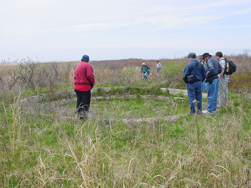
- Members of the Coast Defense Study group examining the remains of the dynamite gun’s emplacement, May 2, 2003. The dynamite gun left little trace on Fishers Island. The visible section of the emplacement is located between the bird watching mound at Race Point (Battery 215) and the small pond to its west. Photo courtesy of Mark Berhow, CDSG.
-

- Mortar firing, Battery Clinton, August 5, 1933. Fort Wright had two mortar pits that were both being used as metal dumps in the mid-1990s when David Burnham’s Race Rock Garden Company moved to Mosquito Hollow. Both pits were slated to be capped and covered by fill, but David convinced the Garbage District to let him take over one pit for his company’s use. Photo courtesy of the H.L. Ferguson Museum Collection.
-
- Race Rock Garden Company has utilized Battery Clinton’s mortar pit since the mid-1990s. The adjacent Metal Dump mortar pit was buried and is all but forgotten today. Photo by John Wilton, 1997.
-
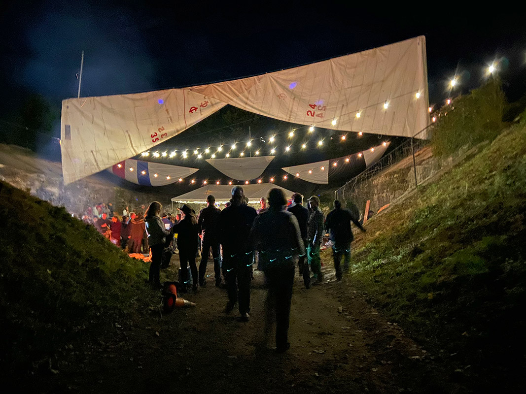
- Race Rock Garden Company pit party, October 13, 2019. A former mortar pit put to good use. Photo by Polly Talbott.
-

- Battery Marcy, 6-inch gun emplacement, Parade Grounds, Fort Wright, circa 1910s. The silhouetted mound of former Battery Marcy is visible from Whistler Ave. as you are heading to the ferry. Photo courtesy of Jim Diaz.
-
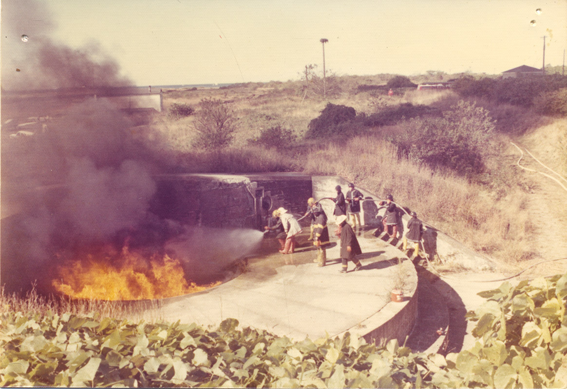
- The Fishers Island Fire department (FIFD) has used Battery Marcy on the Parade Ground as a “training pit” from at least the 1960s to date. Photo by Charlie Morgan, 1973.
-
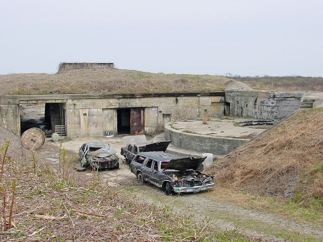
- The FIFD also practices extrication drills using “jaws of life” devices on wrecked cars that have been towed to Battery for that purpose. Photo by Mark Berhow, CDSG, May 2, 2003.
-

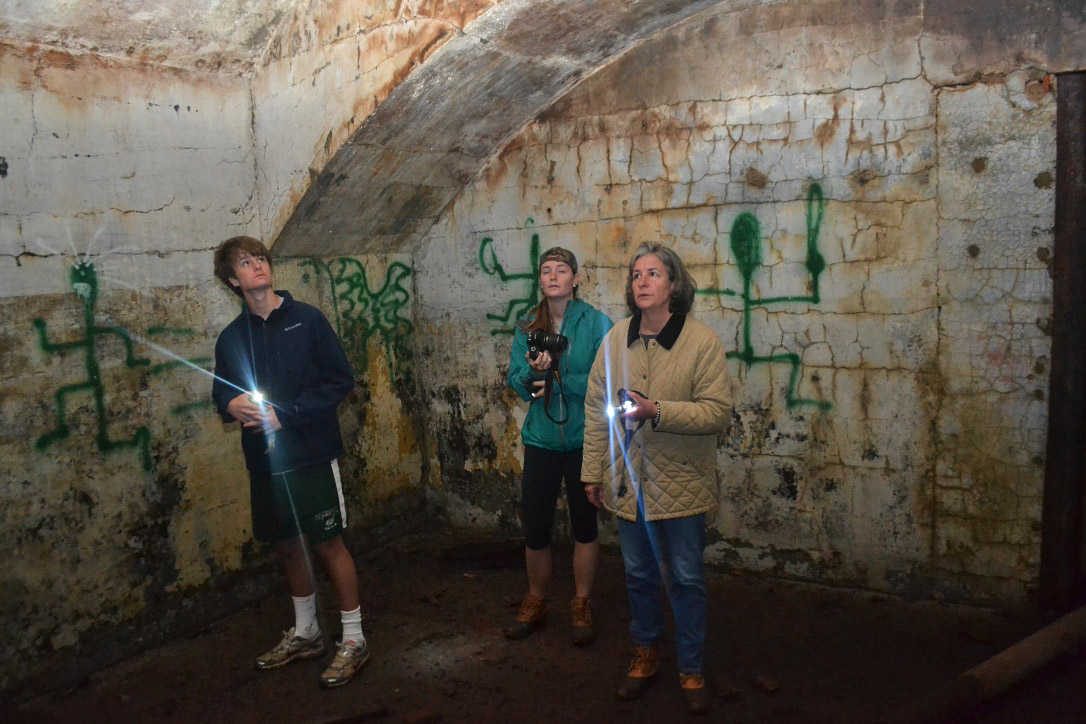
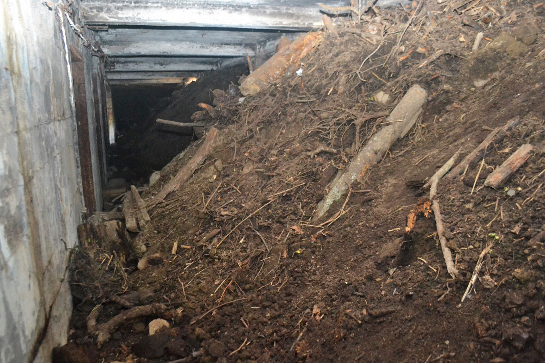
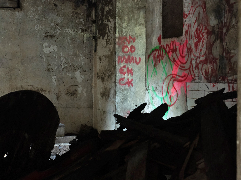
- Battery Marcy, April 17, 2020. Other activities that take place at Battery Marcy include advanced graffiti practice. Photo by Pierce Rafferty.
-
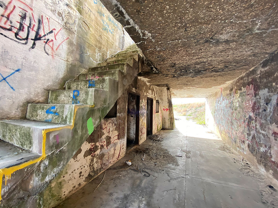
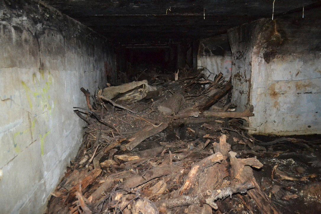
- Passageway under Battery Marcy, April 17, 2020. Photo by Pierce Rafferty.
-
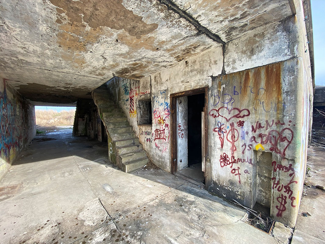
- The reverse angle, Battery Marcy, April 17, 2020. Photo by Pierce Rafferty.
-

-
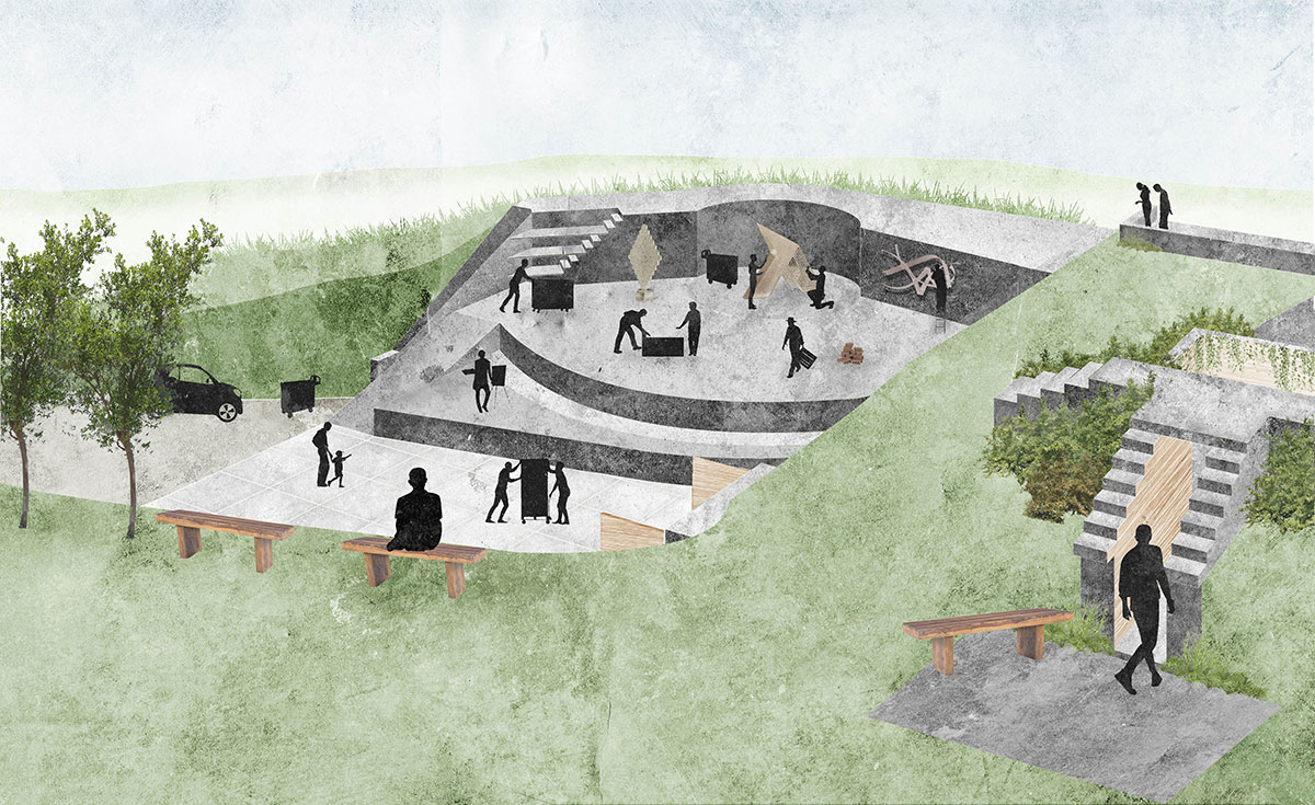
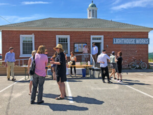
Fishers Island seasonal resident Olivia P. Cleary, UVA School of Architecture, ’20, set out in her thesis project to design an inspiring gathering space that would attract, inspire and engage people living on Fishers Island year round. She chose to convert Battery Marcy into a work and gallery space for sculptors, envisioning this project as an extension of the Lighthouse Works artist residency program. Here are her remarkable drawings and accompanying captions.
Atrium This image illustrates the atrium created when the watchtower’s floor is removed opening up the two rooms below. Once the walls are removed, a beautiful space is created that allows light onto the bottom floor and creates an inspiring space to gather. The interior is wrapped in wood to warm up the area, making it feel less heavy. Drawing courtesy of Olivia P. Cleary.
-
- Outdoor Work Court This image illustrates the usage of the eastern gun emplacement as an outdoor work area for sculptors and designers. The open platform allows observations from a variety of vantage points that offer, in effect, a new exhibit daily as the work unfolds. This view is juxtaposed with the mirroring western emplacement, which features a formalized sculpture garden that displays the final creations. On the right is an enclosed entrance that allows the interior to be winterized. Drawing courtesy of Olivia P. Cleary.
-

- Full View of Bunker This image illustrates the full view of the site, with the usage for each of the rooms. Drawing courtesy of Olivia P. Cleary.
-
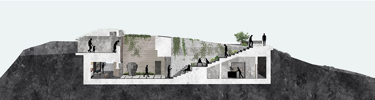
- Stairs Section This image provides a sectional view that cuts from the formal art gallery, to the atrium, to the grand stairway, ending on the balcony view. Each fosters a different community interaction. Drawing courtesy of Olivia P. Cleary.
-
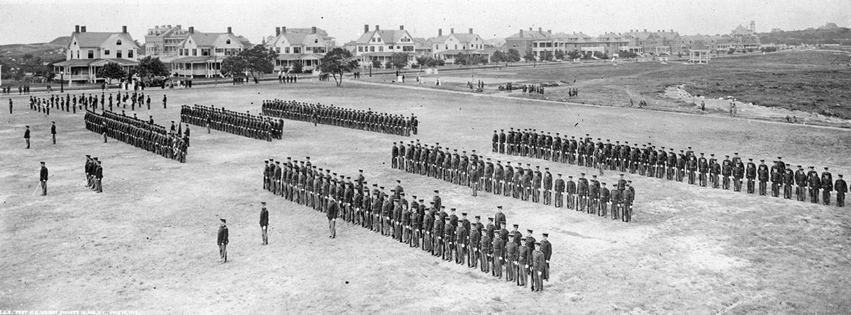
- Dress Parade on Parade Grounds with Officers Row in background, Fishers Island, N.Y., circa 1913. For a half century under military control, the Parade Grounds were a central area for inspections, drills, dress parades, and retreat ceremonies often witnessed by the Island’s civilian population. In the past decade, the Fishers Island Conservancy has undertaken a meadow restoration of these grounds that makes the land a magnet for both community interaction and for diverse flora and fauna. Photo courtesy of H.L. Ferguson Museum Collection.
-
- “Before” photo of Parade Grounds, March 25, 2011. Beginning in the fall of 2010, the Fishers Island Conservancy leased the Parade Grounds and adjacent areas from the Fishers Island Ferry District and embarked on an ambitious project to remove invasive plants and restore native grasses throughout a 65-acre section of the 180-acre property. (They later expanded their efforts to the full property.) The Parade Grounds had been, in the words of a Habitat Committee report, “choked with vines and scrub and depleted of wildlife.” This photo shows a section of the Parade Grounds after a managed burn by the FIFD in the spring of 2011. Photo courtesy of the Fishers Island Conservancy.
-
- “Before” photo of Airport area, March 25, 2011. After the spring burn, a dedicated team worked to remove stones, heavy concrete, and invasive scrub from all corners of the leased property. This extensive clearing was followed by overseeding with native grasses and forbs. Photo courtesy of the Fishers Island Conservancy.
-
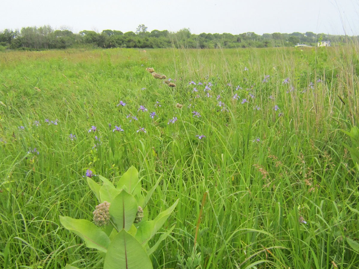
- “After” photo of Airport area, June 2012. The success of the reseeding was soon apparent as the largest grassland on Fishers Island flourished: “Milkweed for butterflies, wild iris, native warm season grasses and cool season grasses are seen in the ‘After’ picture above, providing a sustainable multi-culture grassland habitat for nature’s creatures.” Quote and photo from Habitat Committee Report, 2012, courtesy of the Fishers Island Conservancy.
-
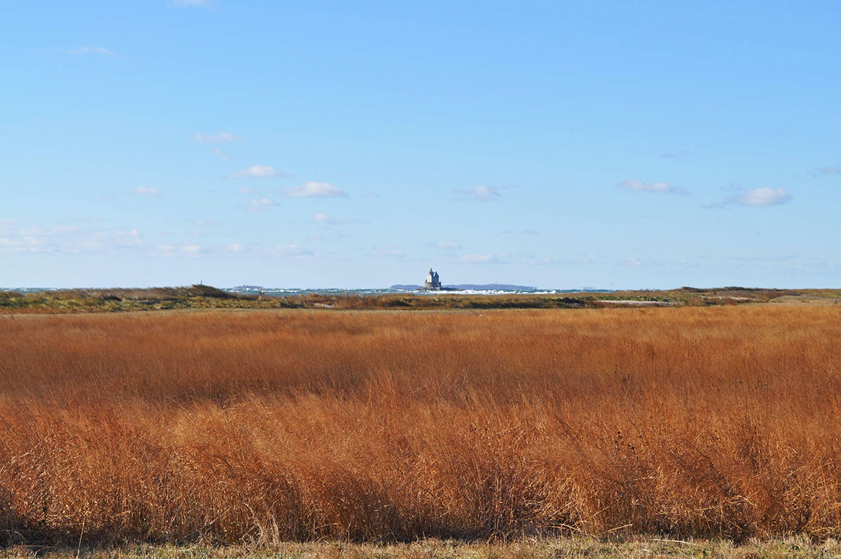
- Looking southwest across the Parade Grounds to Race Rock Light, November 27, 2013. Photo by Jane T. Ahrens.
-
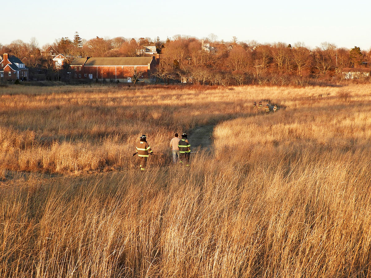
- Walking the Parade Grounds prior to a controlled burn, March 26, 2019. Each year, usually in the early spring prior to nesting season, the FIFD coordinates with the Fishers Island Conservancy to determine the boundaries and examine the conditions for a controlled or “prescribed” burn in the Parade Grounds and Airport sections south of Whistler Ave. Photo by Jane T. Ahrens.
-
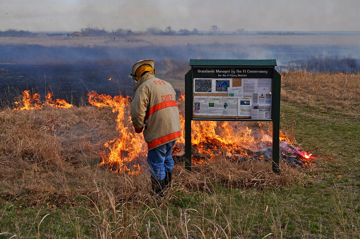
- FIFD Chief Bruce Hubert burning section of grass near the Whistler Ave. F.I. Conservancy sign, April 13, 2017. The burns are conducted to impede the reestablishment of forest growth and invasives and to clear out clumps of dead grass that suffocate live grasses if allowed to accumulate untended. Sections are burned in a three year rotation The result is a rebirth of the grassland that greatly benefits its floral and faunal inhabitants. Photo by Jane T. Ahrens.
-
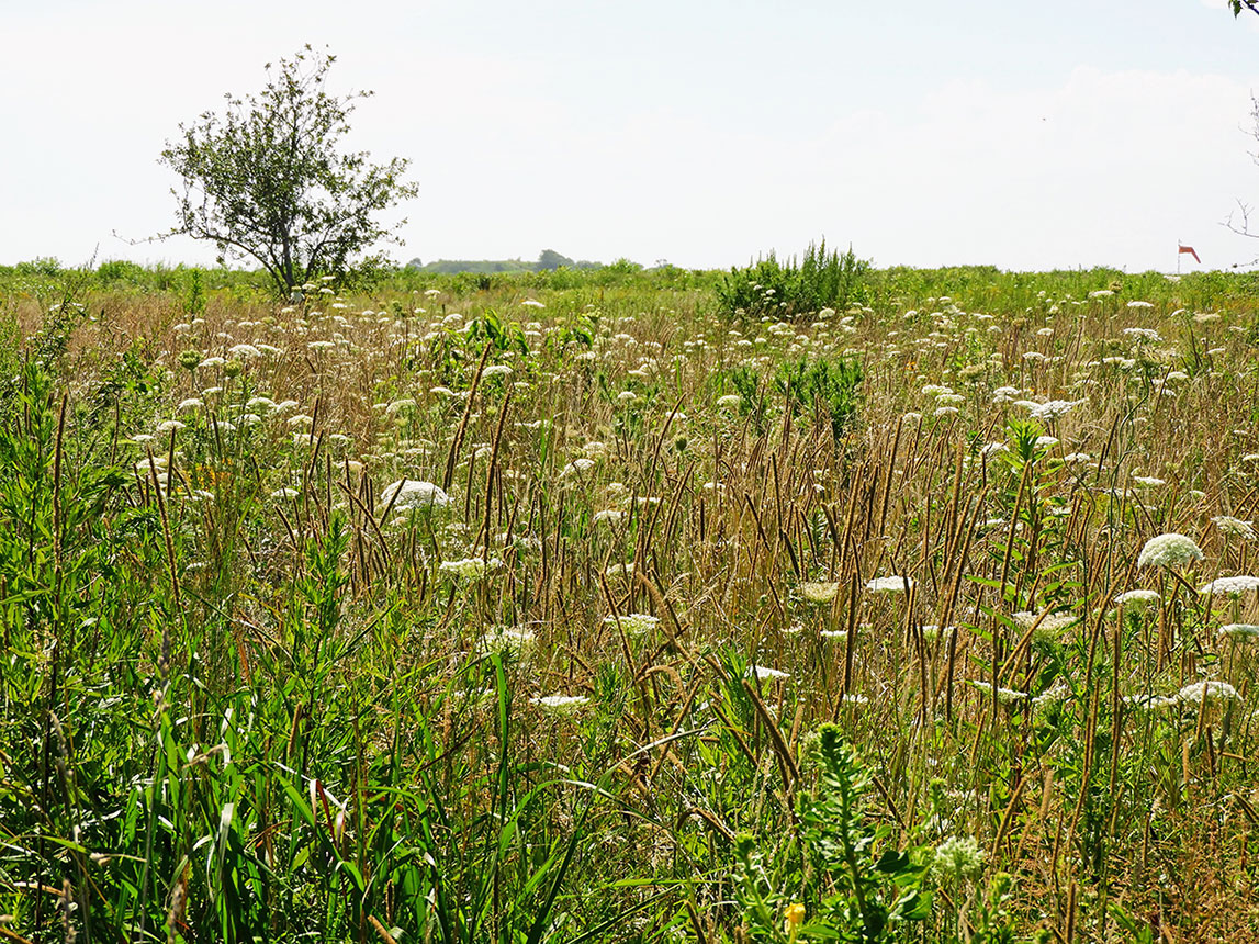
- Queen Anne’s Lace on the Parade Grounds, August 2, 2018. Renowned entomologist and author, Dr. Douglas W. Tallamy, of the University of Delaware, has been a guiding consultant for the F.I. Conservancy since the early days of the project. He has voiced the equivalent of a clarion call to bring back native vegetation and remove invasives from Fishers Island. Dr. Tallamy advocated from the outset that insects thrive when native plants are restored, as do all the species that depend on insects for food. It’s an interconnected, interdependent win, win, win that restores nature’s balance. Photo by Jane T. Ahrens.
-

- Monarch caterpillar on milkweed, Parade Grounds, August 11, 2018. Another scientist central to the restoration project is Dr. Adam Mitchell, whose PhD thesis at the University of Delaware was based on the meadow restoration on Fishers Island. His ”boots on the ground” data documenting the recovery of the flora and fauna within the Fort property south of Whistler Ave. are invaluable as they provide benchmarks for all future studies. Photo by Jane T. Ahrens.
-

- Marine Debris Tent, August 3, 2018. On special event days, displays of educational material on a variety of topics are made available to the public along with ecological tours of the property that are conducted by volunteers and naturalists. The restored biosphere of the Parade Grounds functions in effect as an institution of natural learning with an infinite number of available classes. Photo courtesy of the Fishers Island Conservancy.
-
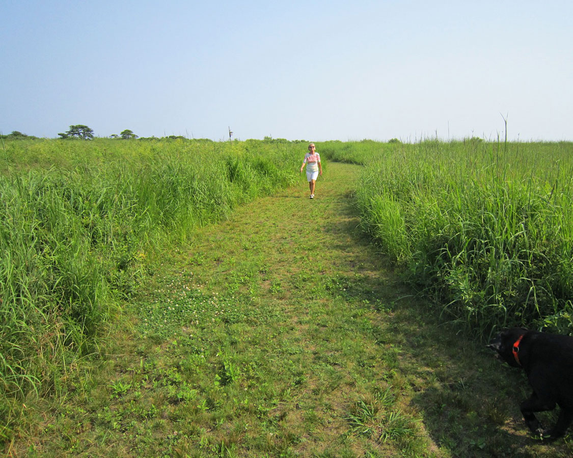
- The recreational walking trails that crisscross the Parade Ground property were recently expanded to 6-feet in width to facilitate physical distancing during the current crisis. Photo courtesy of the Fishers Island Conservancy.
-

- Bench in the Fishers Island Conservancy’s Demonstration Garden, August 2, 2019. The Demonstration Garden, which showcases native plants in a garden setting, was recently renamed “The John Thatcher Native Garden” in memory of John Thatcher, a co-founder and an avid proponent of the F.I. Conservancy’s mission. Photo by Jane T. Ahrens.
-
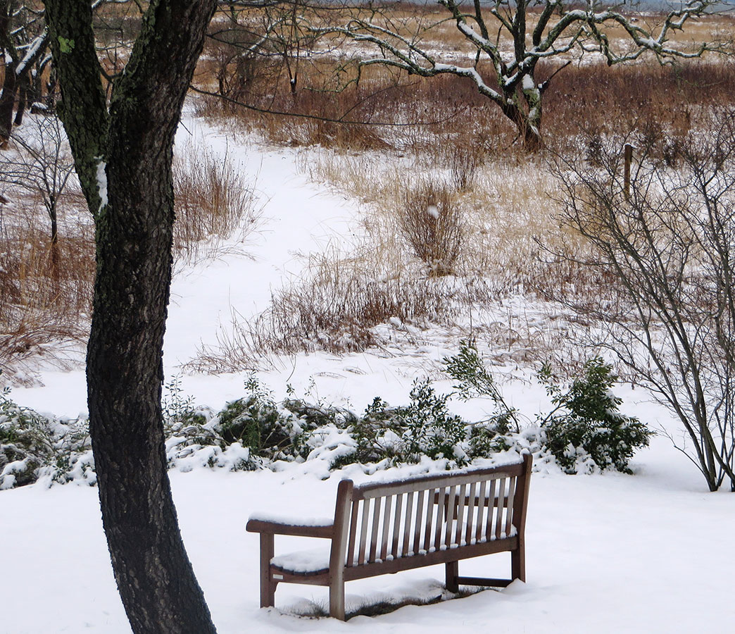
- Bench in the Demonstration Garden (The John Thatcher Native Garden), March 3, 2019. The Parade Grounds welcome you no matter what the season! Congratulations to the Fishers Island Conservancy for restoring a central and essential section of former Fort Wright for people, plants and animals. Photo by Justine Kibbe.
-

- Fort Parade, Oil & mastic on canvas, by Jeff Carpenter, 2006. Heartfelt thanks go out to all who have helped keep the physical structures and the spirit of Fort Wright alive on Fishers Island, including the 30 original subscribers to the Race Point Corporation, the persevering property owners who have restored and repurposed Fort buildings adjacent to Silver Eel Cove and along Officers Row, the scores of Fishers Island Conservancy supporters who, along with members of the FIFD, have contributed time, labor and resources to the cause of restoring and maintaining the grasslands south of Whistler Ave., and the selfless board members and staff of the F.I. Ferry District and F.I. Waste Management who keep it all humming. Due to your considerable, sustained efforts over time, Fort Wright remains seamlessly integrated into our community and lives on in many guises.
Videos
National Guard at Fort H.G. Wright, circa 1938.
Courtesy of U.S. Military History Institute.
Howard Best home movies, circa 1954.
Courtesy of Dennis and Roz Pitts.
Charles B. Ferguson home movie excerpt, circa 1965.
Courtesy of the late Charles B. Ferguson.
Silver Eel Cove Building Conversion Galleries
Fort Wright’s Buildings in Conversion Date Order
Building 98 into a Community Center
Building 57 into Private Living and Work Space

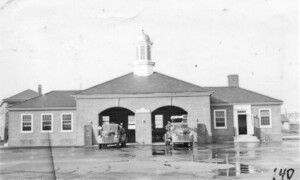
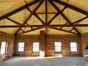
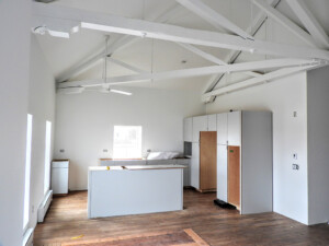
Building 1 into Artist Studios and Public Space
Building 209 into Housing for Year-round Residents
Building 100 into Creative Workspace
Annual exhibition sponsored by:
ACKNOWLEDGMENTS
Fort H.G. Wright, Fishers Island, N.Y.
We are very grateful for the evocative emplacement photographs shot by William Gill, Mary Murphy, Charlie Morgan, Jim Reid, and John Wilton, for the historical photo of Battery Marcy supplied by Jim Diaz, for the pit party snapshots conjured up by Melie Spofford and Polly Talbott, for the information on the mortar pits shared by David Burnham, for the dates and descriptions of Waste Management’s history supplied by Beth Stern and Greg Thibodeau, and for the numerous photos and maps documenting Fort Wright’s buildings and infrastructure contributed by Mark Berhow, a member of the always helpful Coast Defense Study Group.
The Officers Row section of the exhibition was informed by original documents shared by Jan and Peter Burr. It was structurally centered around a period photo that Sandy and George Esser kindly sent in showing their house in shambles circa 1962.
We are greatly appreciative of the images and information documenting the F.I. Conservancy’s extensive restoration project south of Whistler Ave. provided by Jane T. Ahrens, Joe Henderson, Justine Kibbe, Kristen Peterson, Betty Ann Rubinow, and Tom Sargent.
Special thanks to Olivia P. Cleary for sharing her imaginative drawings of a repurposed Battery Marcy, and to Jeff Carpenter for letting us use his wonderful painting Fort Parade that helped tie the ending all together.
The following institutions provided additional images: Coast Defense Study Group, Daily News, Fishers Island Conservancy, National Archives and Records Administration, and U.S. Coast Guard.
The images in the associated galleries that celebrate the conversions of five former Fort Wright buildings in the Silver Eel Cove area were gathered by Nate Malinowski, Fort Wright Building 1, Lighthouse Works Annex (Artist Studios and Public Space); Billie Tsien and Tod Williams, Fort Wright Building 57 (Private Work/Living Space); John Spofford and Jeanie Cook, Fort Wright Building 98 (F.I. Community Center); Mary and Brad Burnham, Fort Wright Building 100, Ordnance (Creative Work Space); Matthew Edwards, Fort Wright Building 209, 2nd Floor, Walsh Park Benevolent Corp. (Apartments for Year-Round Residents). We thank all of you and your sponsoring institutions for your timely cooperation and assistance on these side galleries. We also would like to acknowledge Matthew Burnham’s striking aerial photo that includes all five converted buildings.
Jane T. Ahrens was the sole photographer of the remarkable gallery showing the conversion of the 2nd floor of the freight building, and also contributed images to other galleries and the main exhibit. In recent decades she has become the premier visual chronicler of Fishers Island and her work is much appreciated.
The home movies in this section were excerpted from those originally gathered for display in 2003 in our new building. The three sources were U.S. Military History Institute (Carlisle Barracks, PA.) for the color footage of the big guns and other weapons firing at Fort Wright in the late 1930s, the Pitts family for the Howard Best home movies of the distressed structures of Fort Wright in the mid-1950s, and the late Charlie Ferguson for home movies on the same theme taken a decade later in the mid-1960s. They all provide literally moving evidence that complements the exhibition.
Once again, a big “thank you” to all who contributed to this multilayered Fort Wright exhibition. We couldn’t have done it without you!
Pierce Rafferty,
Director,
Henry L. Ferguson Museum