ANNUAL EXHIBITION 2020
Fort Tyler, Gardiners Point Island, N.Y.:
“The Ruins”
The story of Fort Tyler would be a comedy if it weren’t so tragic. The Fort was completed by 1898, but only after the end of the Spanish American War. Fort Tyler was never assigned armament or a garrison. In the ensuing decades, it became the haunt of boating sightseers, rumrunners and bootleggers. Robert Moses tried to make it a park in the 1920s. The War Department made it a bombing target range in the mid-1930s. FDR subsequently declared it a bird preserve in 1938, but after World War II it became a practice bombing target again. Today, Gardiners Point Island has reverted to bird preserve status; however, with perhaps longer memories than humans seem to have, nesting birds have never returned to “The Ruins” in any great numbers.
-
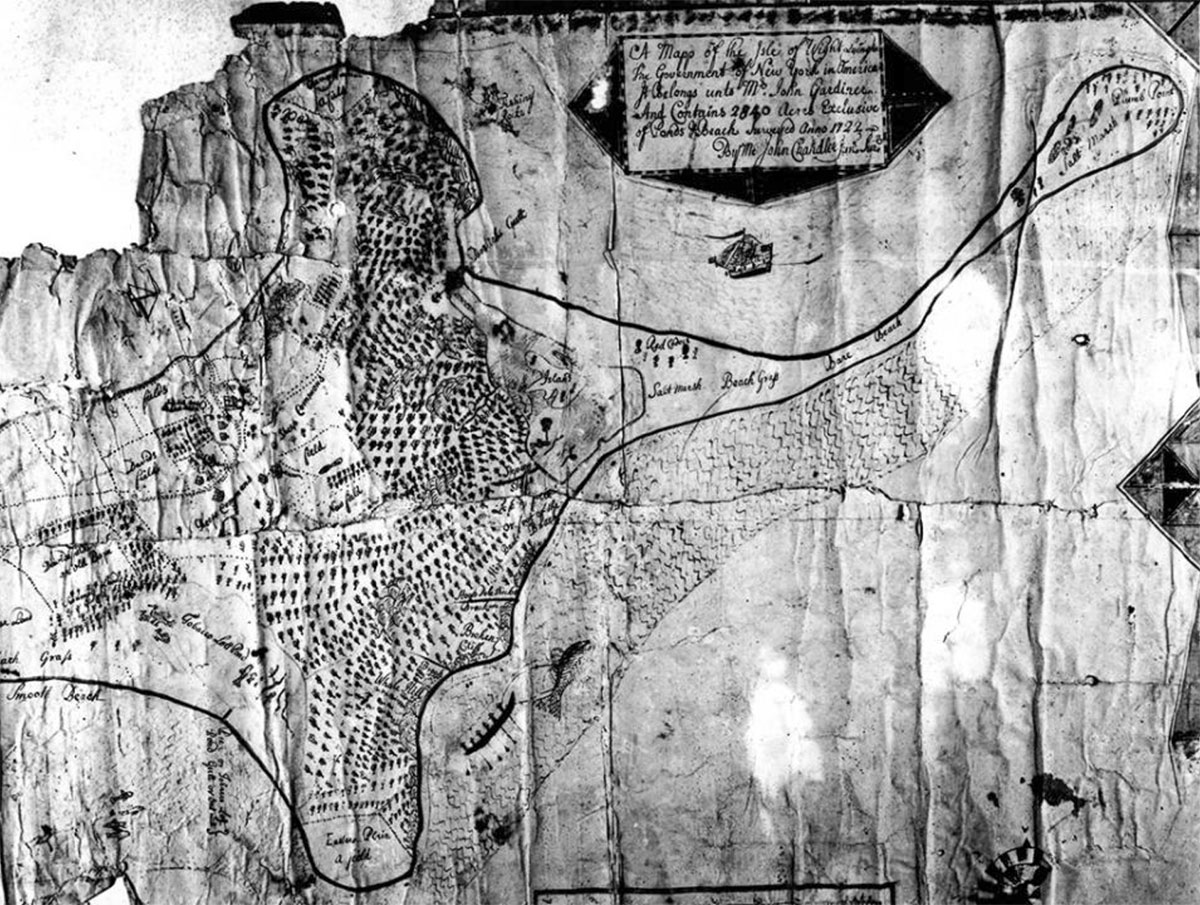
- 1722 Map showing Gardiners Island with sand shoal extending to current site of Gardiners Point Island. The Great Blizzard of 1888 breached the sand shoal turning the former point into an island. Courtesy of East Hampton Library, Long Island Collection.
-
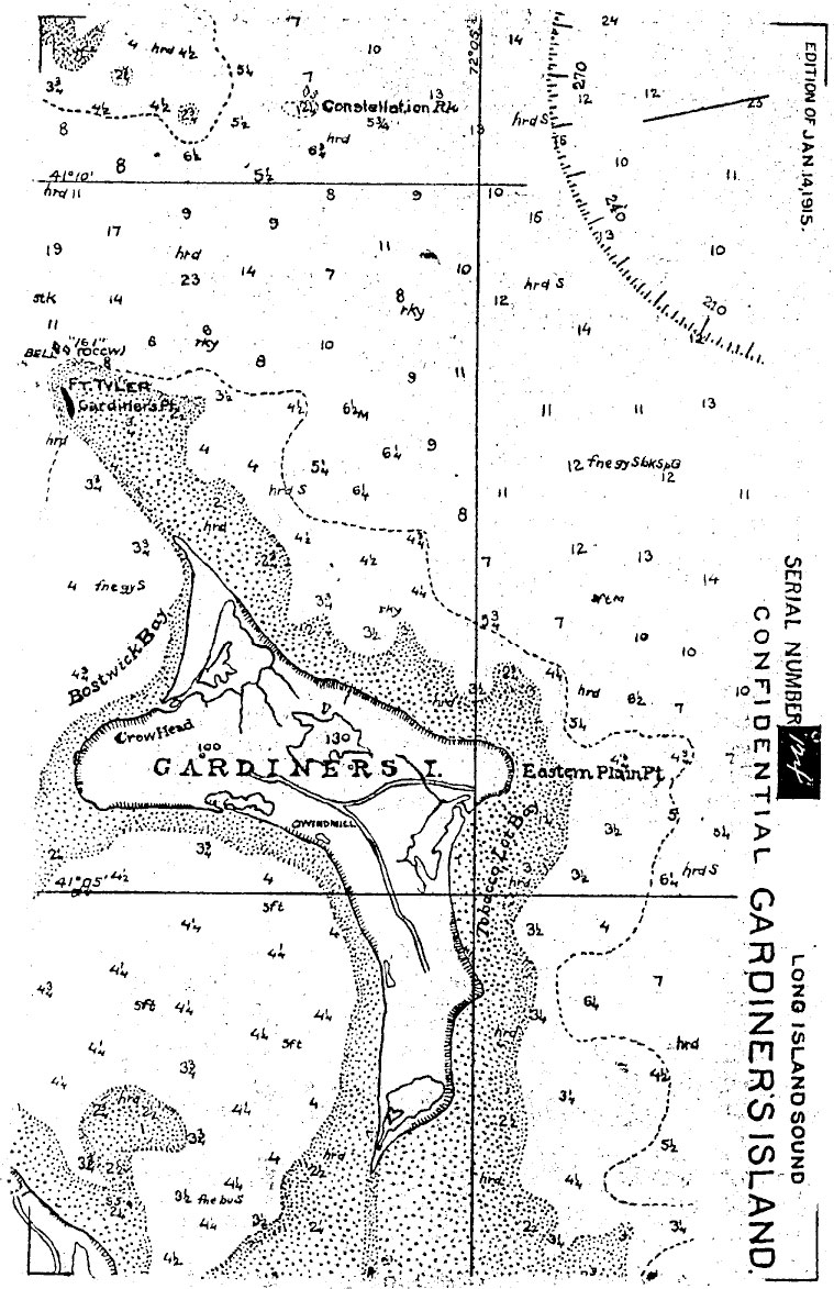
- Map “Gardiner’s Island, Long Island Sound.” Edition of Jan. 14, 1915. Note the submerged sand shoal that extends to the southwest of Gardiners Island (upper left as seen here) to the Fort Tyler site. The unstable sands beneath Fort Tyler were a major factor in its abandonment by the War Department. Photo source: National Archives and Records Administration (NARA). Courtesy of Coast Defense Study Group.
-
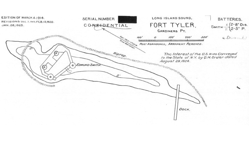
- Map “Fort Tyler, Long Island Sound.” Edition of March 4, 1914. Revisions to Jan. 28, 1925. Triggered by the war fever surrounding the outbreak of the Spanish American War, construction of Fort Tyler was completed by 1898, but only after the war had ended. Fort Tyler initially had a temporary battery intended for two 8-inch guns. The permanent fort, formally named in 1904, had emplacements designed for two 8-inch disappearing guns and two 5-inch guns on pedestal mounts. However, no armament was ever mounted at Fort Tyler and no garrison assigned. Photo source: NARA. Courtesy of Curt Kessler.
-

- The type of 8-inch coast defense gun intended for, but never mounted at, Fort Tyler. Photo source: “The Americana: A Universal Reference Library,” (1906).
-

- Group of sightseers approaching Fort Tyler, circa 1905. Beginning in the early 1900s, Fort Tyler, lacking both armament and an occupying garrison, quickly became a destination for the curious who arrived on both sailing and motor vessels. Photo courtesy of Bolling Smith.
-
- Group entering Fort Tyler through an archway, circa 1905. Photo courtesy of Bolling Smith.
-
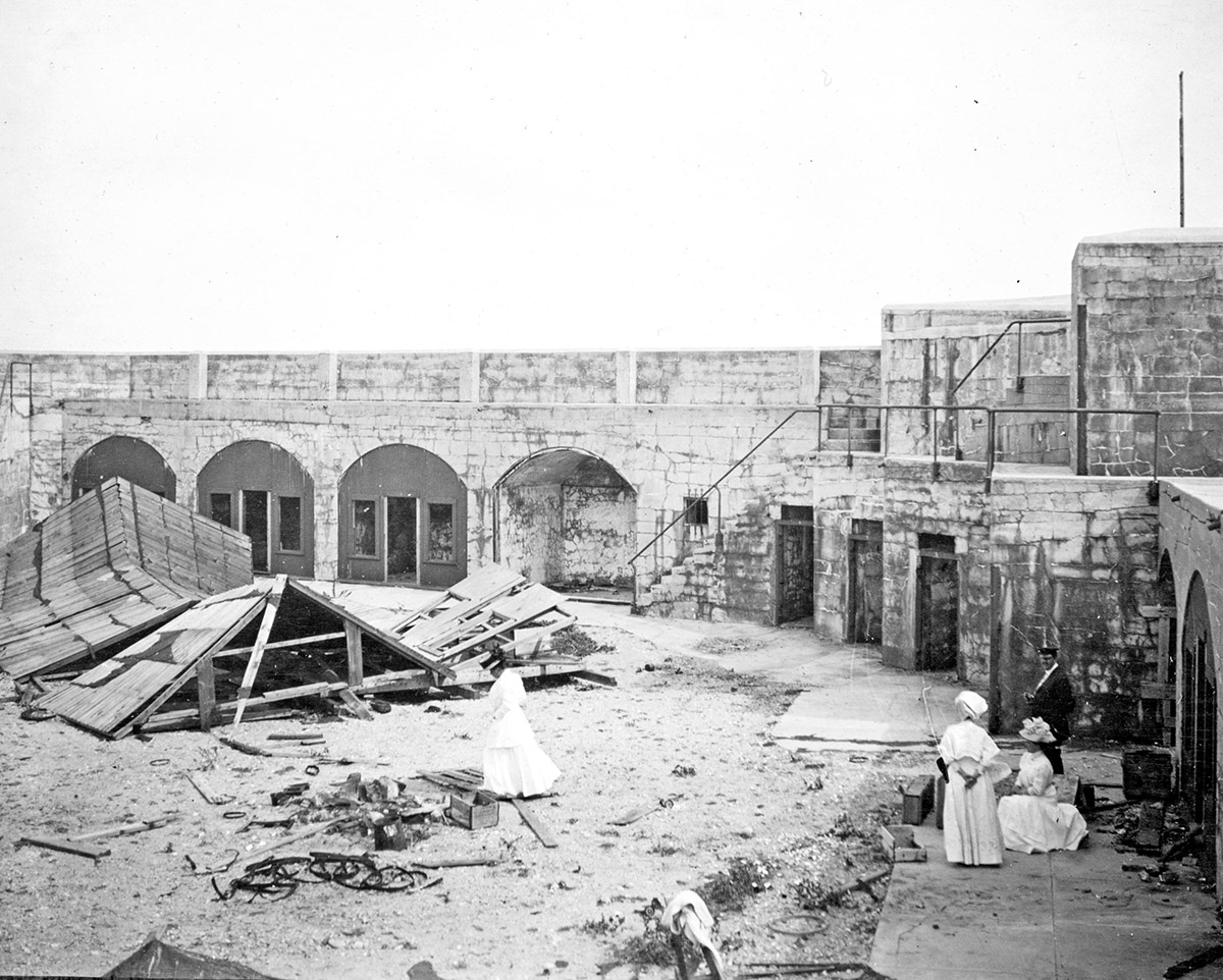
- Sightseeing group exploring within Fort Tyler, circa 1905. Photo courtesy of Bolling Smith.
-

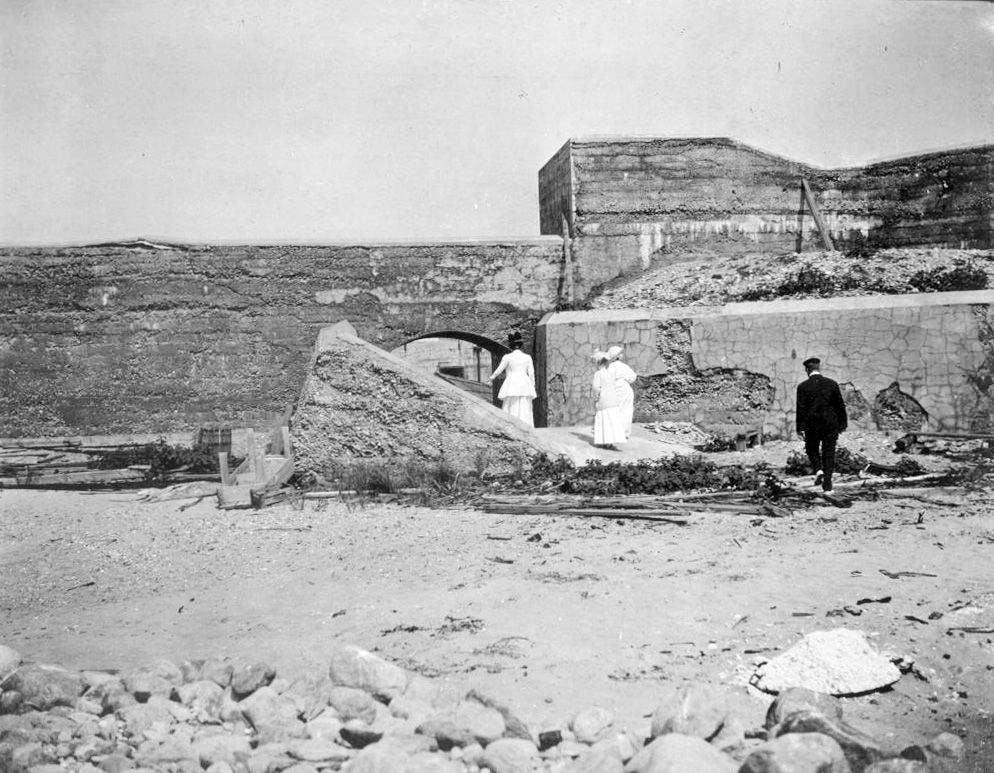
- Our group of peripatetic sightseers take their exploration of Fort Tyler to the next level. Photo courtesy of Bolling Smith.
-

- A nice spot for an afternoon stroll, Fort Tyler, circa 1905. Photo courtesy of Bolling Smith.
-

- The visitors climb even higher onto the ramparts of Fort Tyler, circa 1905. Photo courtesy of Bolling Smith.
-
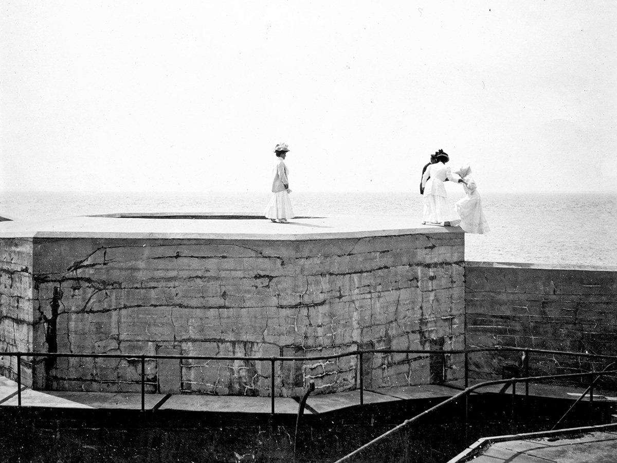
- Sightseers helping each other up to the very top of Fort Tyler, circa 1905. Photo courtesy of Bolling Smith.
-
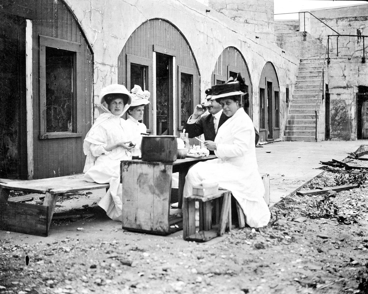
- A picture of contentment as sightseers get a well-deserved rest while consuming a picnic lunch within the walls of Fort Tyler, circa 1905. Photo courtesy of Bolling Smith.
-

- Fort Tyler, Gardiners Point Island, N.Y., as seen from the water, circa early 1930s. During this period Fort Tyler was the haunt of wildfowl, picnickers, bootleggers and rumrunners. Photo courtesy of the late Maj. Gen. George Ruhlen.
-
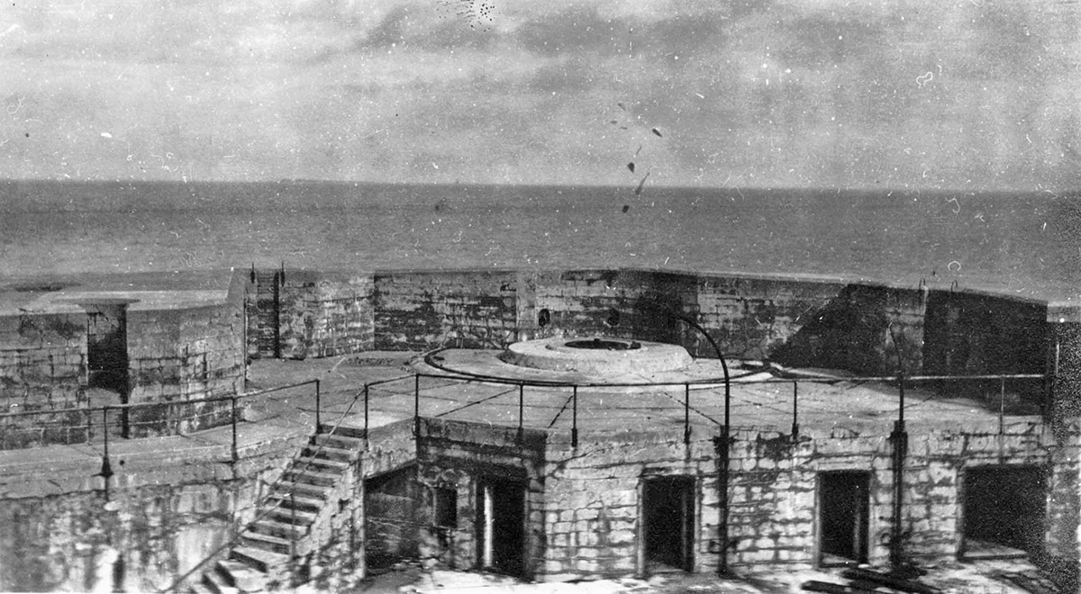
- Gun emplacement, Fort Tyler, Gardiners Point Island, N.Y., circa early 1930s. On August 29, 1924, The Long Island State Park Commission, Robert Moses chairman, purchased Gardiners Point Island from the US Government for $50. The press reported: “It would make a delightfully airy camping spot swept by the breezes of Gardiner’s Bay and Block Island Sound.” Photo courtesy of the late Maj. Gen. George Ruhlen.
-
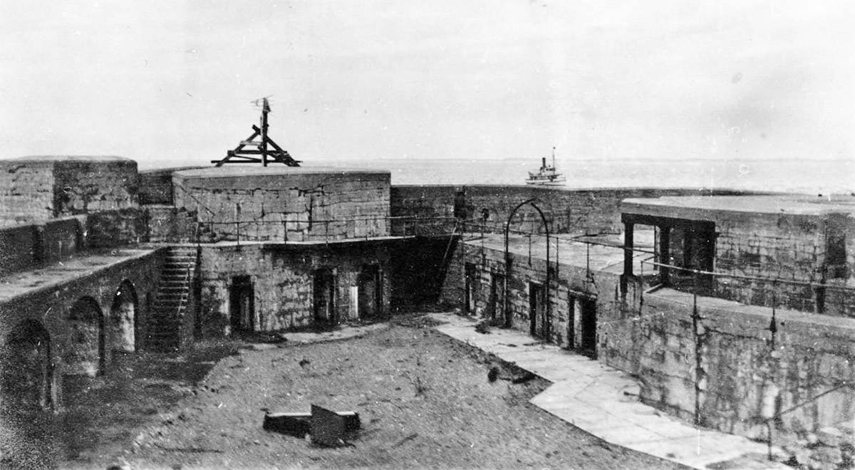
- Interior view of Fort Tyler, Gardiners Point Island, N.Y., circa early 1930s. The Park Commission relinquished title to Gardiner’s Point Island in July 1936, “because it was not suitable for park development.” The title reverted to the US Government and was immediately passed to the War Department who were ready to go with a new military use for Fort Tyler. Photo courtesy of the late Maj. Gen. George Ruhlen.
-
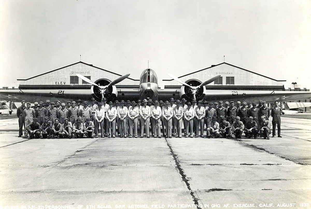
- 9th Bombardment Group posing with new B-10 bomber, Mitchel Field, Long Island. In August 1936, this group began a series of bombing raid exercises targeting the Fort Tyler site with “dummy” bombs. Photo courtesy of Paul Martin.
-
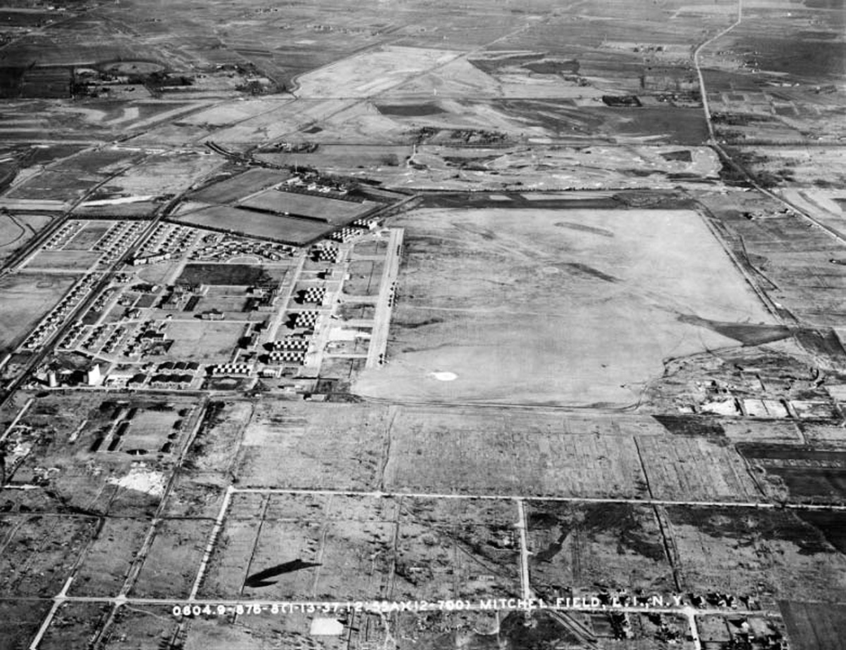
- Aerial view of Mitchel Field, Long Island, 1937. The B-10 bombers that conducted bombing exercises over Fort Tyler departed from this airfield in groups ranging from two to twelve bombers. Photo courtesy of Paul Martin.
-
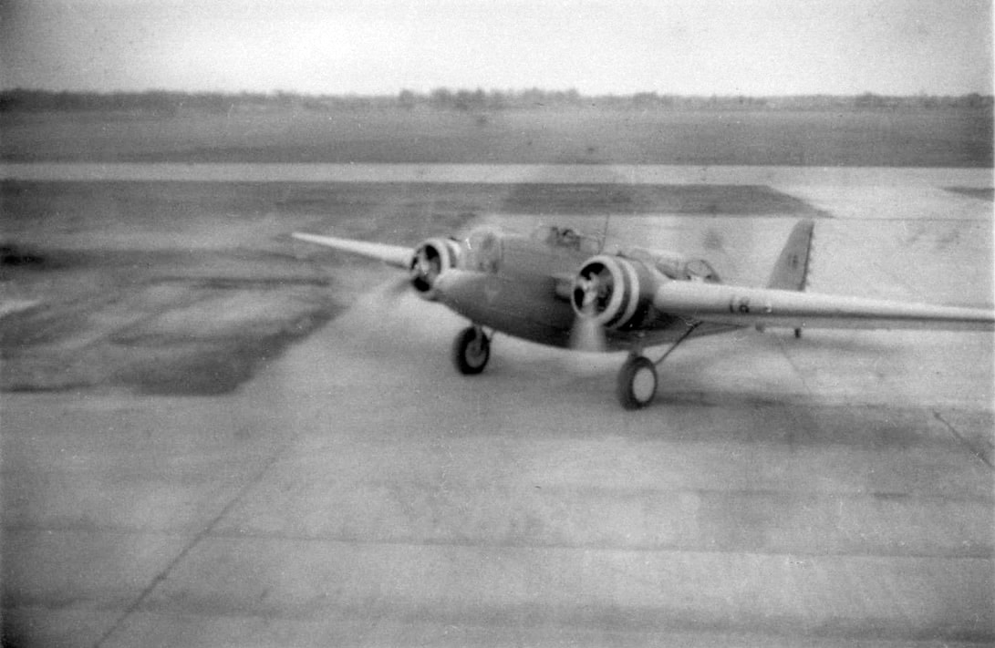
- A single B-10 bomber ready for take off from Mitchel Field, Long Island, circa 1936. Photo courtesy of Paul Martin.
-
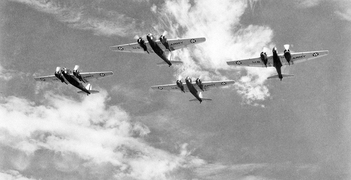
- Group of four B-10 bombers in flight, circa 1936. The 9th Bombardment Group was responsible for the air defense of the East Coast of the United States. Bombing runs over Fort Tyler were seen by military brass as important for their overall mission as the other available alternate target was in Virginia. With bombs falling on their favorite fishing grounds at the eastern entrance to Long Island Sound, sports fishermen of the region immediately organized a fierce opposition to the bombing runs. Photo courtesy of The National Museum of the USAF.
-
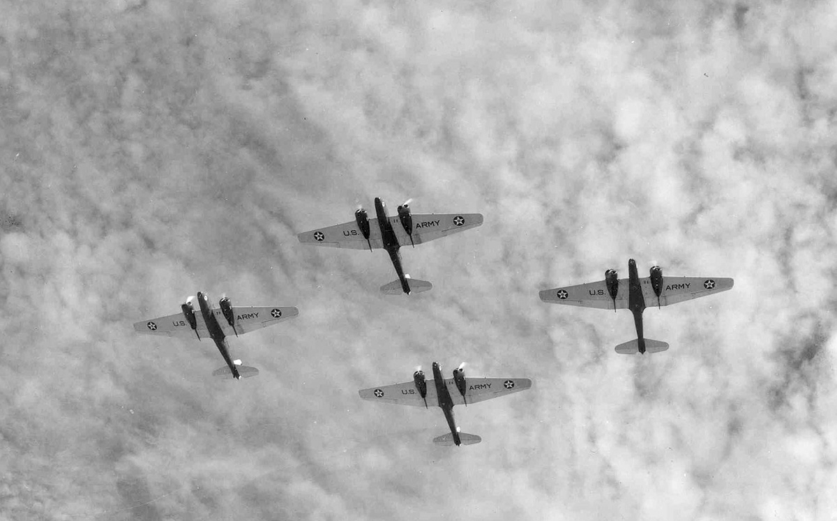
- Four B-10 bombers flying overhead, circa 1936. According to press reports, the bombers dropped their bombs from altitudes that ranged from 2,000 to 10,000 feet, with some flying as high as 18,000 feet. Photo courtesy of The National Museum of the USAF.
-
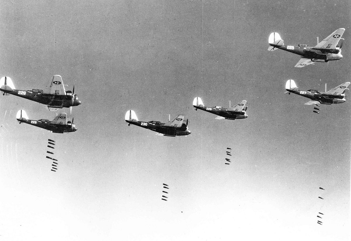
- Bombs away! Group of B-10 bombers dropping their loads during an exercise. The ”dummy “ bombs weighed 100 pounds each and were mostly filled with sand and water. However, they each contained approximately one pound of black powder whose explosion marked the striking spot. With fish, fishermen and boating vacationists collectively scared away from the target area, the protests grew loud enough that New York Governor Lehman intervened. The War Department halted the bombing of Fort Tyler in September 1936. Photo courtesy of USAF.
-

- Portrait of President Franklin Delano Roosevelt in 1938. On August 2, 1938, FDR issued Executive Order 7941 creating the Fort Tyler Migratory Bird Refuge, 14 acres in size, located on Gardiners Point Island, N.Y.. The Refuge operated under the U.S. Department of Agriculture. Photo courtesy of NARA.
-
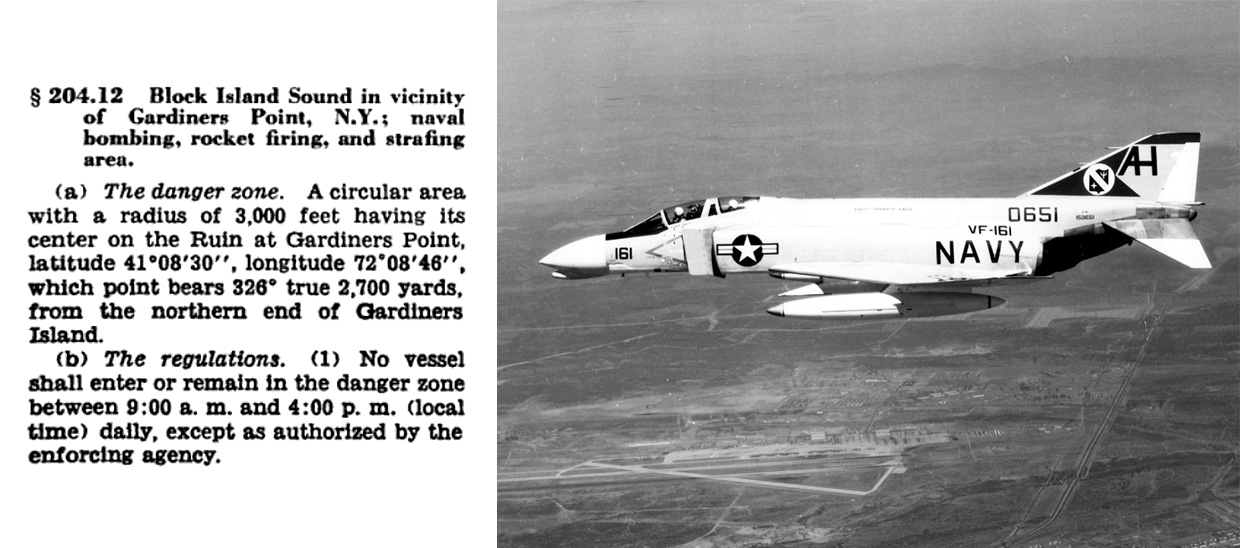
- Danger zone notice for area around Gardiners Point, N.Y., from the “Code of Federal Regulations.” (1962). From 1949 to 1964, the War Department once again utilized Fort Tyler for target practice, primarily using U.S. Navy and Marine aircraft. Anyone within the 3,000 foot danger zone circle was at risk from “naval bombing, rocket firing, and strafing.” The Fort Tyler Migratory Bird Preserve (whose name had changed to Fort Tyler National Wildlife Refuge in 1940) was literally obliterated beginning in 1949. Fort Tyler’s nickname soon became “The Ruins.”
-
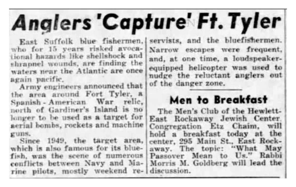
- Newspaper clipping: “Anglers ‘Capture’ Ft. Tyler.” In 1964, after fifteen long years of opposition, fishermen finally succeeded in halting the military bombardment and strafing aimed at Gardiners Point Island. Over time birds returned to the Island, but despite sustained efforts by biologists and naturalists, a thriving tern colony has not yet been established at the site. In recent decades Gardiners Point Island has been under the stewardship of the US Fish and Wildlife Service (USFWS) as a part of its Long Island National Wildlife Complex. Newspaper clipping from Daily News, March 15, 1964.
-
- The Ruins of Fort Tyler, August 2011. Please note Azucena Ponce (Murphy), US Fish and Wildlife Service biologist, at center right setting up a tern call/playback device to try to attract nesting terns to the island. Photo by Curt Kessler.
-

- Azucena Ponce (Murphy), USFWS biologist, working at Fort Tyler, August 2011. Photo by Curt Kessler.
-
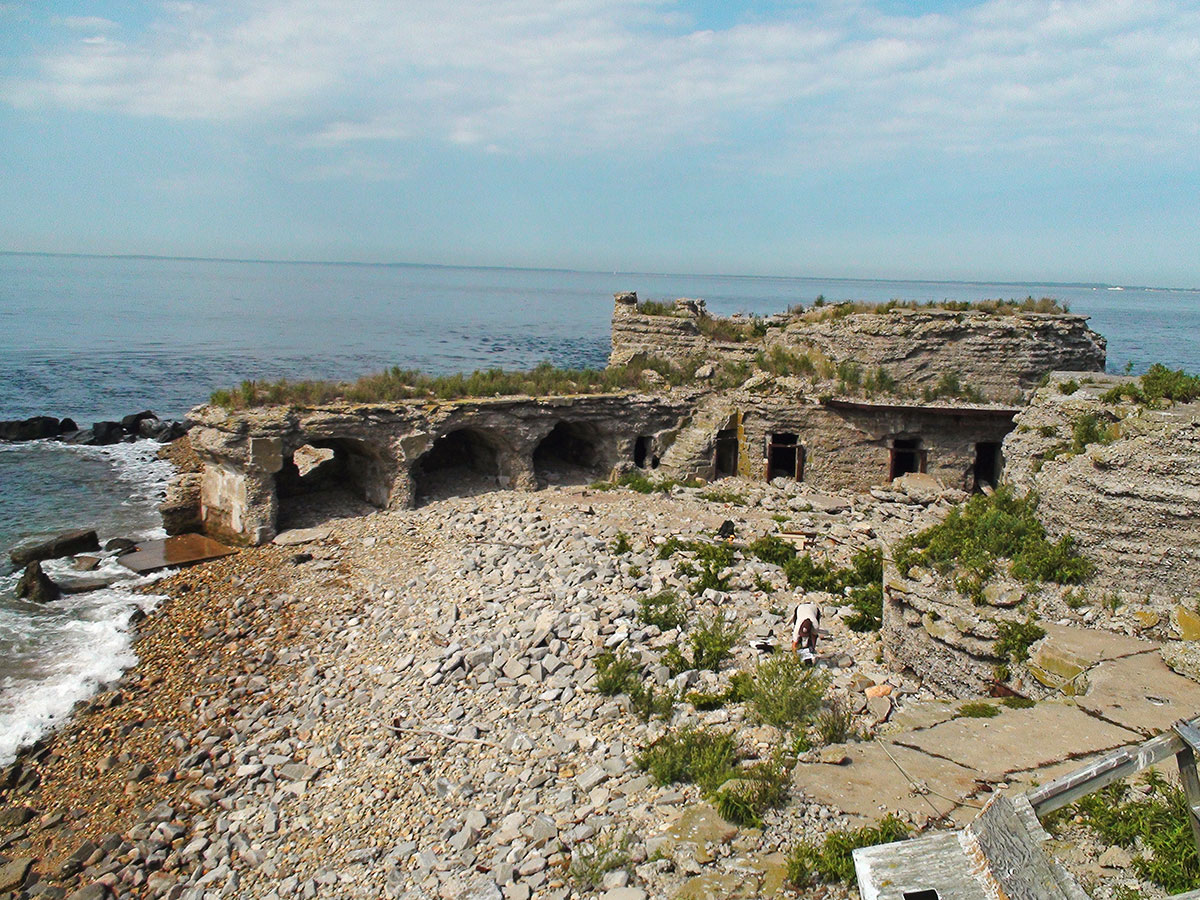
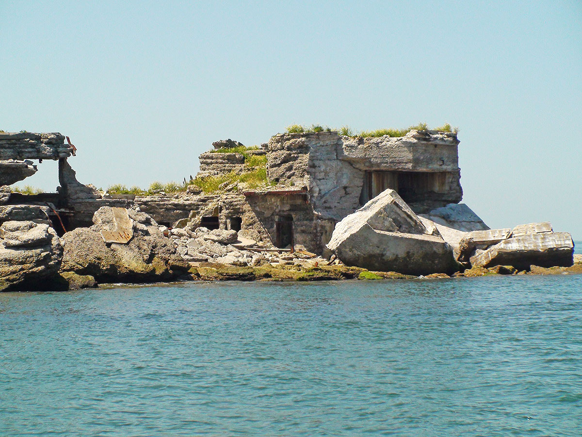
- The Ruins of Fort Tyler, August 2011. After decades of bombing and strafing, every square foot of the Fort lives up to its nickname: “The Ruins.” Photo by Curt Kessler.
-

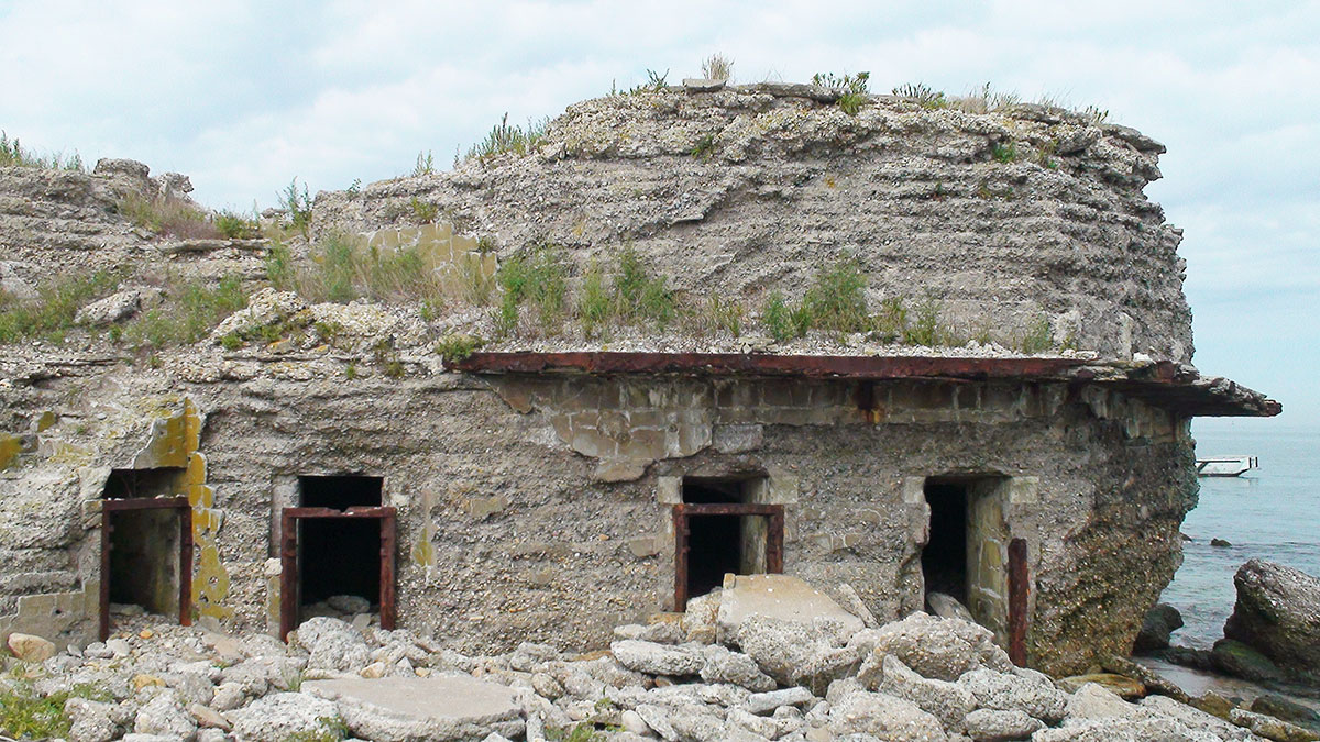
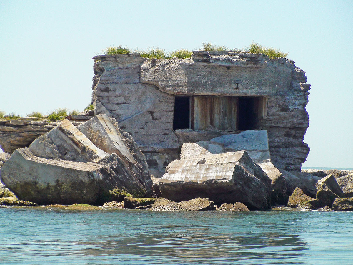
- The Ruins of Fort Tyler, August 2011. Photo by Curt Kessler.
-
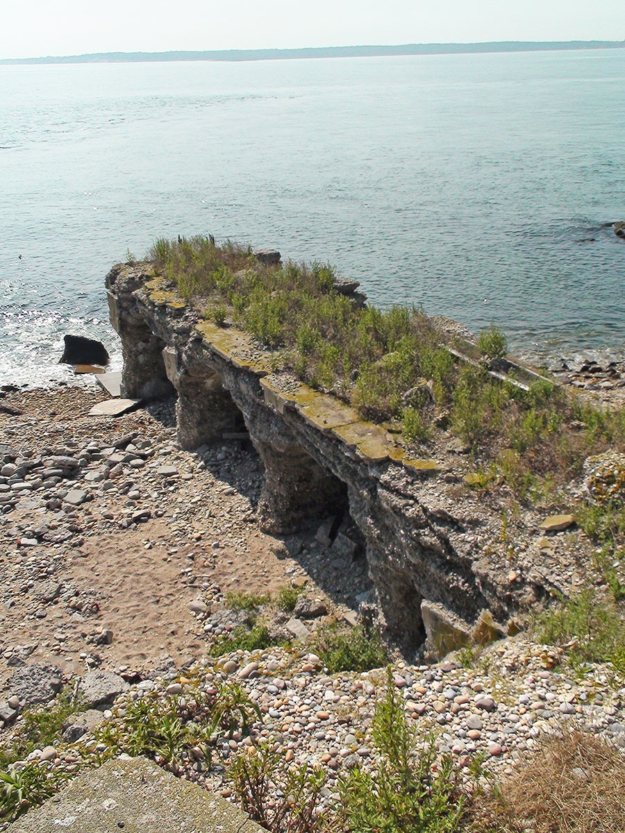
- The Ruins of Fort Tyler, August 2011. Each year there is less and less of Fort Tyler left standing. Photo by Curt Kessler.
-

- The Ruins of Fort Tyler, August 2011. Note the solar-powered tern call/playback device at center right. Photo by Curt Kessler.
-
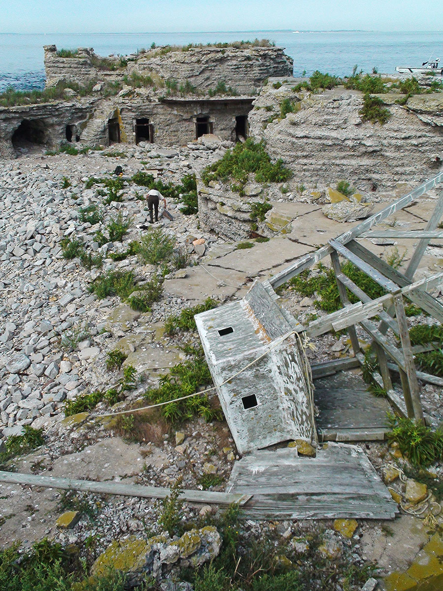
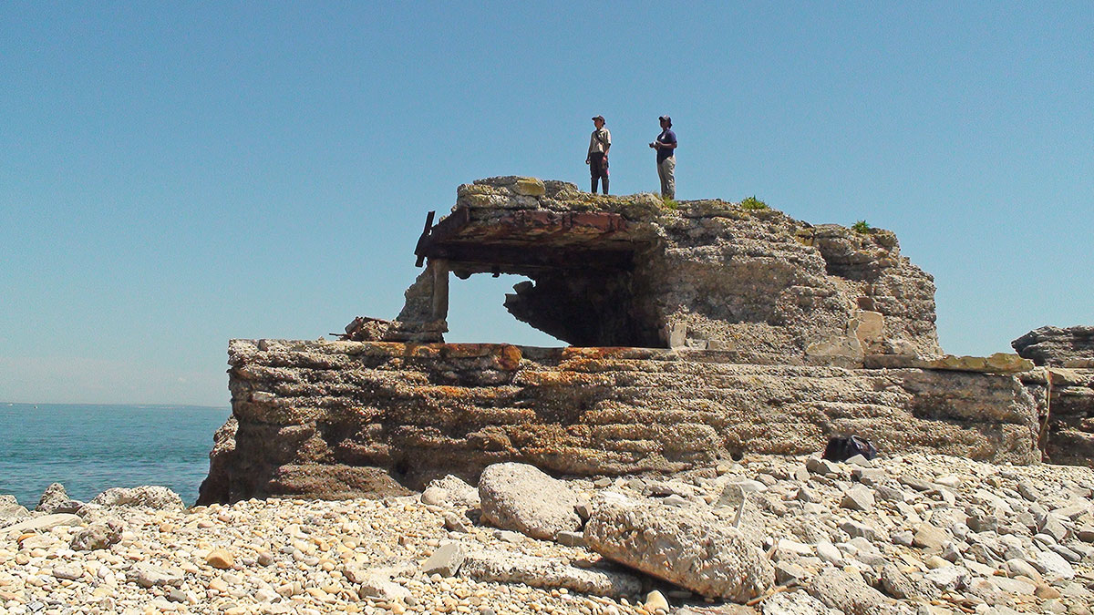
- Toppled bird blind platform, Fort Tyler, August 2011. These blinds were built in the mid-1980s by Matthew Male. They were part of the initial tern colony restoration project on Gardiners Point Island. Matthew was working at the site out of the Great Gull Island Tern Research Center in conjunction with the USFWS. Photo by Curt Kessler.
-
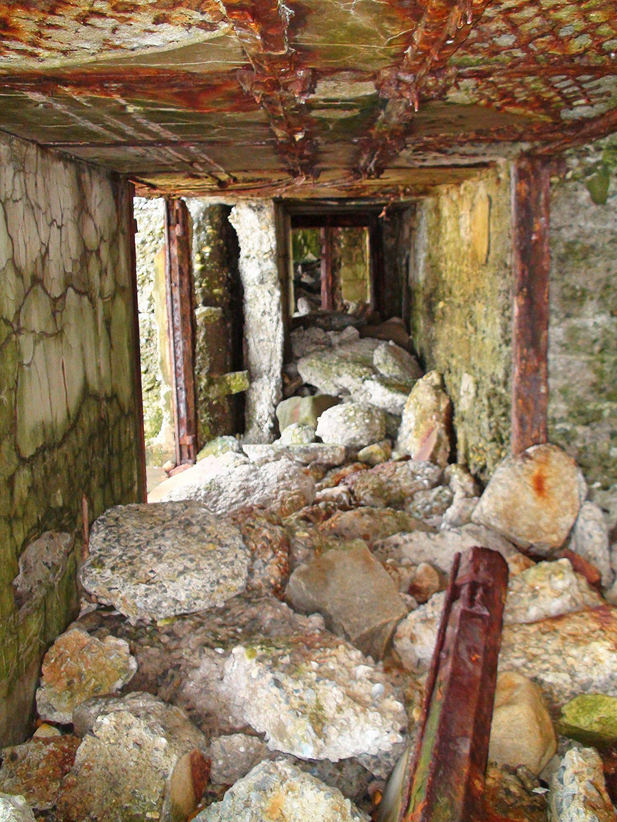
- Storm driven rocks and rubble fill the empty spaces throughout The Ruins, August 2011. Photo by Curt Kessler.
-
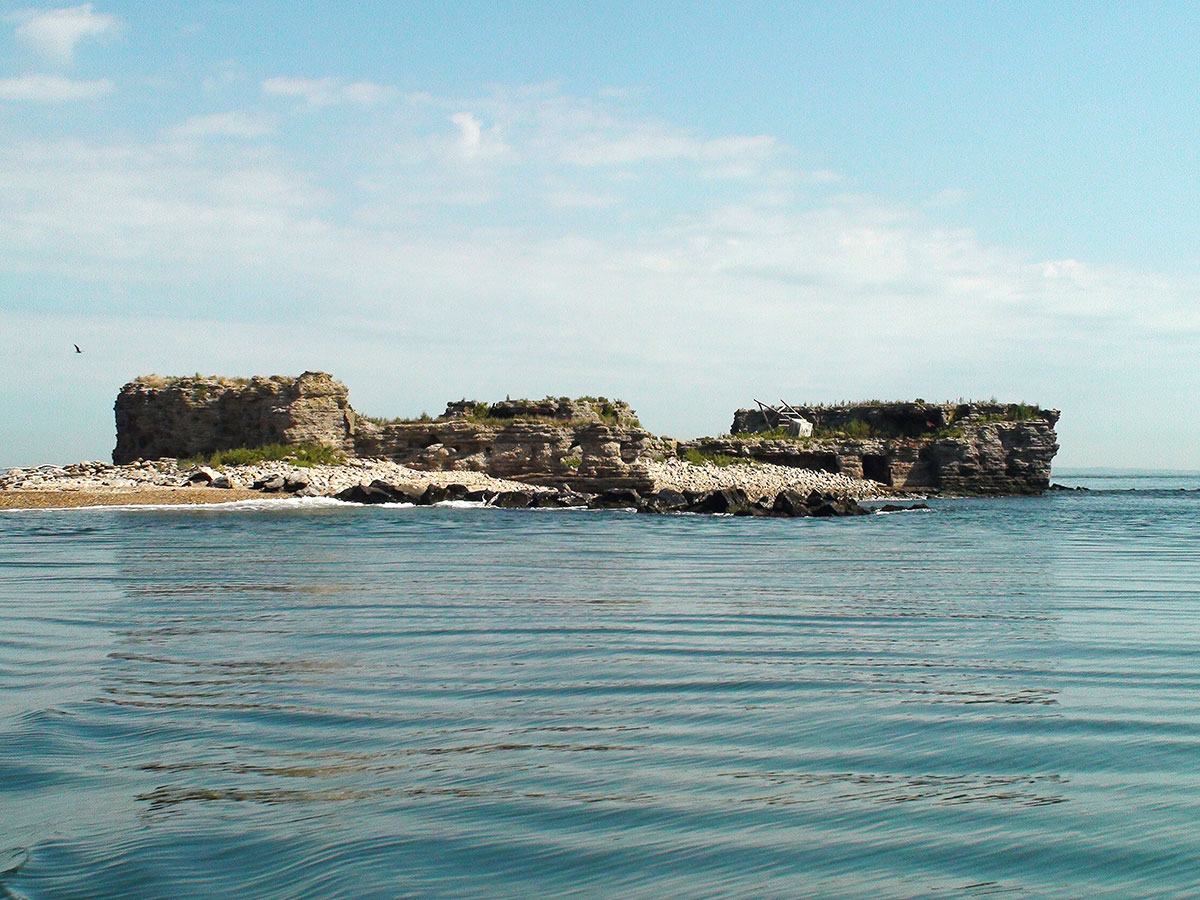
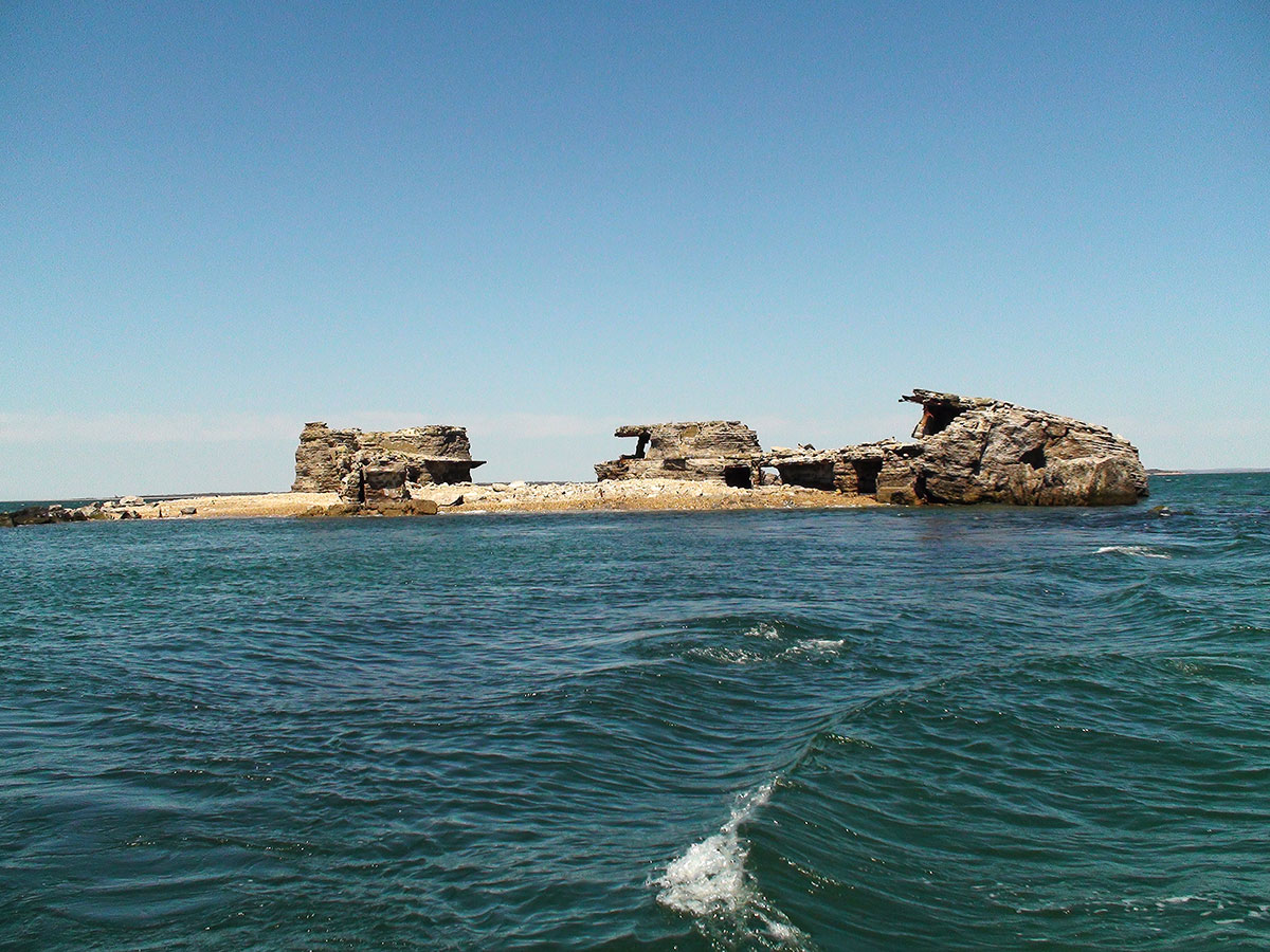
- A view of The Ruins from the water, August 2011. Photo by Curt Kessler.
-
- A corresponding view of The Ruins, April 2013, taken post Superstorm Sandy. Note how much the structure had deteriorated in only one and a half years. (See prior photograph.) Photo by Curt Kessler.
-
- The Ruins, April 2013. During Superstorm Sandy (Oct 22, 2012 – Nov 2, 2012) entire sections of the Fort collapsed. The storm also tossed concrete blocks across the island with disturbing ease. Photo by Curt Kessler.
-
- A closer view of structural changes wrought by Superstorm Sandy on Gardiners Point Island. Photo by Curt Kessler, April 2013.
-
- The USFWS team on Gardiners Point Island, June 2013. On this trip four USFWS biologists were counting bird nests, assessing bird activity, and removing gull nests to try to increase tern nesting viability on the island. Photo by Curt Kessler.
-
- Large and small fragments of bombs were uncovered or thrown ashore by Superstorm Sandy, Gardiners Point Island, April 2013. Photo by Curt Kessler.
-
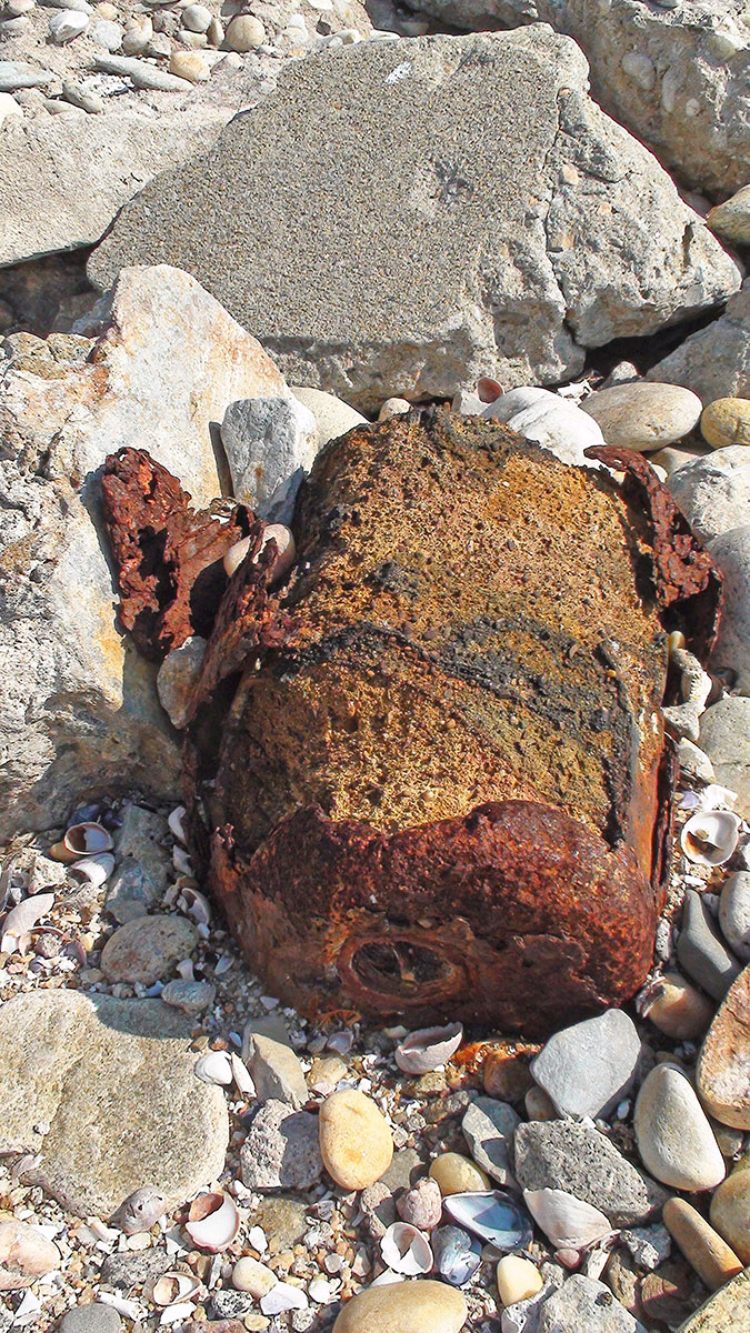
- Biologist Curt Kessler of the USFWS found three unexploded bombs during his search of the shoreline, April 2013. These were U.S. Navy bombs that dated to the second round of target practice that began in 1949. They were considerably smaller than the 100-pounders dropped by the USAF in the mid-1930s; each weighed, according to press reports, two pounds four ounces, and measured only about eight inches in length. Photo by Curt Kessler.
-

- After the bomb discoveries were called in, East Hampton Marine Patrol ferried the bomb squad to Gardiners Point Island, April 2013. Photo by Curt Kessler.
-
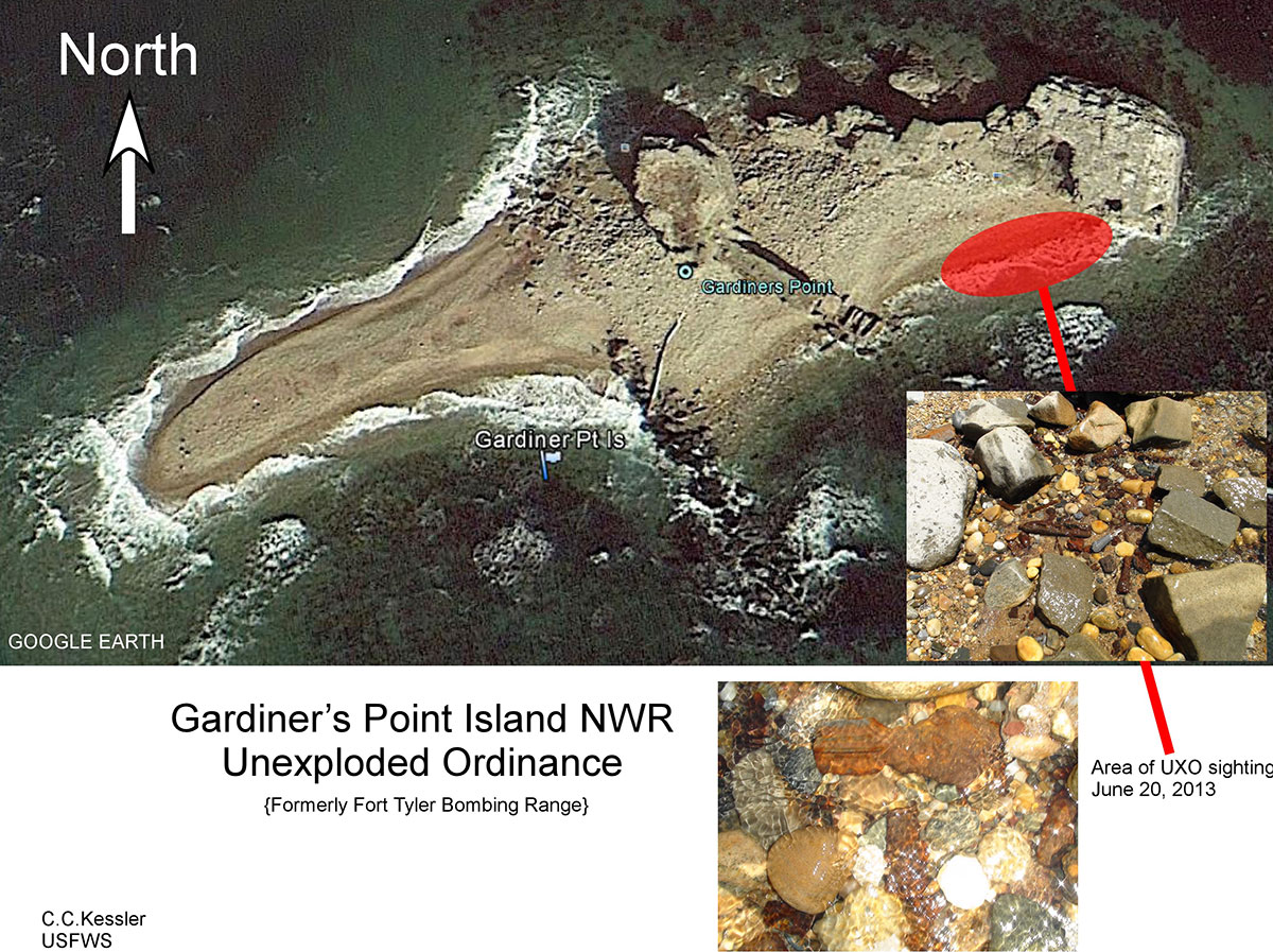
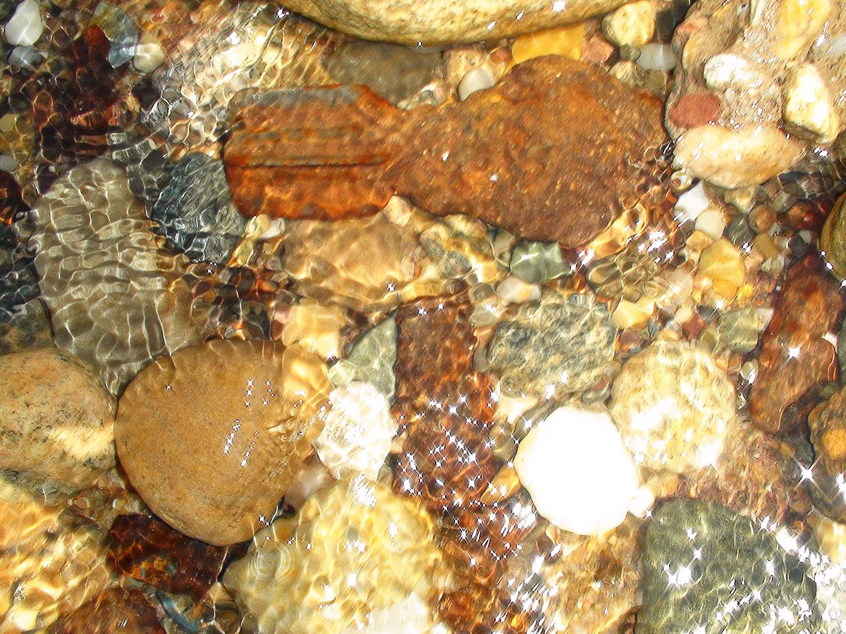
- Chart showing location of Unexploded Ordinance (sic) on Gardiner’s Point Island, April 2013. The bomb squad exploded the three discovered bombs on site. Two had lost their explosive charges and detonated harmlessly. The third blew up leaving a crater in the shoreline. Because of these leftovers from decades of target practice, a “Danger Zone” is marked on nautical charts that surrounds Gardiners Point Island. Boaters, fishermen and the curious are prohibited from landing, increasing the odds that this area once again can be an undisturbed wildlife sanctuary.
-
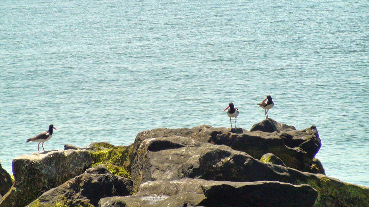
- Oyster catchers on the rocks, Gardiners Point Island, June 2013. Photo by Curt Kessler.
-
- USFWS biologist Robin Donhue departing with his co-workers from Gardiners Point Island, June 2013. They are the stewards of a refuge that is bit by bit being swallowed by the sea. Photo by Curt Kessler.
-

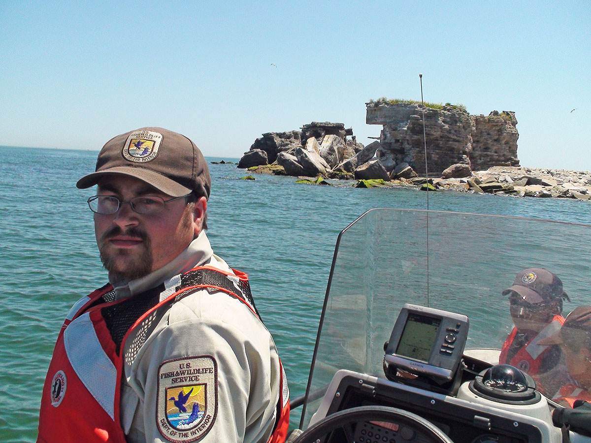
- An interested observer, just offshore in June 2013. Photo by Curt Kessler.
Video
“The Ruins”
Original Footage by Curt Kessler
Edited with permission by Marisela La Grave and Pierce Rafferty
for the HLFM ANNUAL EXHIBITION 2020
To learn more about strategic habitat conservation efforts by the US Fish and Wildlife Service, please visit:
fws.gov
To learn more about the history of Mitchel Field, please visit:
mitchelfield.weebly.com
Annual exhibition sponsored by:
ACKNOWLEDGMENTS
Fort Tyler, Gardiners Point Island, N.Y.
The historical section of the Fort Tyler exhibit benefited greatly from the images of sightseers touring the abandoned fort in the early 1900s that were provided by Bolling Smith, member of the Coast Defense Study Group. More than 20 years ago, the late Maj. Gen. George Ruhlen donated copies of his photographs of Fort Tyler to the HLFM. They were invaluable for this project. Paul Martin, an unofficial historian of Mitchel Field, Long Island, generously shared images of and information about that airfield and the B-10 bombers that used Fort Tyler as a bombing practice target in 1936.
The 21st century section of the Fort Tyler exhibit is almost entirely comprised of photographs taken by former U.S. Fish and Wildlife Service biologist Curt Kessler. He also provided the video footage of Gardiners Point Island taken in 2013 after Superstorm Sandy. Special thanks go out to Curt. This section of the exhibit rests entirely on the foundation of his in-depth documentation of “The Ruins.”
Thanks also to Marisela LaGrave for her editing work on Curt Kessler’s video of Gardiners Point Island, 2013. Southold Town Historian Amy Folk was of great help, as was Jon Fuller of Groton Long Point.
The following institutions provided additional images: Coast Defense Study Group, East Hampton Library, National Archives and Records Administration, and The National Museum of the United States Airforce.
Thank you all. We couldn’t have done it without you!
Pierce Rafferty,
Director,
Henry L. Ferguson Museum