ANNUAL EXHIBITION 2020
Fort Mansfield, Napatree Point, R.I.
Fort Mansfield was established on 60 acres of land purchased by the government on Napatree Point, R.I. in 1898. The post was subsequently abandoned in stages with all armament removed by 1917. The beachscape would be radically altered by storms within a few short decades. By the mid-1940s, the land was being preserved “for public enjoyment and conservation of nature…”
-

- Map of Fort Mansfield, Napatree Point, R.I., Edition of Aug. 26, 1914, Revised to Feb. 13, 1920. Fort Mansfield was established on 60 acres of land purchased by the government on Napatree Point, R.I. in 1898. Note the military buildings that lined the barrier beach leading up to and beyond the 5-inch disappearing gun emplacement of Battery Connell. Photo courtesy of National Archives and Records Administration (NARA).
-
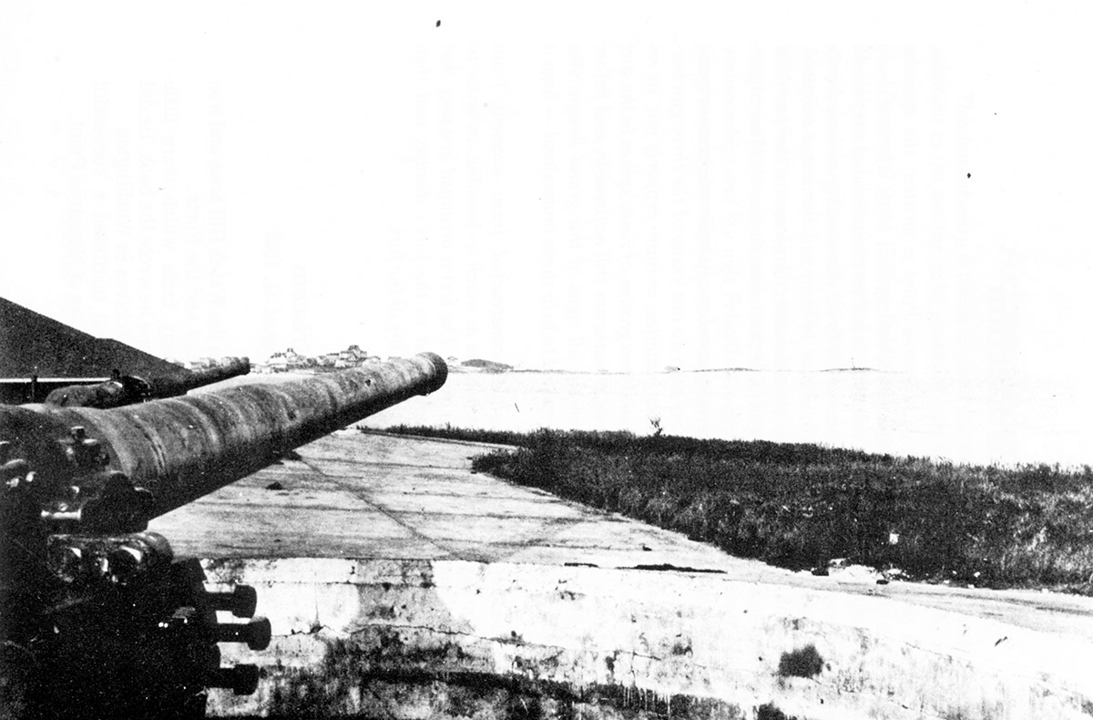
- Looking past the 5-inch guns of Battery Connell toward the Watch Hill Lighthouse. Battery Connell was perilously close to the shoreline of the Sound, a proximity that would literally bury the emplacement in the decades to come. Photo courtesy of NARA.
-
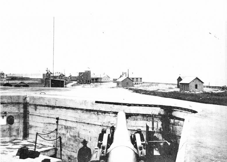
- 8-inch gun emplacement, Battery Wooster, Fort Mansfield. Construction began at Fort Mansfield in 1899. First garrisoned in 1901, the usefulness of Fort Mansfield was called into question when a “fatal flaw” was discovered during a 1907 mock war exercise. The Fort proved militarily defenseless, subject to a withering and unanswerable “enemy” attack from ships along the Rhode Island coast due to a “blind angle.” The post was subsequently abandoned in stages with all armament removed by 1917. Photo source: NARA. Courtesy of The Watch Hill Conservancy.
-
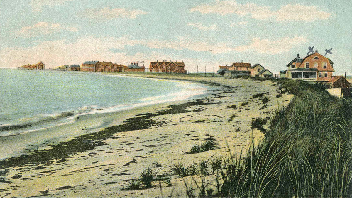
- “Fort Mansfield, Watch Hill, R.I.” The military housing and other structures that stretched out along the barrier beach toward Napatree Point were demolished in the winter of 1928-29 following the Government’s sale of the land. Printed postcard, circa 1910, from H.L. Ferguson Museum Collection.
-

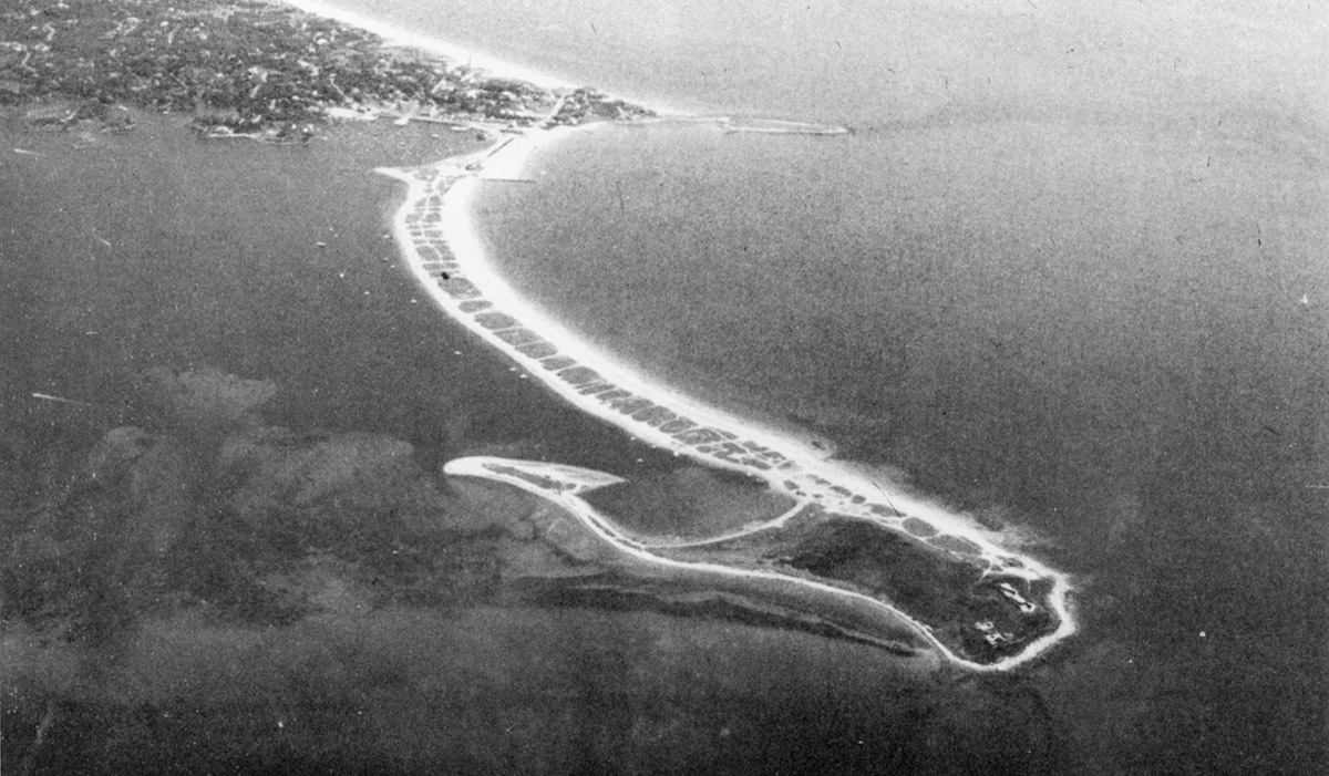
- Aerial view of Fort Mansfield, July 10, 1926. Batteries Crawford and Wooster are in foreground and Battery Connell in right center where the road jogs left. Everything about this beachscape would radically alter in a few short decades. Photo source: NARA, courtesy of Mark Berhow.
-

- Aerial view of Napatree Point with the Sandy Point extension intact in 1936, two years before the Hurricane of 1938. Please note that the government structures are gone, having been removed in 1928, but the three gun batteries remain. Source: Geographical Review, from “Fort Mansfield” by Clement A. Griscom (1992).
-
- This 1971 aerial reveals the dramatic reconfiguration of Sandy Point with only two gun batteries visible on land. Battery Connell has disappeared in the ”surf zone” as the barrier beach shifted landward. Photo from “Fort Mansfield” by Clement A. Griscom (1992).
-

- Chart showing the reconfiguration of the Sandy Point extension of Napatree Point between the years 1848 and 2014. Chart courtesy of The Watch Hill Conservancy.
-
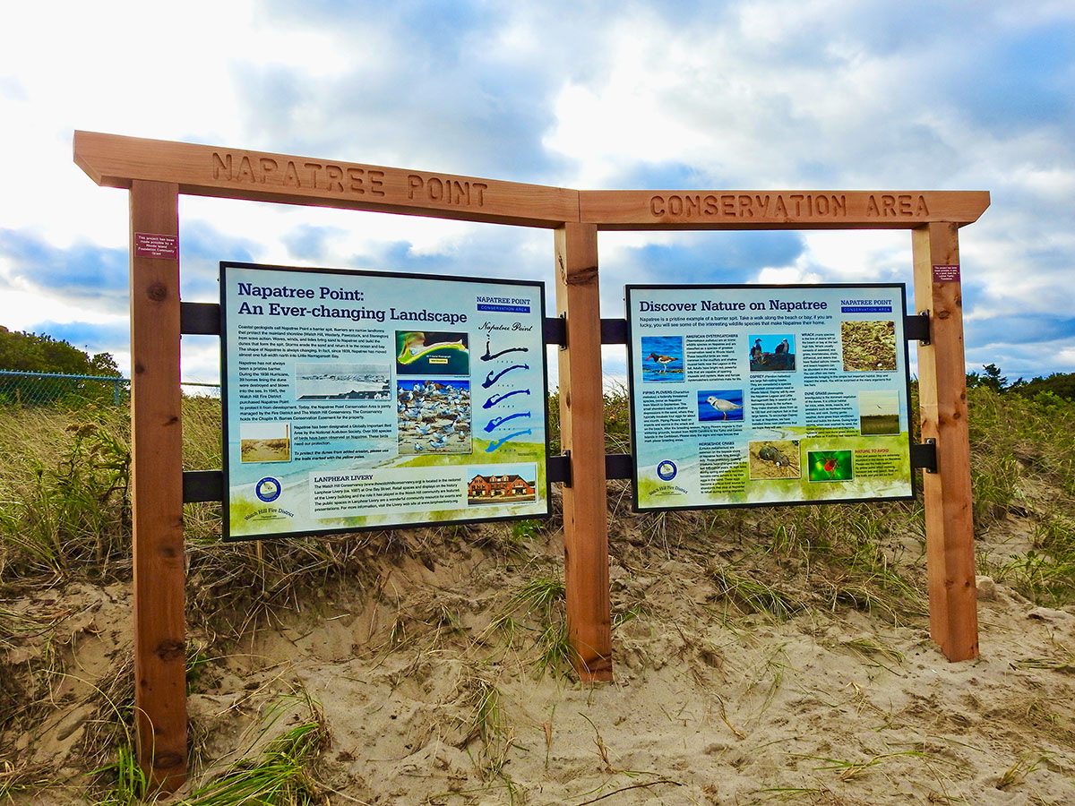
- Napatree Point Conservation Area signs, October 24, 2018. Photo courtesy of The Watch Hill Conservancy. “In 1945, the Watch Hill Fire District purchased most of the land that comprises Napatree Point to preserve it for public enjoyment and conservation of nature…”
-
- “…In 2013, the Fire District granted the Chaplin B. Barnes Conservation Easement over their parcels on Napatree to The Watch Hill Conservancy. The Fire District and the Conservancy collaboratively steward Napatree and offer educational programs for children and visitors.” Photo courtesy of The Watch Hill Conservancy. Quote from “History of Napatree” at thewatchhillconservancy.org.
-

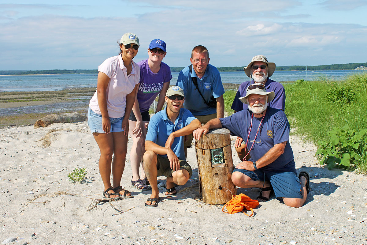
- Scientists of the lagoon monitoring team heading to work, August 1, 2016. L to R: Napatree Naturalist, Christian Fox, Charles Roman, PhD, Nicole Rohr, PhD, JD, Peter V. August, PhD, and Napatree Naturalist, Emily Bodell. Photo courtesy of The Watch Hill Conservancy.
-

- Lagoon monitoring team measuring loss of marsh edge, Napatree Point, August 1, 2016. Photo courtesy of The Watch Hill Conservancy. Beginning in 2014, The Watch Hill Conservancy initiated annual studies of the 9.9 acre lagoon on the western end of Napatree.
-
- Lagoon monitoring team posing with wildlife camera trap, August 1, 2016. Photo courtesy of The Watch Hill Conservancy.
-
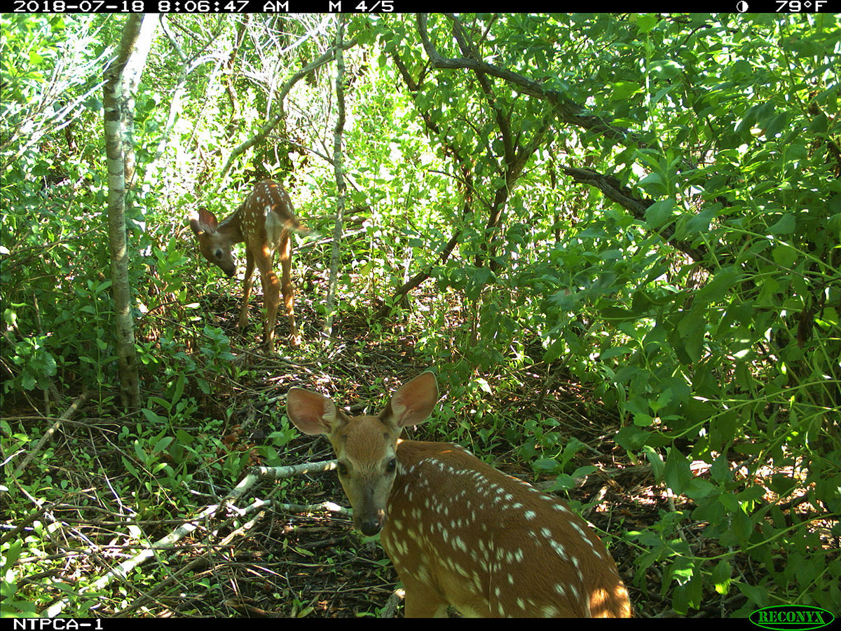
- Who goes there? Deer, caught in the camera trap on Napatree Point, July 18, 2018. Photo courtesy of The Watch Hill Conservancy.
-

- Measuring a horseshoe crab, Napatree Point, July 14, 2014. Napatree naturalists, science advisors and volunteers come together each year to count, tag and record data on horseshoe crabs. The 400 million year old living fossils are intercepted as they make their way to shore to lay eggs during the high tides of the new and full moon during May, June and July. The recorded data provide an important measure of the health of the ocean while revealing the supply level of horseshoe crab eggs, a critical food supply for shorebirds. Photo courtesy of The Watch Hill Conservancy.
-

- Napatree science advisor Dr. Bryan A. Oakley measuring a beach profile using RTK-GPS, December 21, 2015. These measurements are used to decipher the short- and long-term response of the Napatree barrier and headland to storms which are the “driving force” in shoreline change at Napatree Point. Dr. Oakley is an Associate Professor in the Dept. of Environmental Earth Science, Eastern Connecticut State University. Photo courtesy of The Watch Hill Conservancy.
-
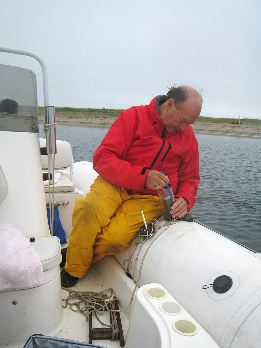
- Grant G. Simmons III monitoring water quality off Napatree Point. Mr. Simmons, a member of a family long associated with Fishers Island, serves as both a Watch Hill Park Commissioner and vice-president of The Watch Hill Conservancy. Photo courtesy of The Watch Hill Conservancy.
-
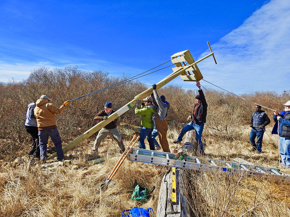
- Group erecting an Osprey platform on Napatree Point near the lagoon, February 17, 2017. Photo courtesy of The Watch Hill Conservancy.
-
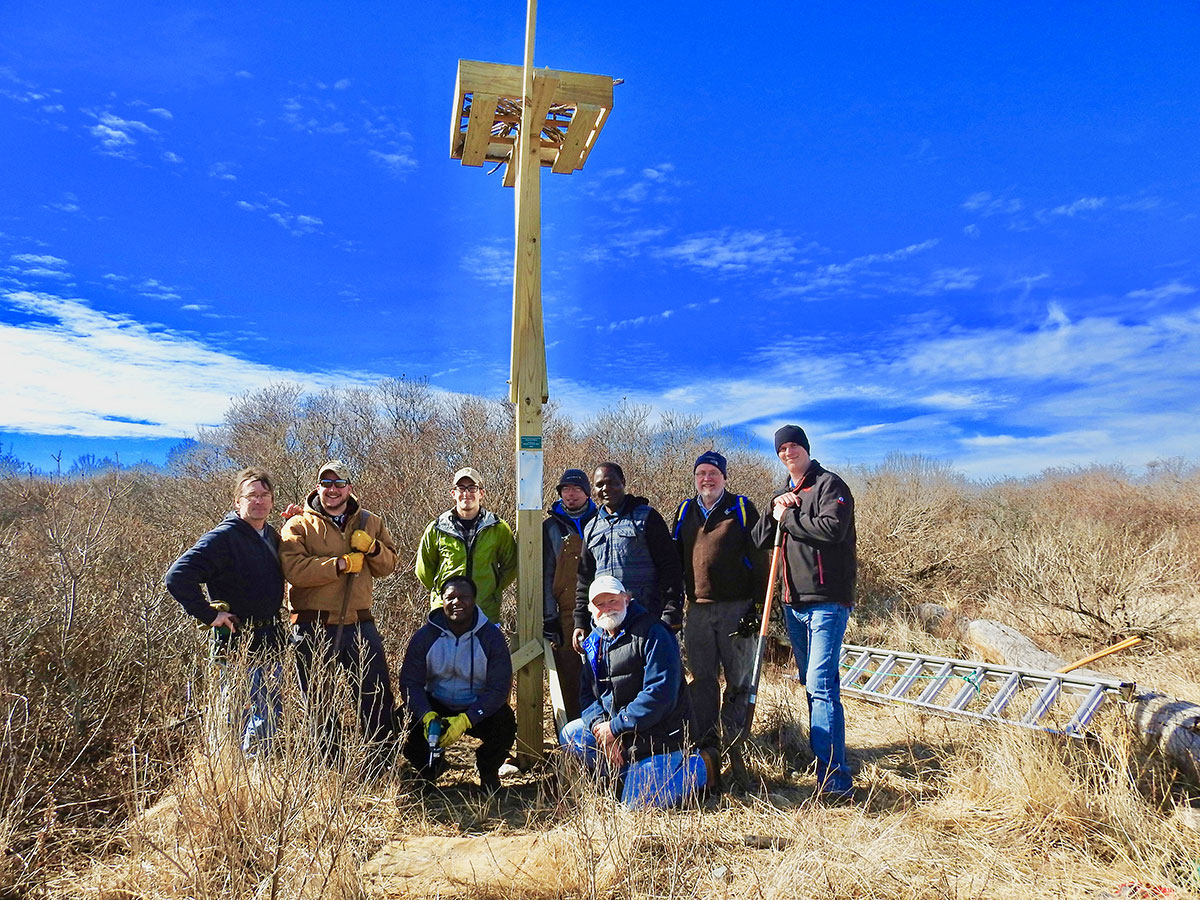
- Napatree naturalists and scientists posing beneath new Osprey platform, Napatree Point, February 17, 2017. Photo courtesy of The Watch Hill Conservancy.
-
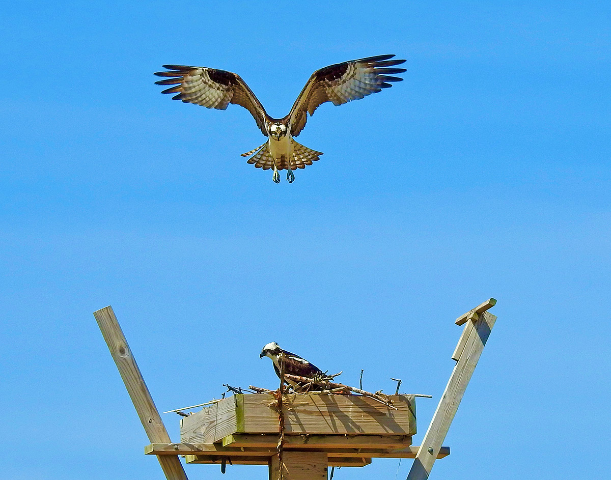
- An Osprey approaching one of Napatree Point’s three Osprey platforms, April 25, 2020. Photo courtesy of The Watch Hill Conservancy.
-
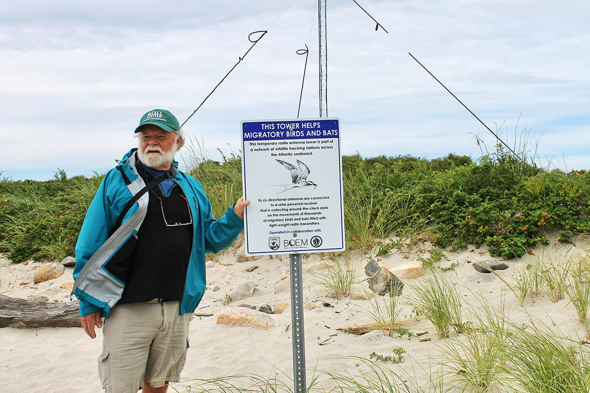
- Peter V. August, professor emeritus of the University of Rhode Island, standing by a sign for the Nanotag Tower on Napatree Point, September 5, 2016. This tower is part of a system of telemetry towers that stretches from the Arctic to the tip of South America, with additional sites in the Caribbean, Europe and Africa. Photo courtesy of The Watch Hill Conservancy.
-
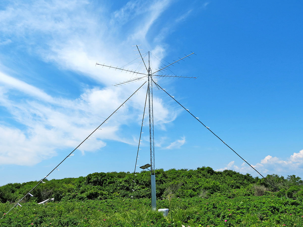
- The Nanotag Tower, Napatree Point, July 12, 2014. The tower is part of the Motus System: “The Motus Wildlife Tracking System is an international collaborative research network that uses a coordinated automated radio telemetry array to track the movement and behavior of small flying animals. Researchers fit small lightweight radio-transmitters on animals such as birds, bats and large insects, and their signal is detected by receivers scattered around the landscape.” Quote from: motus.org. Photo courtesy of The Watch Hill Conservancy.
-
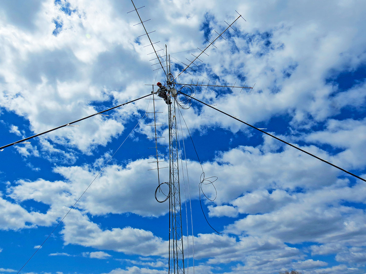
- Ant’s eye view of Nanotag Tower, Napatree Point, April 28, 2015. Data received via the tower guide are distributed to scientists studying migratory patterns of birds, bats and large insects. This accumulated data is of considerable use in the placement of offshore wind turbines to lessen impact to migratory birds. The US Fish and Wildlife Service takes the lead on this important Napatree monitoring project. Photo courtesy of The Watch Hill Conservancy.
-
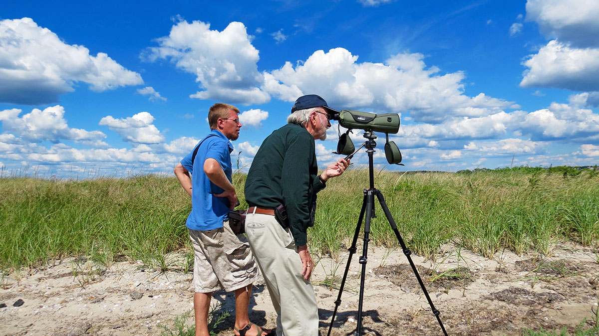
- Veteran birder Rey Larsen looking through a scope accompanied by Napatree naturalist Kevin Rogers. Mr. Larsen has been conducting bird surveys on Napatree Point since 1963. He surveys the perimeter of Napatree twice a month monitoring the seasonal and annual patterns of birds on Napatree. Photo courtesy of The Watch Hill Conservancy.
-
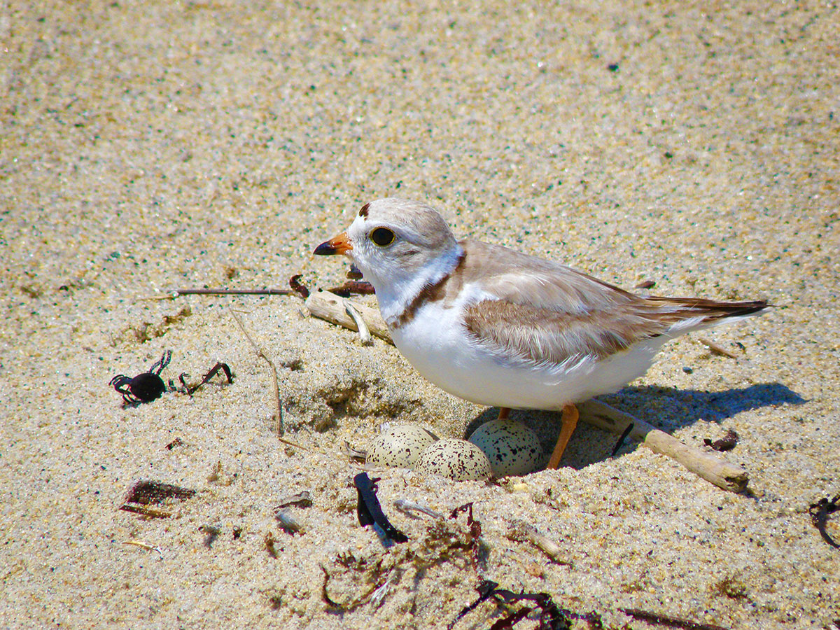
- Piping Plover standing over eggs, Napatree Point, June 26, 2011. The US Fish and Wildlife Service conducts multiple surveys each week during the nesting season to monitor the breeding success of the threatened Piping Plover. Photo courtesy of The Watch Hill Conservancy.
-

- Red Knot and Purple Sandpiper feeding in the shallows at Napatree, May 22, 2018. The tidal flats of Napatree Point have much to offer the probing bills of this Red Knot (in background) and Purple Sandpiper (in foreground). Photo courtesy of The Watch Hill Conservancy.
-
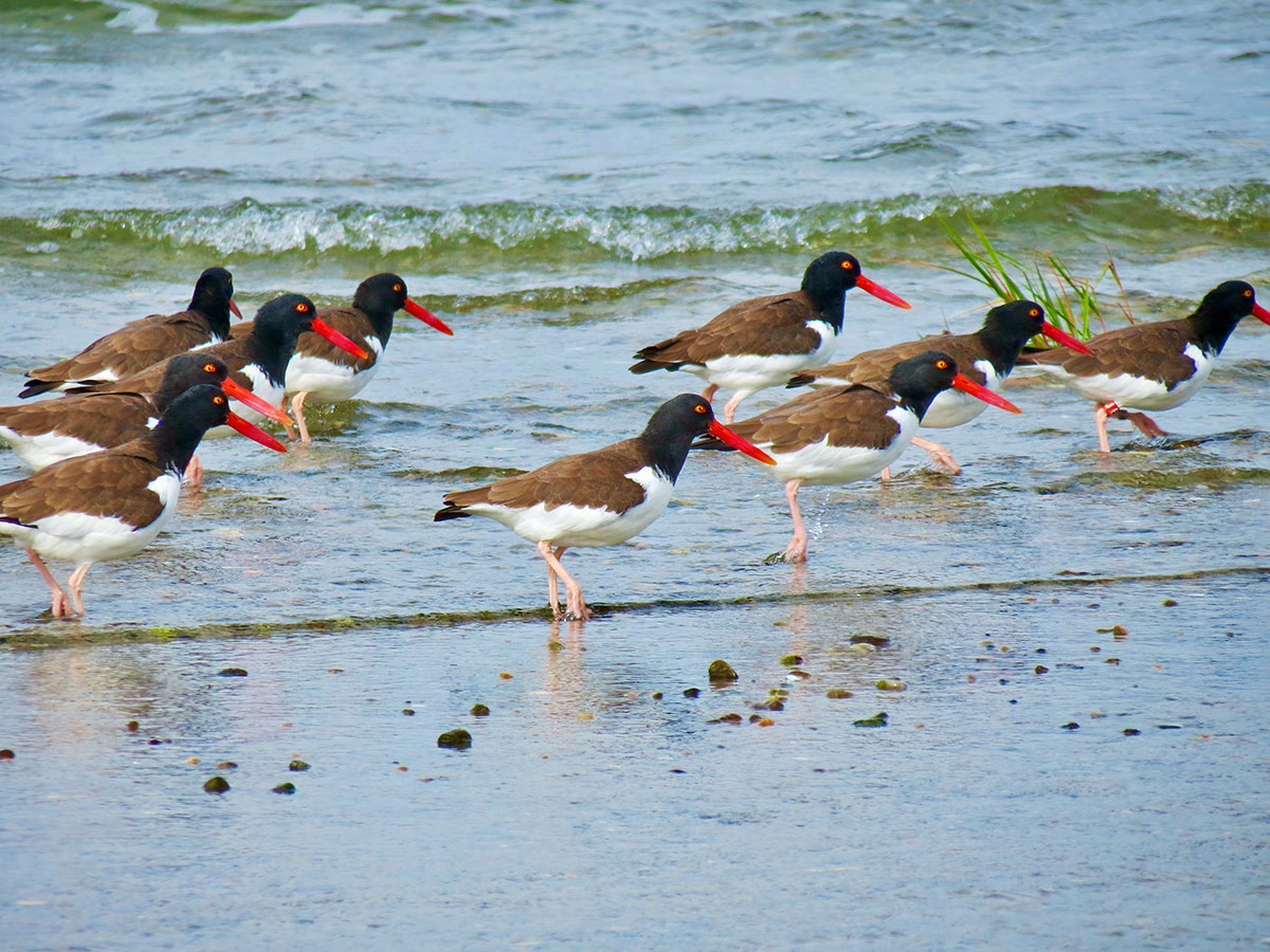
- A group of Oystercatchers working the tideline, Napatree Point, R.I., October 5, 2015. Photo courtesy of The Watch Hill Conservancy.
-
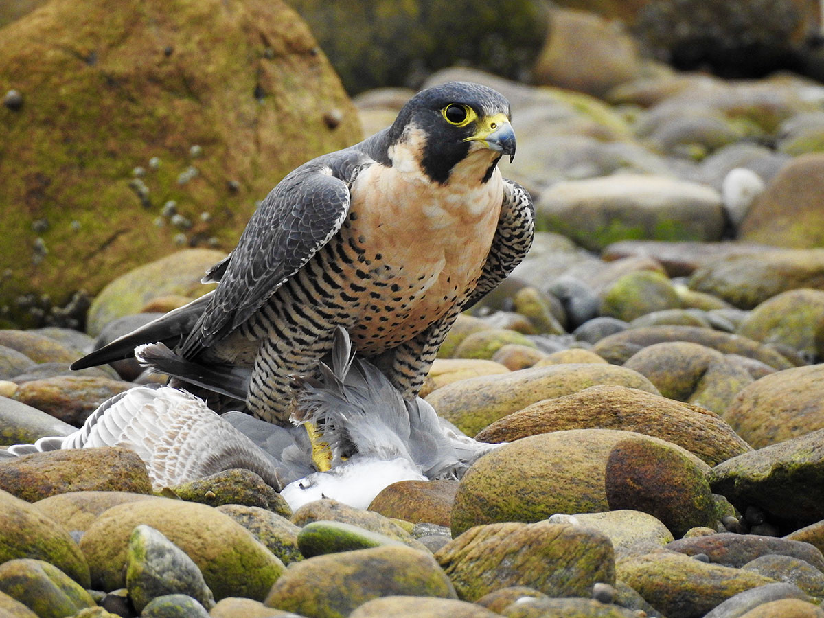
- Female Peregrine Falcon standing over Laughing Gull prey, Napatree Point headlands, November 7, 2017. Photo courtesy of The Watch Hill Conservancy.
-
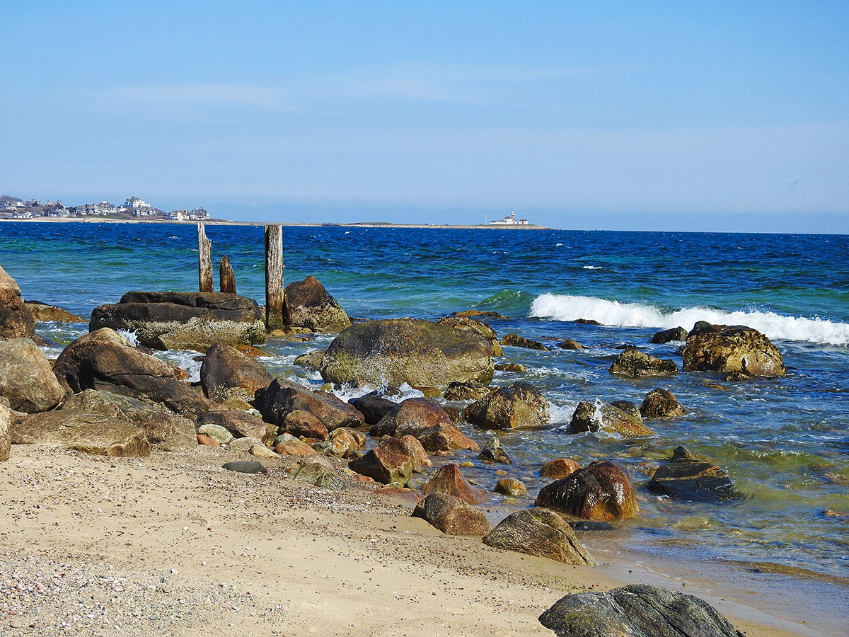
- Remnants of dock pilings on the south side of Napatree, April 11, 2018. These are the last vestiges of the run of military buildings and structures that dotted Napatree a century ago on the approach to the headland. Photo courtesy of The Watch Hill Conservancy.
-

- Fort Mansfield site plan map (1914) superimposed on Rhode Island Geographic Information System image (November 2019, Source RIGIS). Please note how the entire row of military buildings would now be under water if it hadn’t been demolished in the late 1920s. Remarkably, the barrier beach sands of Napatree have migrated 200 feet landward toward Little Narragansett Bay between 1939 and 2004, driven by major storms and hurricanes. Composite image created for The Watch Hill Conservancy by Dr. Peter August.
-
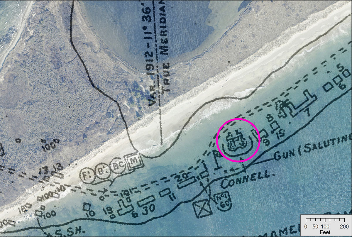
- Detail view of Fort Mansfield site plan map (1914) superimposed on RIGIS image (November 2019, Source RIGIS). This closer view reveals more clearly the location of Battery Connell (bright pink circle) buried by sand well off the shoreline. Composite image created for The Watch Hill Conservancy by Dr. Peter August.
-

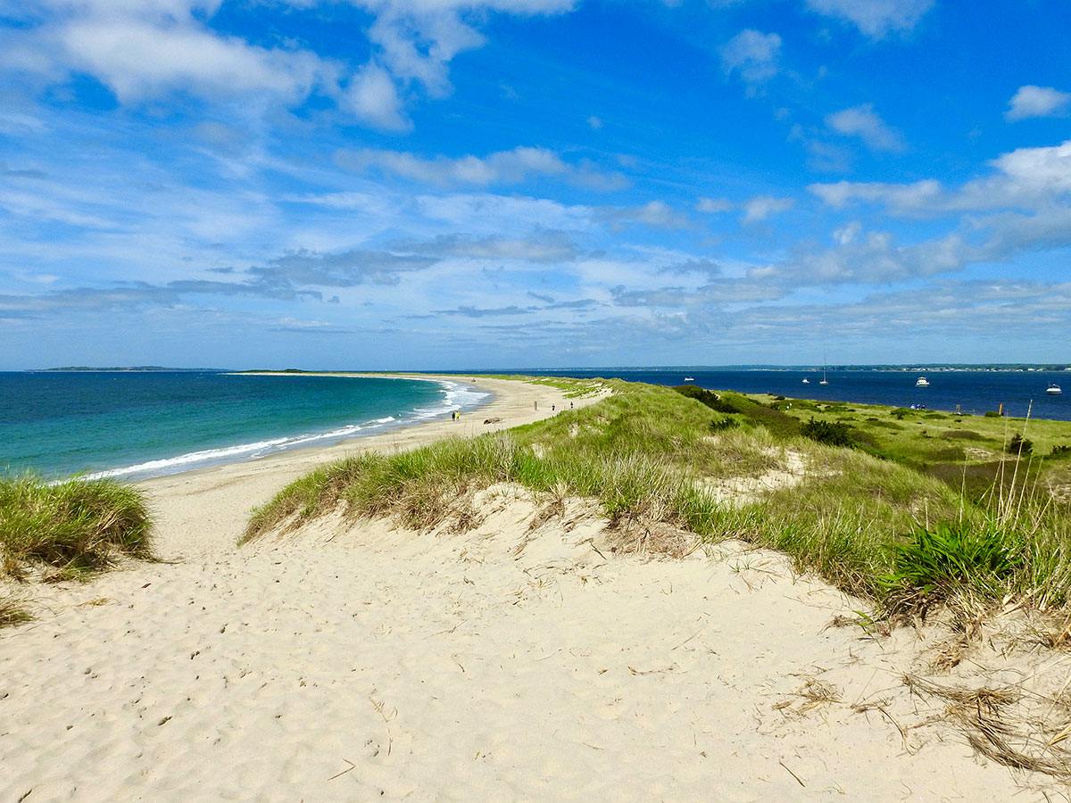
- Aerial image of the headland, Napatree Point, August 18, 2013. Photo by Dr. Bryan A. Oakley.
-
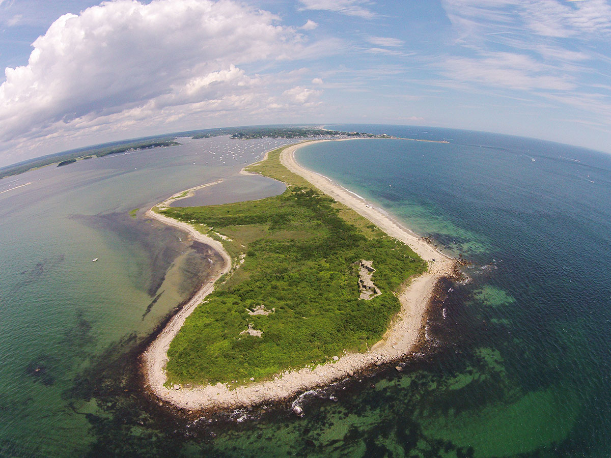
- Aerial view of the headland, Napatree Point, with the Fort’s two surviving batteries clearly visible: Battery Crawford (built for two 5-inch disappearing guns) on left and Battery Wooster (built for two 8-inch disappearing guns) on right. Aerial drone image, July 25, 2015, courtesy of Kevin Rogers.
-

- Battery Wooster, circa 2010. Photo by John Leuba.
-
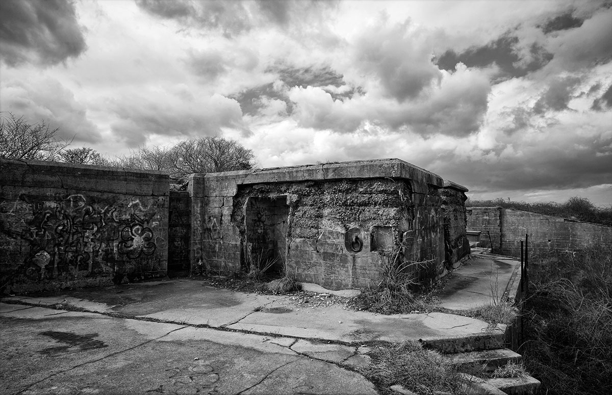
- Battery Wooster, circa 2010. Photo by John Leuba.
-
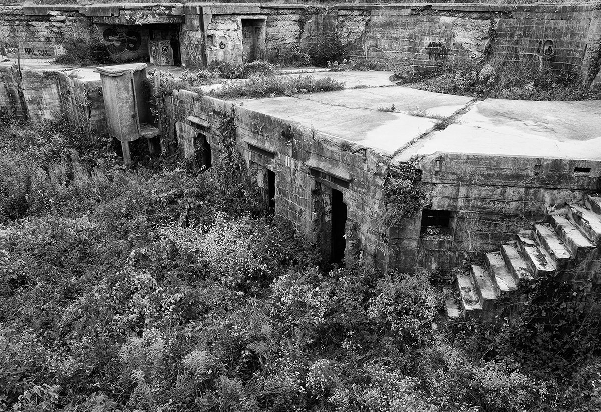
- Battery Wooster, circa 2010. Photo by John Leuba.
-
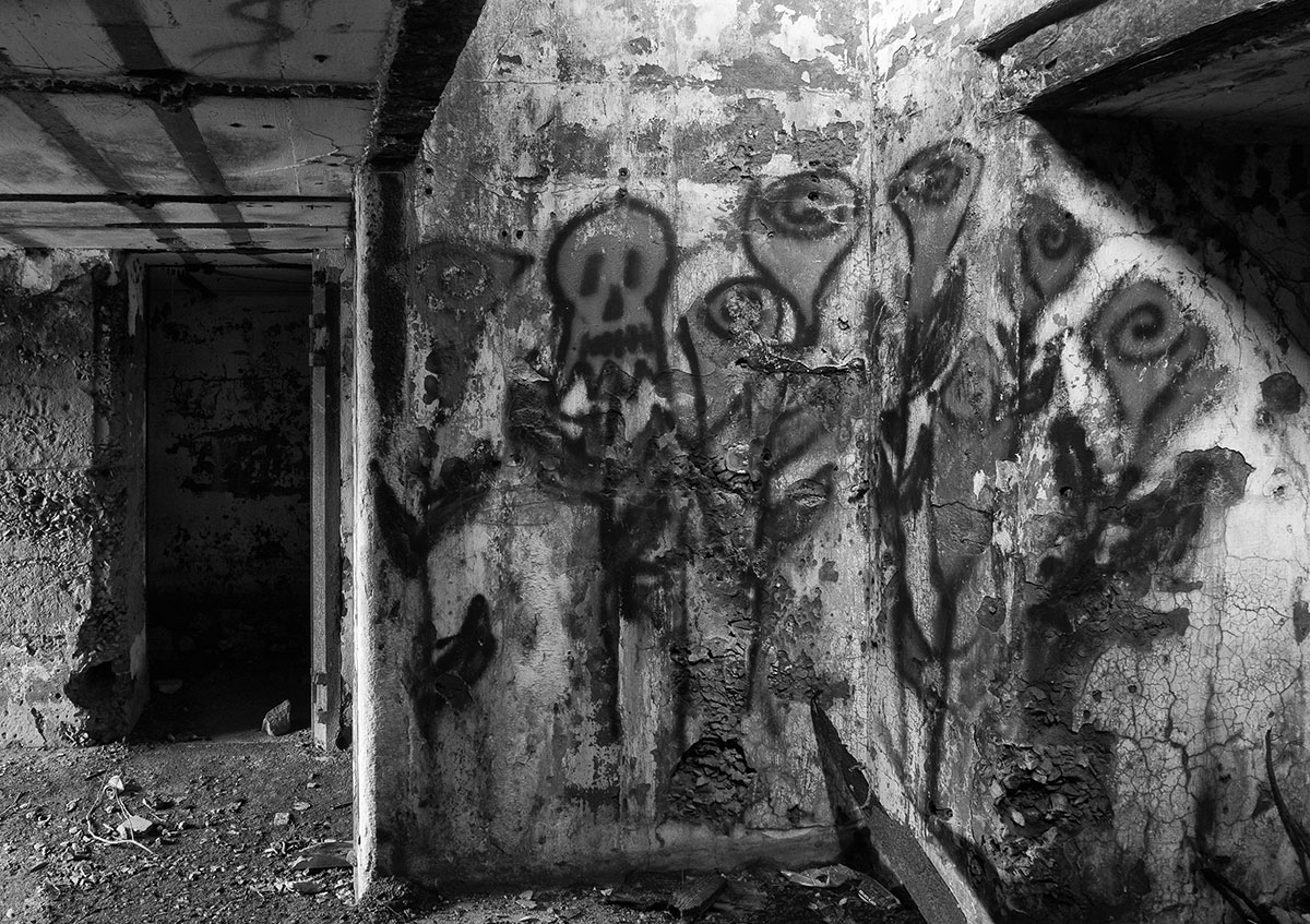
- Battery Wooster, circa 2010. Photo by John Leuba.
-

- Battery Wooster, circa 2010. Photo by John Leuba.
-
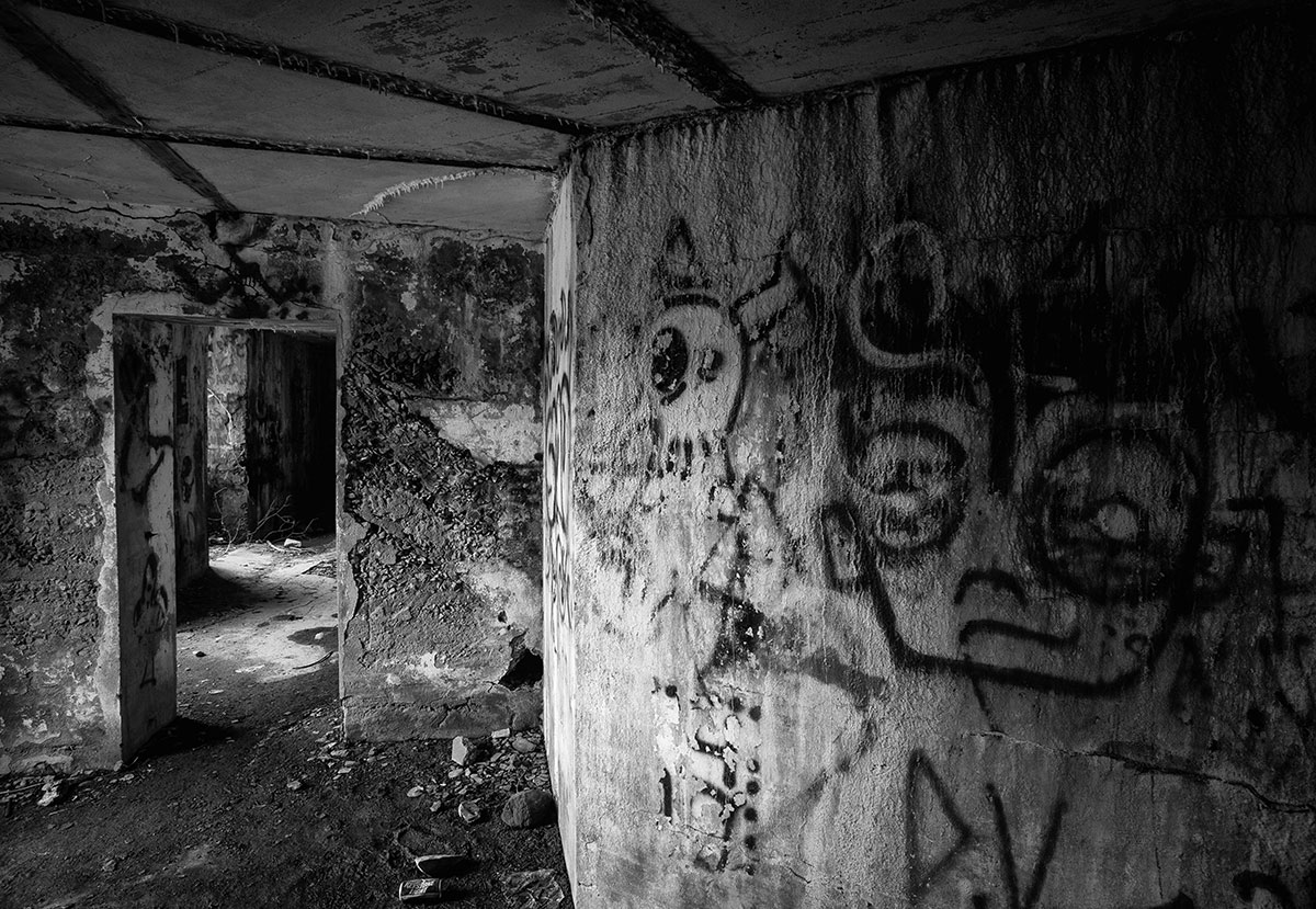
- Battery Wooster, circa 2010. Photo by John Leuba.
-

- Battery Wooster, circa 2010. Photo by John Leuba.
-
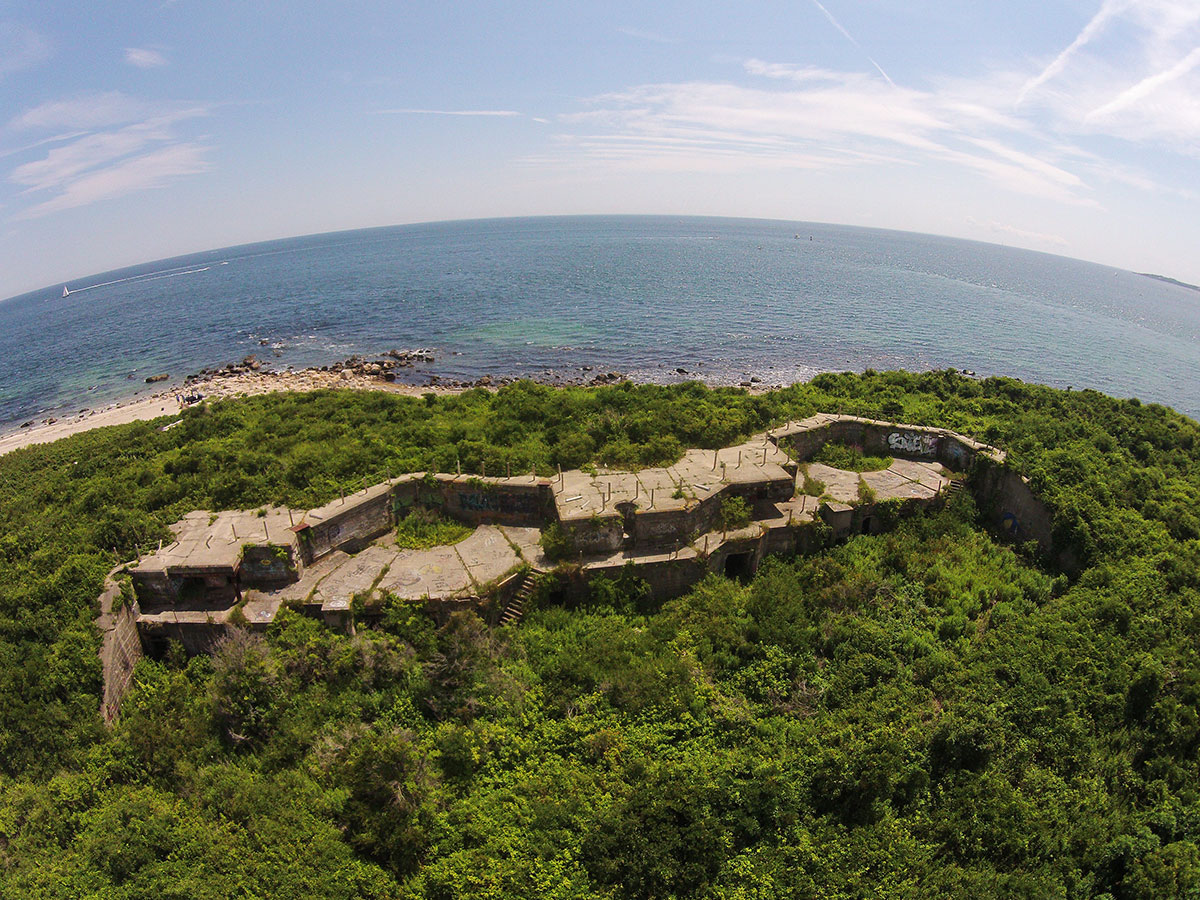
- A high-angle view aerial of Battery Wooster, Napatree Point, with Fishers Island Sound in background, July 25, 2015. Aerial drone image courtesy of Kevin Rogers.
-
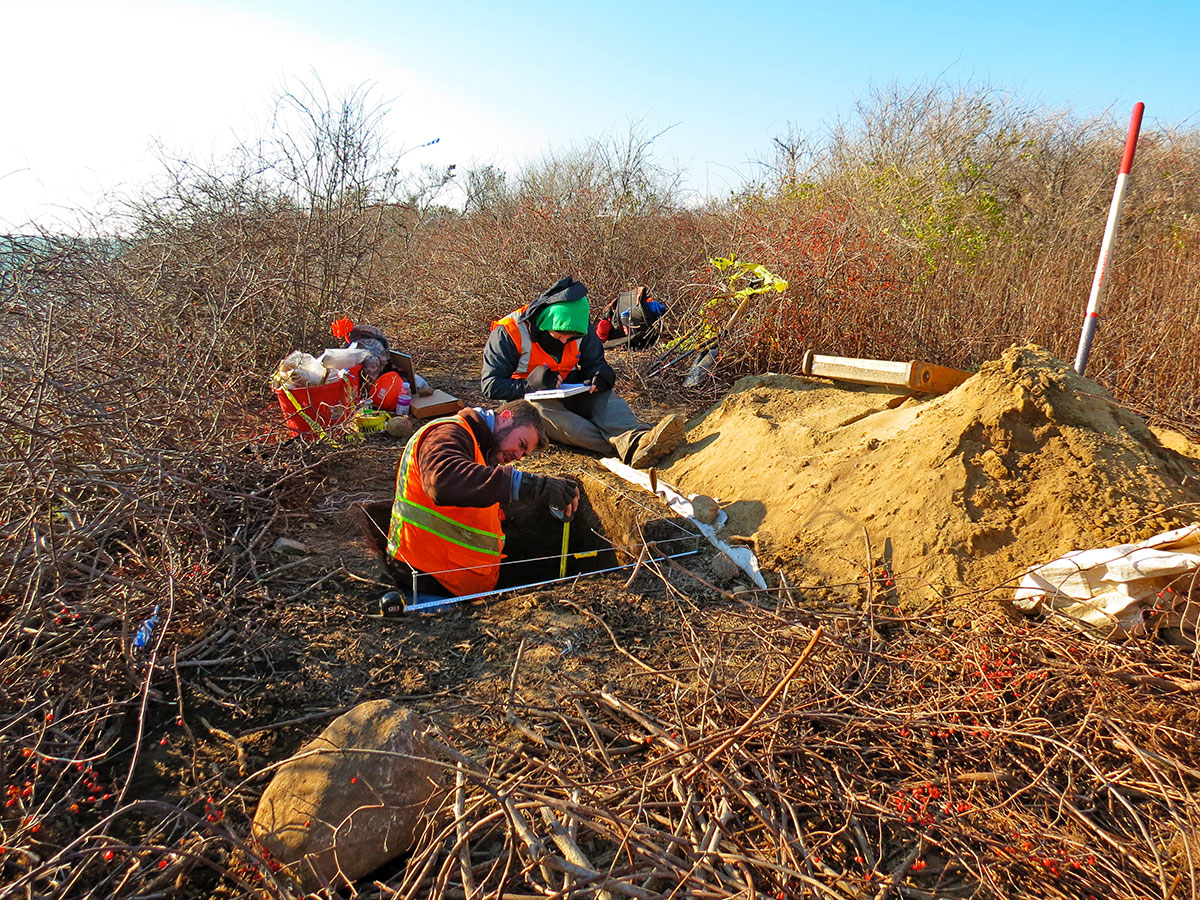
- After Superstorm Sandy in 2012, the National Park Service commissioned an archaeological survey of the Rhode Island coast. The group seen here are digging test pits in the vegetated area of the headlands on November 20, 2014. Photo courtesy of The Watch Hill Conservancy.
-

- Spring vanquishes the color schemes of late fall and winter on Napatree’s headland. Beach Pea and Dusty Miller are prominent in foreground with Rosa Rugosa in background, June 11, 2015 . Photo courtesy of The Watch Hill Conservancy.
-
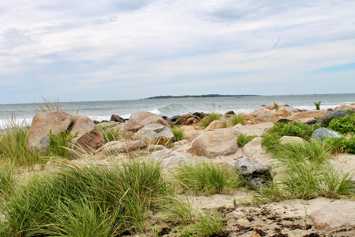
- From the shoreline of Napatree Point, there is a clear view of Fishers Island, N.Y., an island that was once the home of Fort H.G. Wright, the adjacent fort in the chain that defended the eastern entrance to Long Island Sound, and this exhibition’s next stop. Photo taken on September 5, 2016, courtesy of The Watch Hill Conservancy.
Video
Napatree Trilogy, URI Coastal Institute
Judith Swift & Ayla Fox
For more information on the conservation efforts and education programs offered by The Watch Hill Conservancy, please visit:
Annual exhibition sponsored by:
Acknowledgments
Fort Mansfield, Napatree Point, R.I.
Janice Sassi, manager of the Napatree Point Conservation Area for The Watch Hill Conservancy, almost singlehandedly coordinated the response to requests for images and information relating to modern day Napatree Point. She not only pulled all the pieces together and answered innumerable questions about conservation activities at that location, but also was the photographer who created almost all of the vibrant color photos that were provided by The Watch Hill Conservancy. She didn’t want credit within the body of the show but has earned a huge “thank you” from me and the HLFM.
Approximately ten years ago, photographer John Leuba produced an extraordinary B/W series documenting the ruins of Battery Wooster, Fort Mansfield. Earlier this year he unhesitatingly and generously made all of them available for this exhibition. Each image that is displayed is compellingly dark and dystopian and yet somehow fantastically uplifting. His very impressive documentation of the decaying ruins was a great addition to the show. There were many other wonderful contributions: Dr. Peter V. August, who works with GIS (computer mapping) created the “see through” map overlay images that place Battery Connell offshore in the surf zone. Dr. Bryan A. Oakley and Kevin Rogers are responsible for the dramatic aerial imagery of Napatree Point’s headland, shooting from a helicopter and via drone respectively. Ayla Fox and Judith Swift produced the mind-boggling time lapse video showing the evolution over time of Napatree Point’s Sandy Point extension. Mark Berhow, a member of the Coast Defense Study Group, provided essential images and maps for this section as he and his fellow CDSG members did for all of the sections. They are truly a generous, sharing organization that deserves much credit for accumulating such a body of knowledge about coastal defense systems and having it so readily available for distribution.
Institutional sources behind the supplied imagery include the Coast Defense Study Group, National Archives and Records Administration, URI Coastal Institute and, for almost all displayed images, The Watch Hill Conservancy, an organization whose good work at Napatree Point is on display throughout the entire Fort Mansfield section of the exhibition.
With one last collective “thanks” to all who helped on the Fort Mansfield section, I’ll state the obvious: We couldn’t have done it without you!
Pierce Rafferty,
Director,
Henry L. Ferguson Museum
Beth Jepsen of Insite Design LLC, New London, Conn., is responsible for both the website design and the exhibit design. Thank you!