ANNUAL EXHIBITION 2021
GRASSLANDS
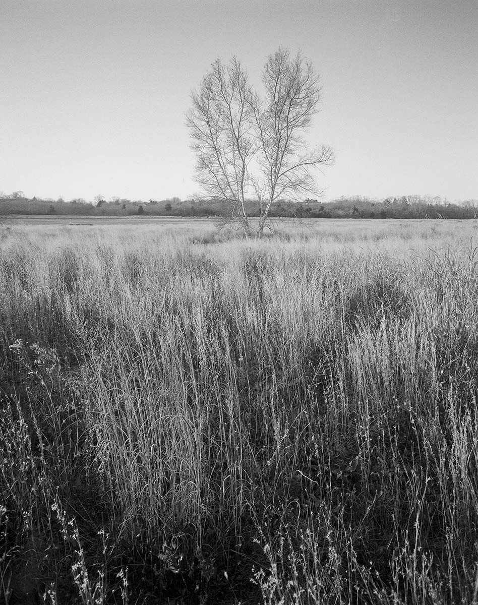
Split tree amidst grassland, Matty Matthiessen Wildlife Sanctuary, Middle Farms
Date unknown
Photograph by John Wilton
On an island that little more than 100 years ago was primarily pasture, there are only two large grasslands still extant. The first is located on former Fort H.G. Wright property south of Whistler Avenue. The Fishers Island Conservancy has restored as meadow approximately 100+ acres at that site under an operating agreement with the Fishers Island Ferry District. The second is an approximately 40 acre section of former farmland on Middle Farms Flats near today’s Driving Range that is owned and managed by the Museum. These maritime grasslands, increasingly rare in our overdeveloped world, provide critical habitat for rare plants and animals. They have earned a “highest ecological significance” ranking from conservationists and environmental scientists.
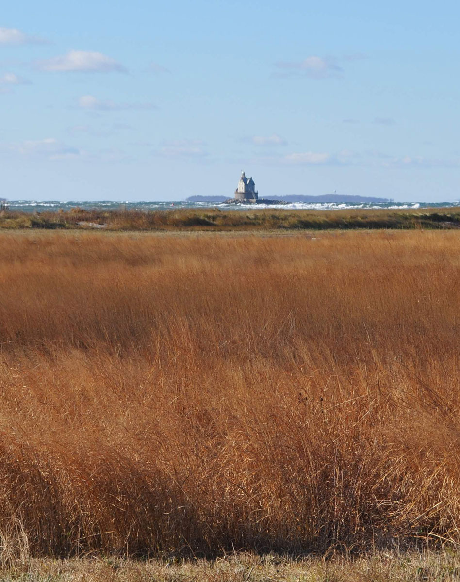
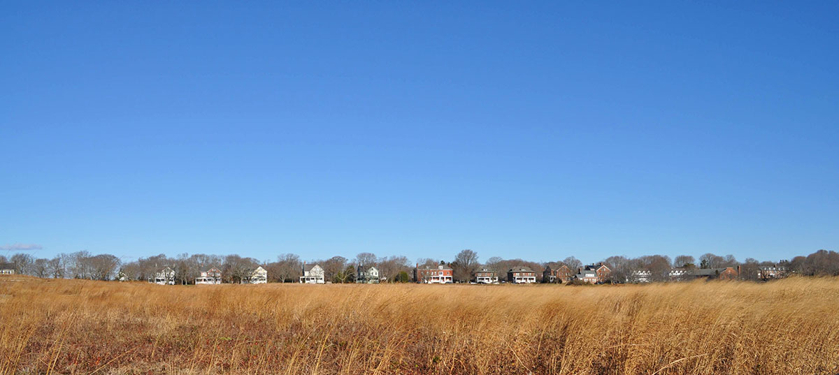
Looking southwest across Parade Grounds grassland to Race Rock Light
November 27, 2013
Photograph by Jane T. Ahrens
Both the former Fort property and the former mid-island farm fields are maintained as grasslands by annual prescribed fires that are planned and coordinated with government agencies and the Fishers Island Fire Department. These “burns,” along with frequent mowing, are necessary to keep the grasslands from being initially overrun by woody shrubs and eventually reverting to successional forest.
An ongoing battle is also being waged by both the Conservancy and the Museum’s Land Trust against invasive plants that outcompete native grasses and threaten habitat diversity.
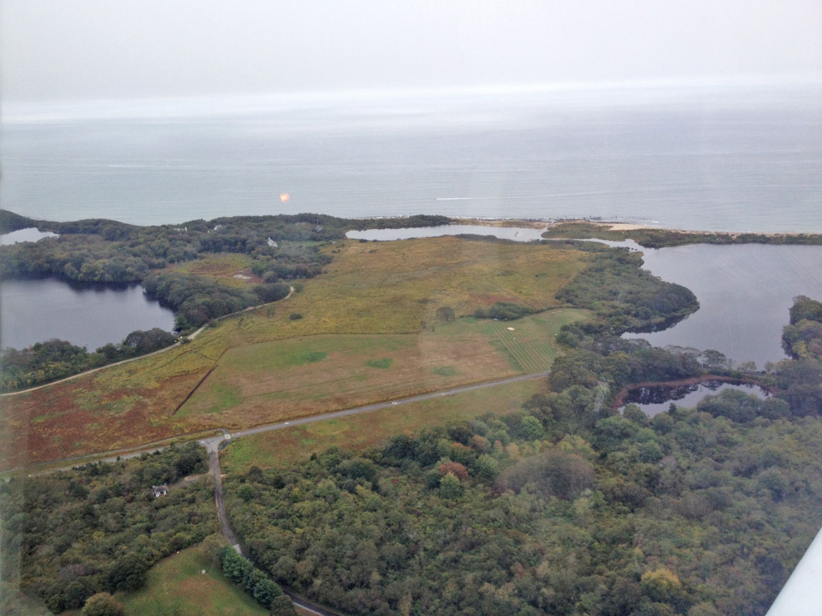
Aerial of grassland within the Matty Matthiessen Wildlife Sanctuary, Middle Farms
2012
Photograph by Mary Burnham. Piloting by Brad Burnham.
Ringing the Land Trust grassland in mid-island are Middle Farms Pond (at left with Treasure Pond beyond), Beach Pond (straight ahead), Island Pond (at right), and the corner of Perch Pond (lower right).
The Sanctuary is surrounded by a variety of habitats, including these fresh and brackish ponds, and shrublands. The Sanctuary supports freshwater wetlands as well as an intermittent fresh water channel outflowing from Middle Farms Pond into Island Pond.
All these factors combine to create a multitude of “ecotones” (a region of transition between two biological communities) that promulgate diversity of flora and fauna. “Ecotones between two habitats are often richer in species than either.” Quote from Oxford Languages.
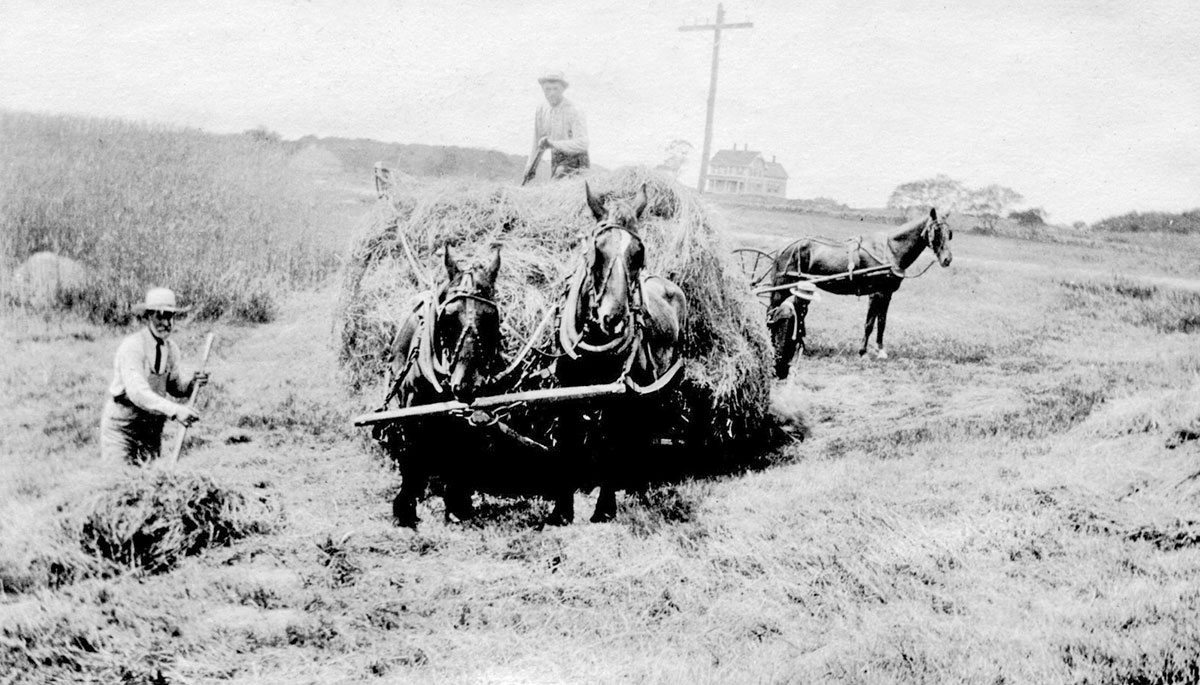
Farmers haying on Middle Farms Flats, circa 1920
Photograph by Harold Baker. Museum Collection.
This photograph captures one aspect of past farming activities on what is today the Matty Matthiessen Wildlife Sanctuary, Middle Farms.
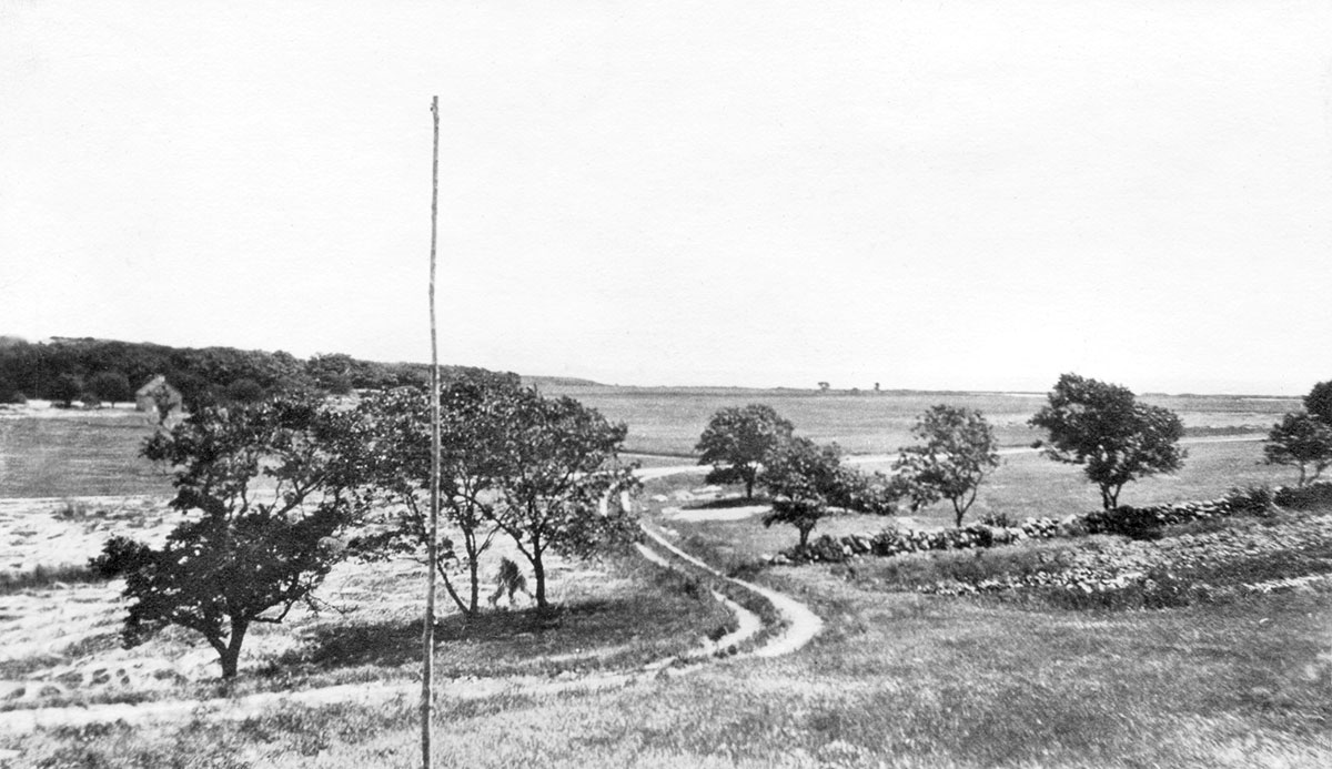
Looking toward Long Island from the Middle Farms Dwelling (Bohlen house), circa 1920
Photograph by Harold Baker. Museum Collection.
This vista would be blocked by trees today were it not for ongoing maintenance that preserves critical maritime grassland habitat.

Wildlife Cam captures HLFM VP and Land Trust Committee Chair Bob Miller mowing Middle Farms grassland with tractor.
August 25, 2017
Photo courtesy of Terry McNamara’s Wildlife Cam
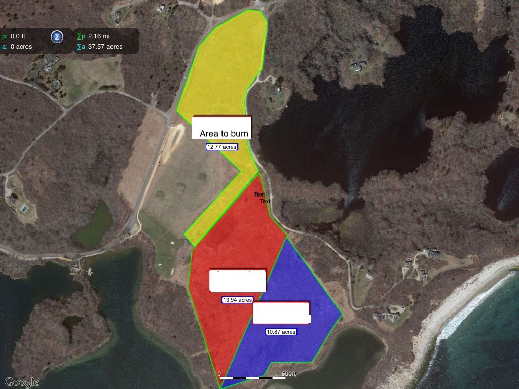
“Burn Plan” map for grassland at Middle Farms
2020 for 2021
Map by Steve Malinowski
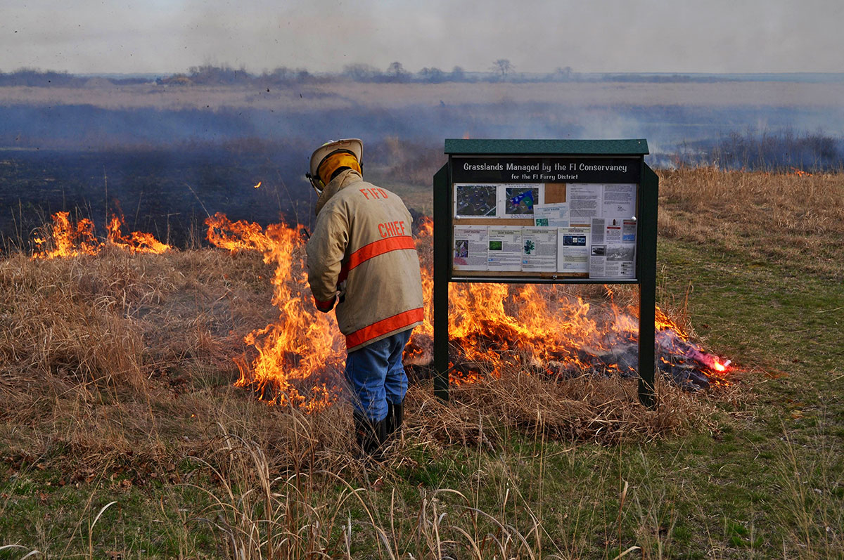
Each year a “Burn Plan” for approximately one third of the grassland at Middle Farms is submitted for approval to the Supervising Forester, Division of Lands and Forests, NYS DEC. Once approved, a date is coordinated with the Fishers Island Fire Department when wind and moisture conditions are favorable, and when birds aren’t nesting.
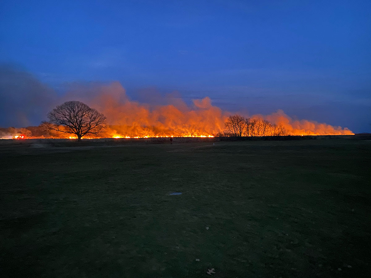
Burning the northern section of grassland, Matty Matthiessen Wildlife Sanctuary, Middle Farms
March 12, 2021
Photograph by Scott Reid

Trail entrance with “Vehicles Prohibited” sign, Matty Matthiessen Wildlife Sanctuary, Middle Farms
April 2005
Photograph by Pierce Rafferty
Trails wind through the Matty Matthiessen Sanctuary allowing visitors to closely observe flora and fauna, on foot only.
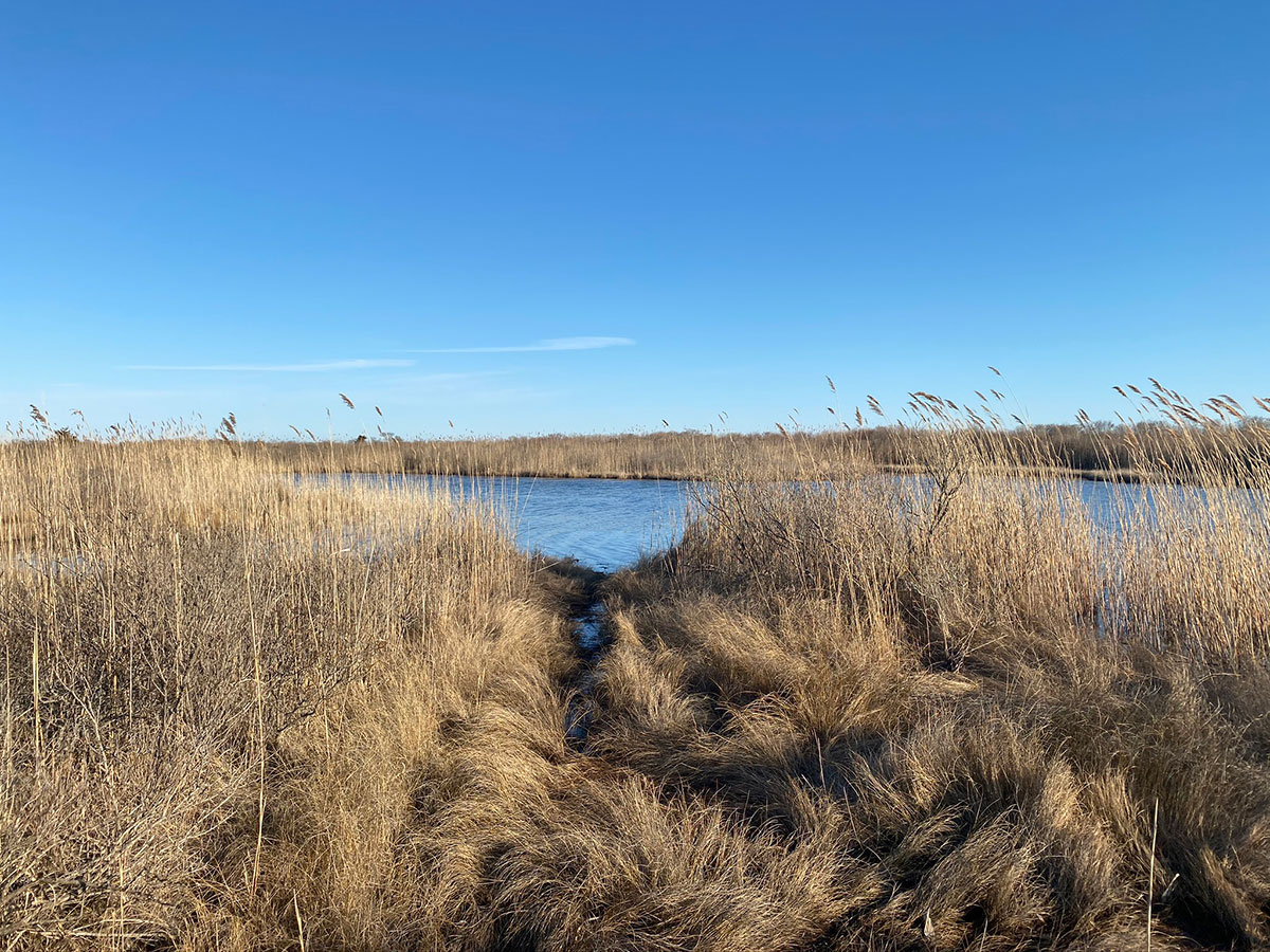
Approaching channel to Beach Pond
Photograph by Pierce Rafferty
Combinations of water and grassland vistas abound in the southern section of the Sanctuary.
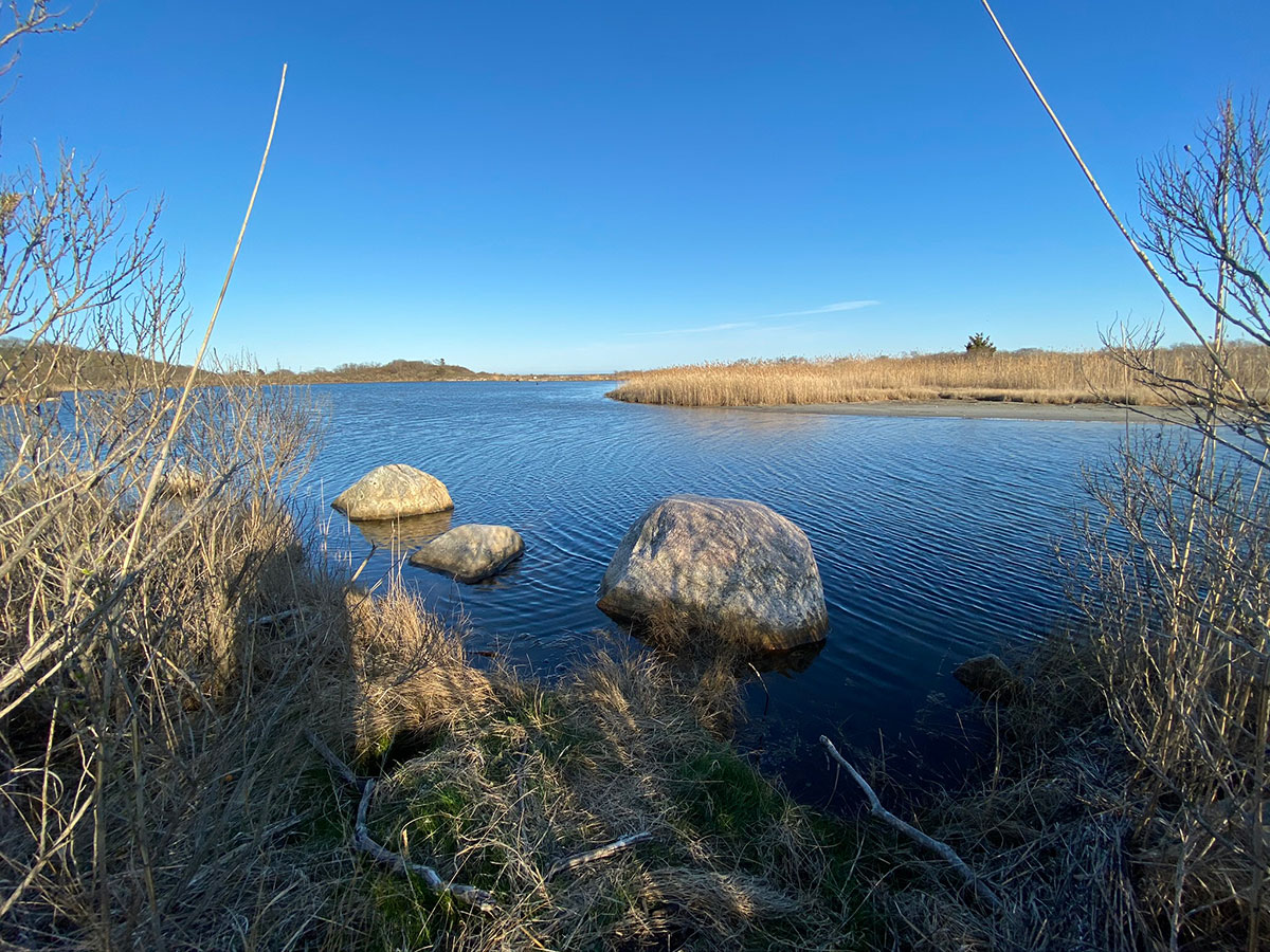
The channel to Beach Pond from Island Pond
Photograph by Pierce Rafferty
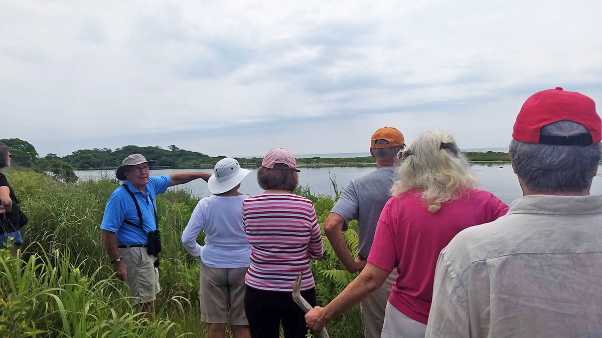
Terry McNamara leading a Nature Walk at Beach Pond
July 11, 2019
Photo by Marnie Briggs
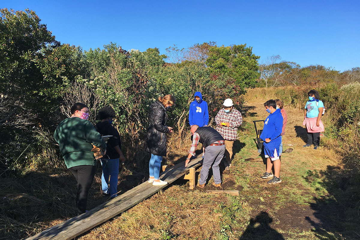
Fishers Island School crew at Middle Farms
October 2020
Photograph by Jack Schneider
Fishers Island School teacher Adam Murray and his Conservation Class students creating a plank bridge across a frequently flooded section of Penni’s Path, Matty Matthiesssen Wildlife Sanctuary.
The Museum is grateful for all the dedicated help provided by Fishers Island School students, Board members and volunteers who assist in the maintenance of Land Trust properties.
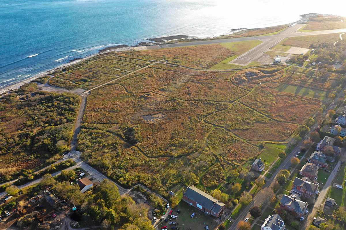
Aerial of former Fort H.G. Wright military property converted into meadow with walking paths
August 10, 2019
Drone photography by Arthur Anthony
Beginning in the fall of 2010, the Fishers Island Conservancy began an ambitious project to convert a large section of the former military property at the western tip of Fishers Island into grassland meadows. This restored grassland area, crisscossed by paths, is known today as “the Parade Grounds.”
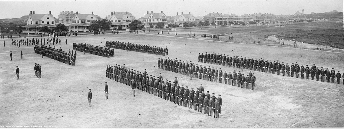
Dress Parade on Parade Grounds, circa 1913
Published by Brown & Dawson, Stamford, Conn.
Museum Collection. Donated by Harry and Susie Ferguson.
This vintage view of the Parade Grounds illustrates its original function.
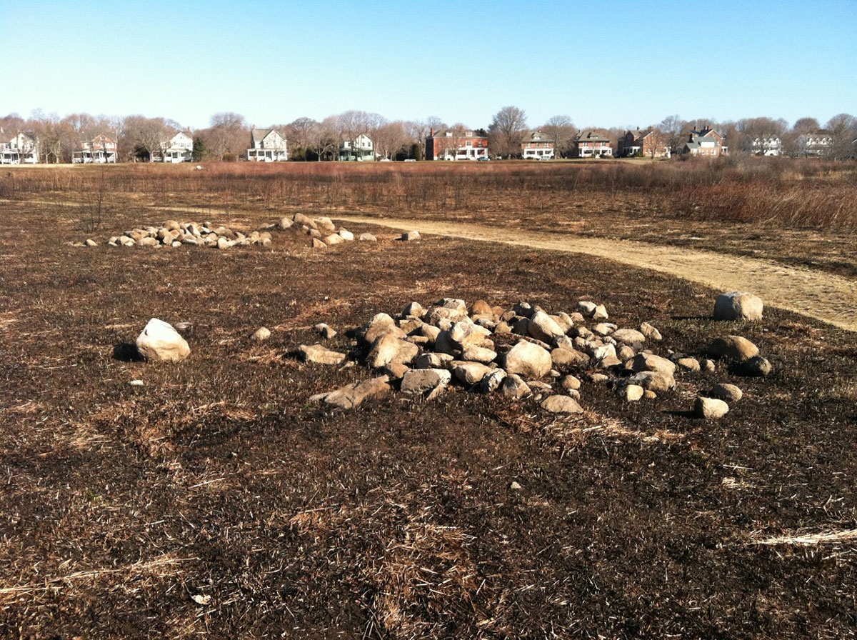
“Before” photo of Parade Grounds, March 25, 2011.
Photograph courtesy of Fishers Island Conservancy.
When the Fishers Island Conservancy began their restoration project, the Parade Grounds had been, in the words of a Habitat Committee report, “choked with vines and scrub and depleted of wildlife.” Extensive efforts were untertaken to clear the property of invasive plants and to reseed grasses. This photo shows a section of the Parade Grounds after a managed burn by the FIFD in the spring of 2011.
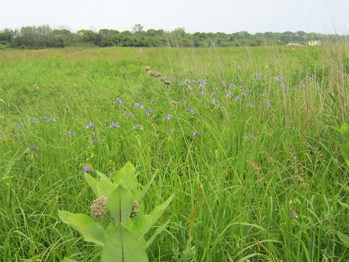
“After” photo of Airport area, June 2012.
Photograph courtesy of Fishers Island Conservancy.
The success of the clearing and the reseeding was soon apparent: “Milkweed for butterflies, wild iris, native warm season grasses and cool season grasses are seen in the ‘After’ picture above, providing a sustainable multi-culture grassland habitat for nature’s creatures.” Quote and photo from Habitat Committee Report, 2012.
Looking from the Parade Grounds to Officers Row
November 27, 2013
Photograph by Jane T. Ahrens
This photo, taken three years after the Conservancy’s restoration plan began, features the restored grasslands.
Controlled burn at the Parade Grounds
April 13, 2017
Photograph by Jane T. Ahrens
FIFD chief Bruce Hubert burning section of grass near Whistler Ave. during controlled burn.
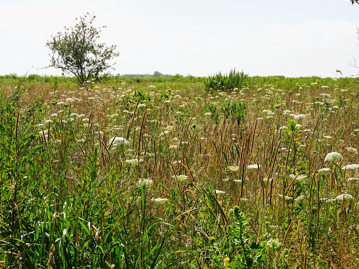
Queen Anne’s Lace on the Parade Grounds
August 2, 2018
Photograph by Jane T. Ahrens
The Parade Grounds are today a thriving ecosystem with native plants attracting insects that support a wide range of other interdependent floral and faunal species.
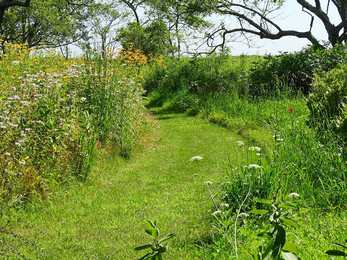
Path from Fishers Island Conservancy’s Demonstration Garden to Parade Grounds
August 2, 2018
Photograph by Jane T. Ahrens
A network of walking paths allows visitors to experience the meadow restoration and the diversity of the natural world on display.
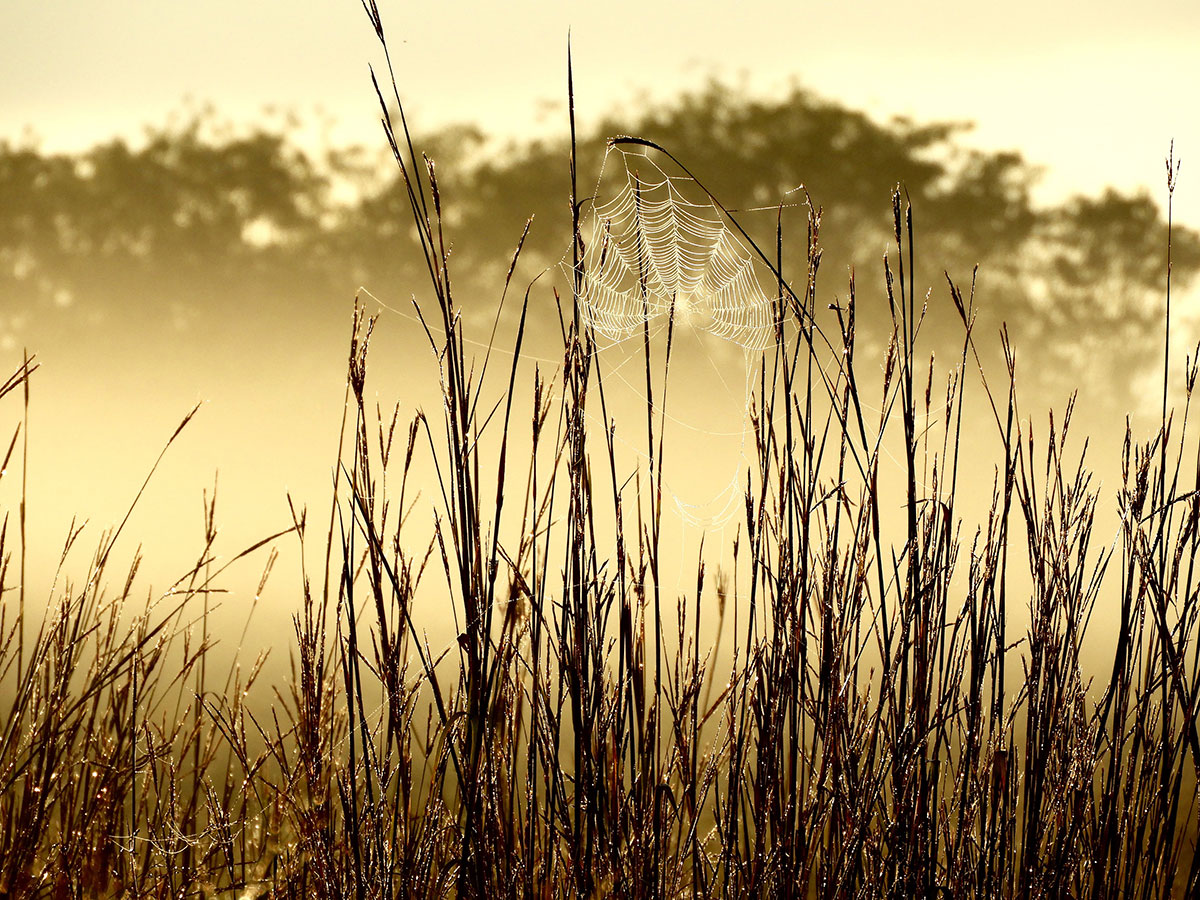
Spiderweb on the Parade Grounds
September 15, 2018
Photograph by Jane T. Ahrens
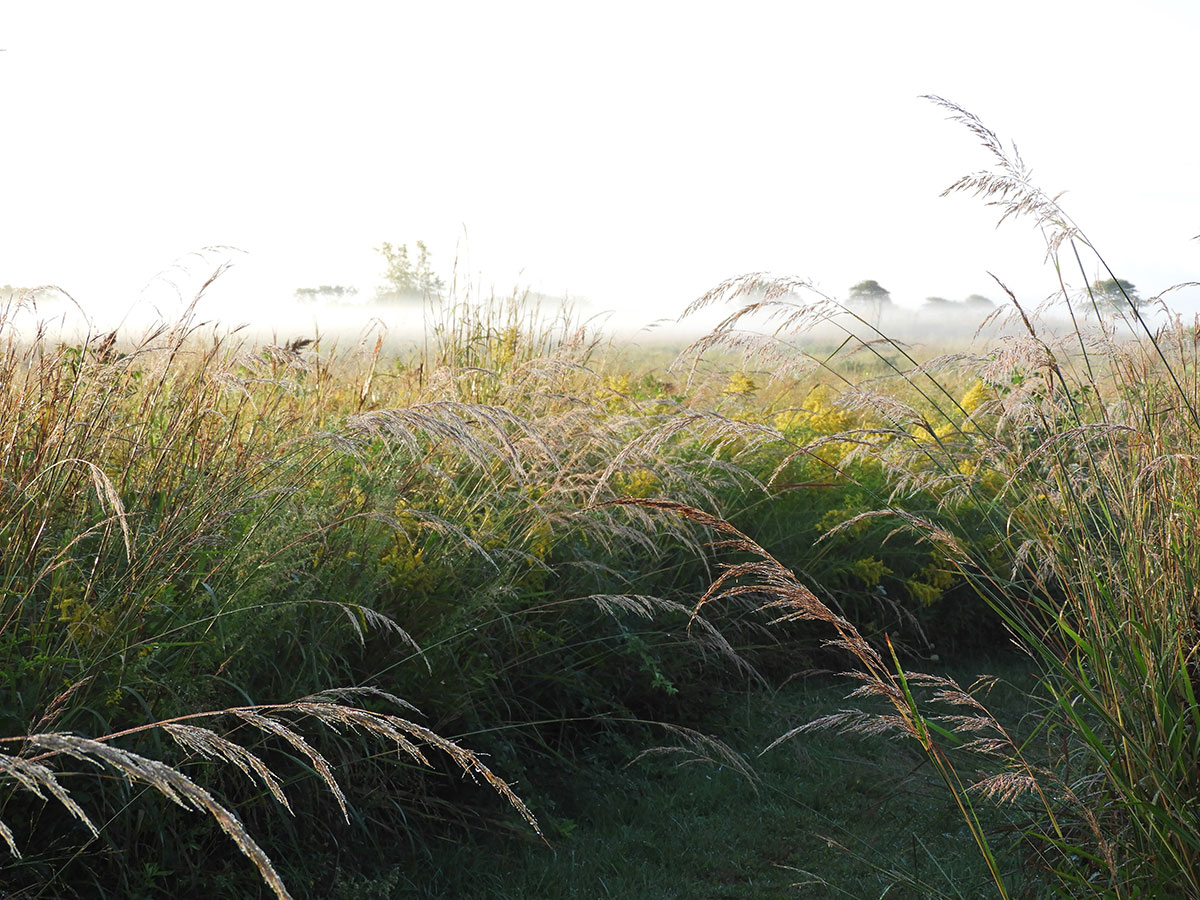
Grasses on the Parade Grounds
September 15, 2018
Photograph by Jane T. Ahrens
Annual exhibition sponsored by ALTUS Partners & CHUBB