ANNUAL EXHIBITION 2022
YEAR ROUND: A CELEBRATION OF COMMUNITY
A NEW SETTLEMENT AND TOWN

Map of Lots on Fishers Island, Embracing the Highland Range, May 1, 1878, traced 1919.
Museum Collection.
The original of this map was produced just two years after the island-owning Fox family began developing the west end of Fishers Island as a seaside resort. Land sales quickly led to the formation of a small town and a year-round community clustered primarily along the edge of Great Harbor, today’s West Harbor.
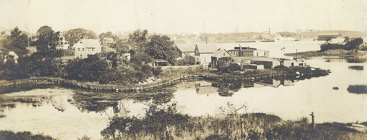
Winter settlement and businesses, West Harbor, circa 1910s.
Photograph courtesy of Jeff and Catherine Edwards
Eldredge’s Fish Market occupied the area at right center currently utilized by BD and Island Hardware.
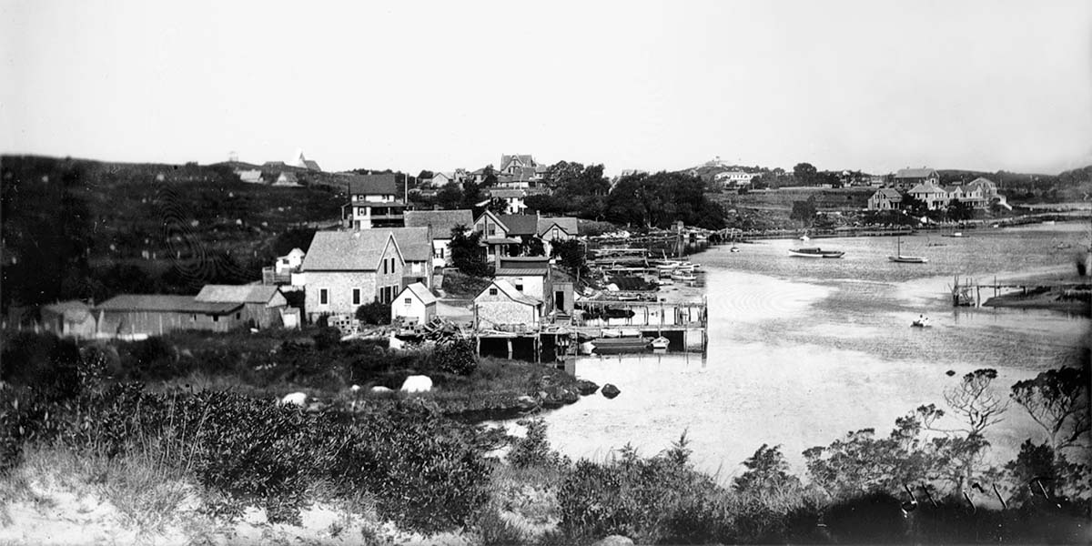
A closer view of houses, businesses, and docks at the foot of the Gloaming, 1902.
Photograph by U.S. Army Corps of Engineers. Museum Collection

An early view of Fishers Island’s “town” with edge of Fones Pond in foreground, circa 1892.
Photograph courtesy of Bob Brooks
This photograph was taken looking north by northwest from the edge of Christian Hansen’s (later Rogan’s, now St. John’s) porch. Please note that the first group of Mansion House Cottages are visible in left background just past Murdock Cottage, today’s “Neau Vue.” The tall structure to its right, Holbrook Cottage, no longer stands. The Lyles Cottage stable or barn (today’s Red Barn) can be seen at center; it originally was located on the opposite side of the hill from where it now stands. The Mansion House proper is partially visible in center right background. Please note Fones Pond in left center and the different route the road takes as it traverses town.
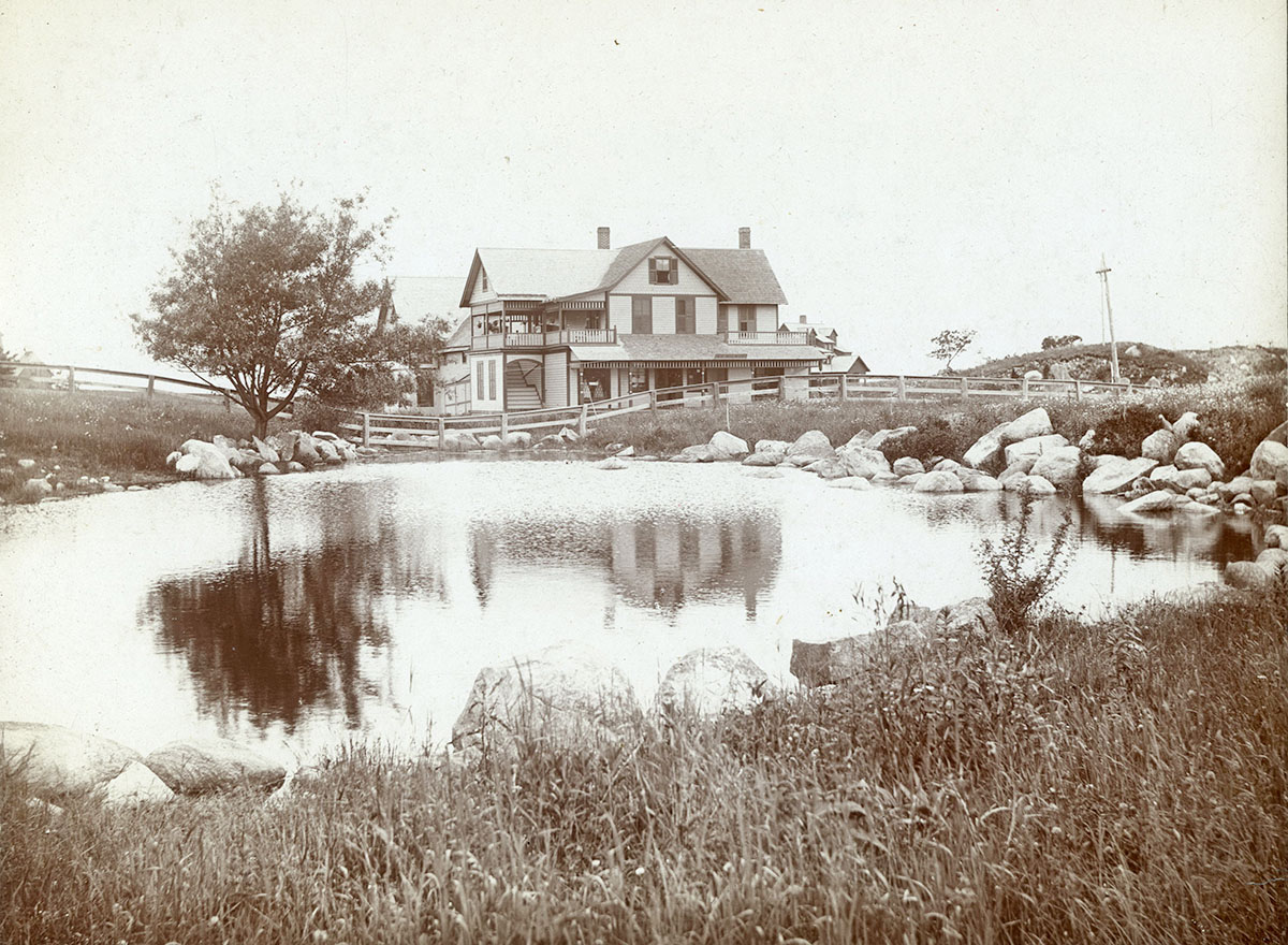
Wilbur’s Store and Fones Pond, Fishers Island, circa 1896.
Museum Collection
Fones Pond was filled in circa 1897 to make room for E.M. & W. Fergusons’ Administration Building, today’s Utility Co. building and Post Office. The Wilbur’s Store building still stands and currently holds Toppers and other stores.
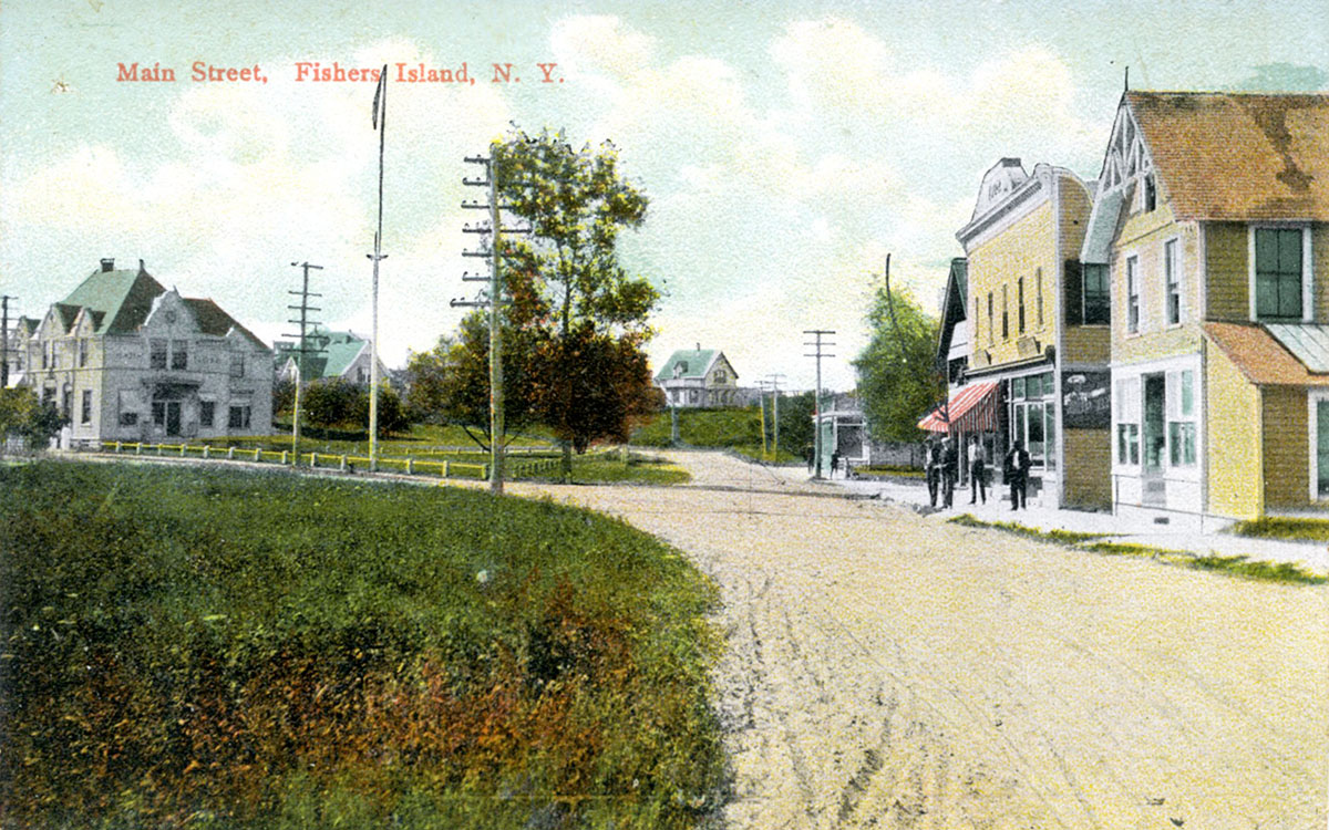
Main Street, Fishers Island, N.Y. circa 1909. Printed postcard pub. by A.C. Bosselman.
Museum Collection
The building with striped awning at right was the Island’s second Pharmacy, built in 1902. It burned in 1947. The first pharmacy was originally in the building seen at right, later the home of Joanne Burr’s Gold ’n Silver shop.
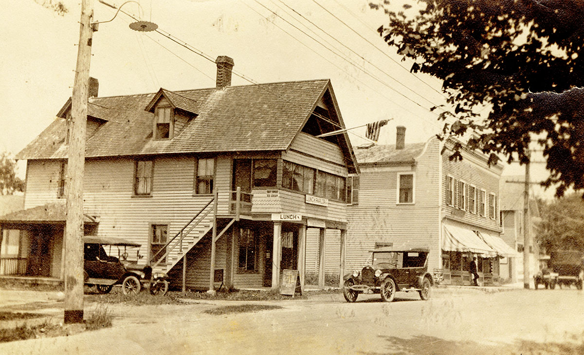
Fishers Island’s main street, circa 1925.
Museum Collection
Note the Lunch Parlor located in today’s Beach Plum building. This structure was converted into the Fishers Island Fire Department’s first Fire House circa 1927.
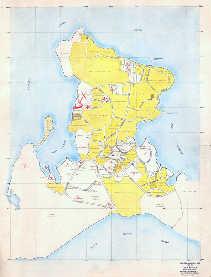
Property and Highway Map, Fishers Island, N.Y., 1927.
Museum Collection
When two Ferguson banking brothers bought nine-tenths of Fishers Island from the Fox estate in 1889, they became by far the dominant economic force on Fishers Island. The degree to which that control was still in effect in 1927 is reflected by this map. All property in deep yellow was then owned by the Fishers Island Farms, an over-arching company that held almost all the Fergusons’ enterprises. Fishers Island functioned as a very benevolent one company town.
Annual exhibition sponsored by ALTUS Partners & CHUBB